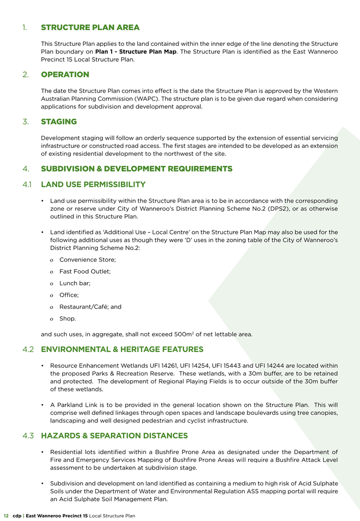
Council Members’ Briefing Session
SUPPLEMENTARY AGENDA
6:00pm, 3 September 2024
Council Chamber (Level 1), Civic Centre,
23 Dundebar Road, Wanneroo
wanneroo.wa.gov.au
Council Members’ Briefing Session
SUPPLEMENTARY AGENDA
6:00pm, 3 September 2024
Council Chamber (Level 1), Civic Centre,
23 Dundebar Road, Wanneroo
wanneroo.wa.gov.au

Briefing Papers for Tuesday, 3 September 2024
CONTENTS
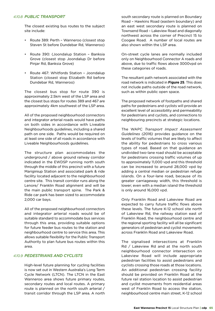
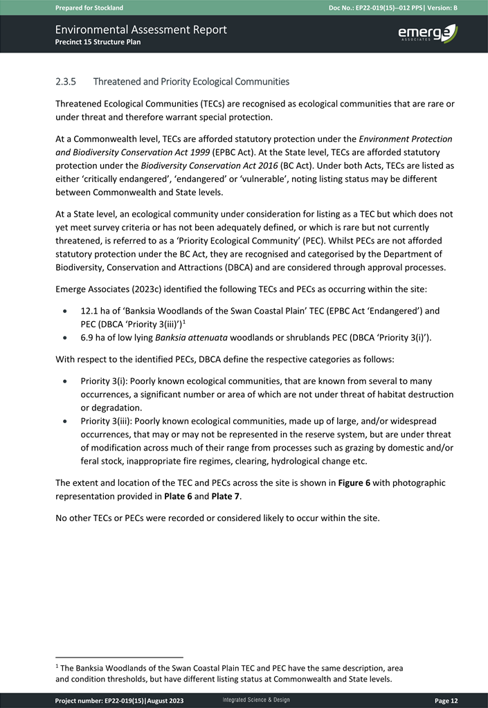
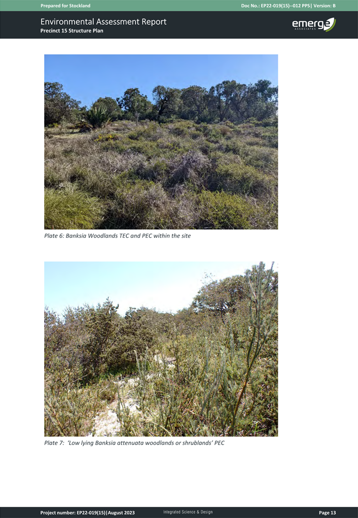
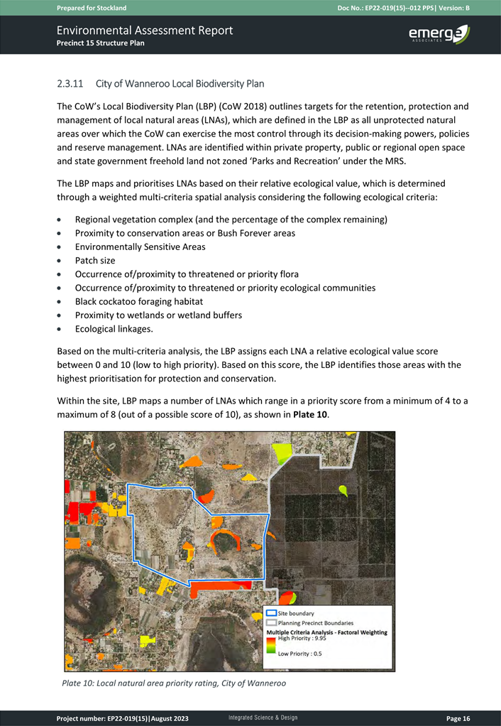
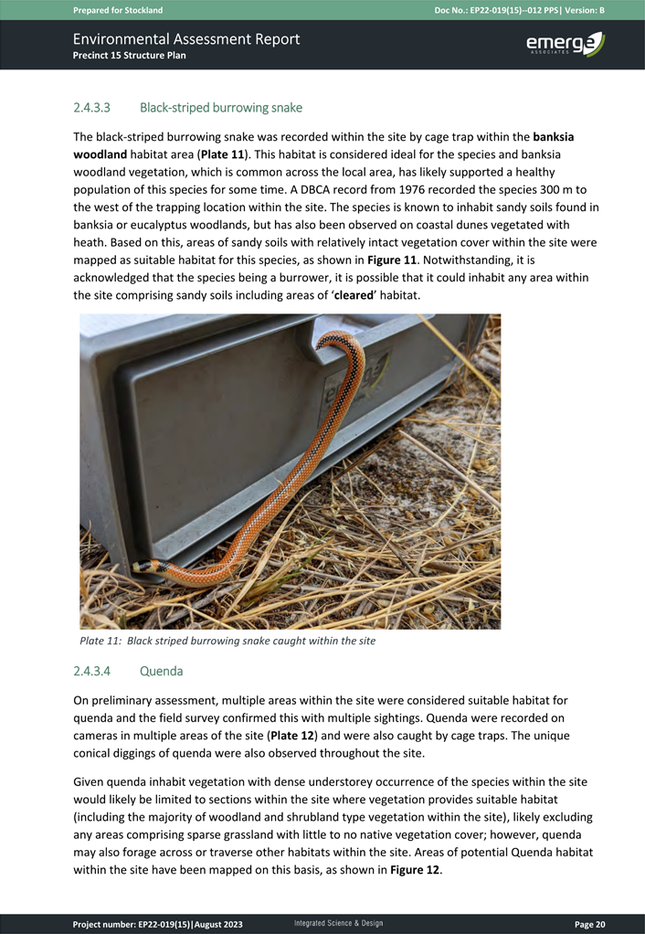
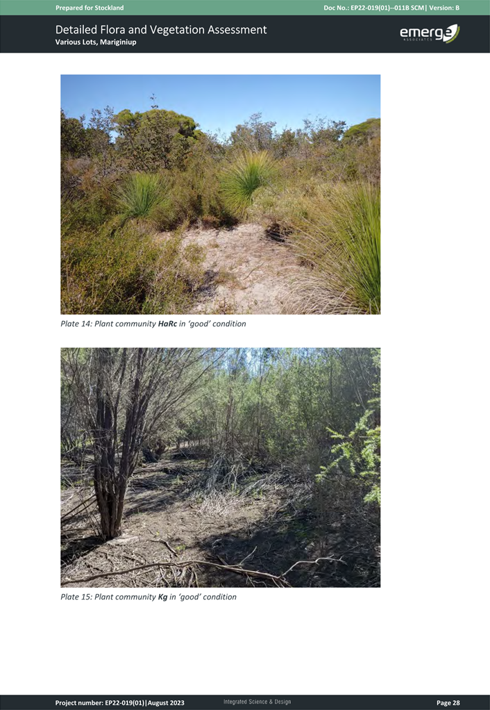
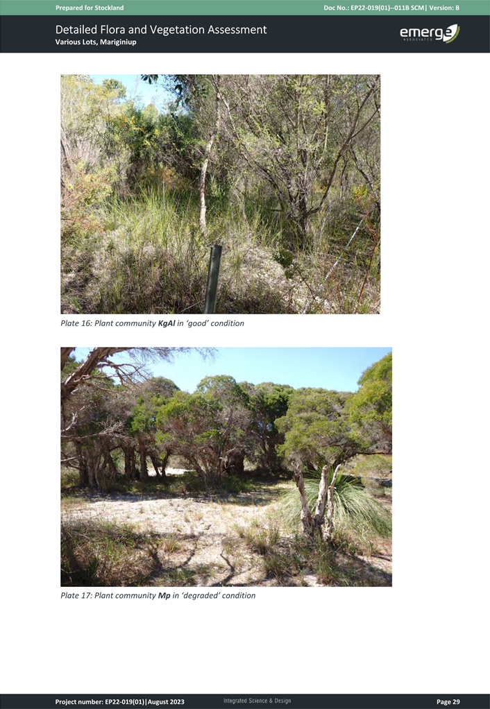
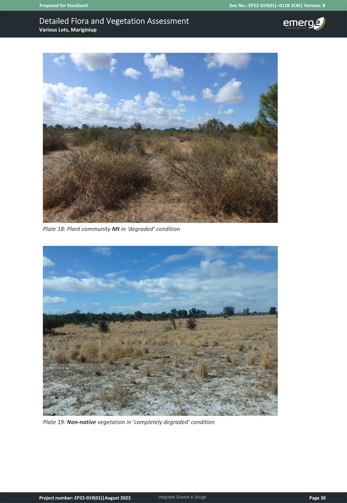
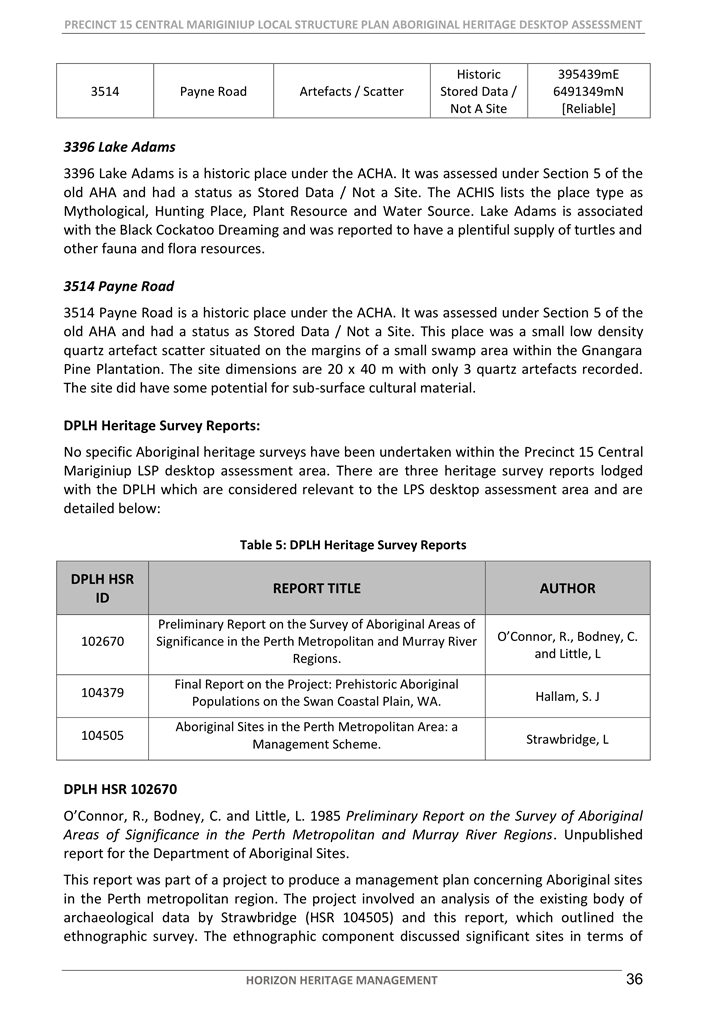
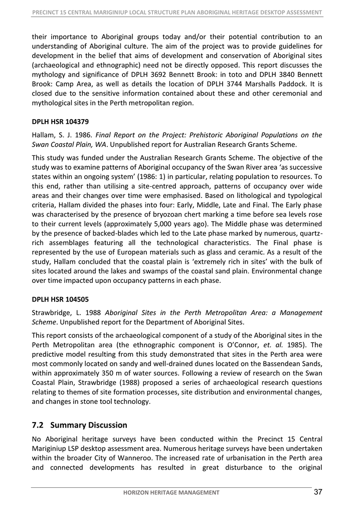
6.1 Consideration of Precinct 15 - Central Mariginiup Local Structure Plan Following Advertising
6.2 Tender 24043 Provision of Jindalee, Alkimos and Eglinton Streetscape and Park Maintenance
CITY OF WANNEROO Late Items Agenda OF Council Members' Briefing Session 03 September, 2024 I
Item 6 Late Reports
File Ref: 47857 – 24/238598
Responsible Officer: Director Planning & Sustainability
Attachments: 23
Issue
To consider the proposed Precinct 15 – Central Mariginiup Local Structure Plan (LSP) and forward its recommendation to the Western Australian Planning Commission (WAPC) for assessment and determination.
|
Applicant |
CDP Town Planning & Design |
|
Owner |
Numerous |
|
Location |
Various Lots |
|
Site Area |
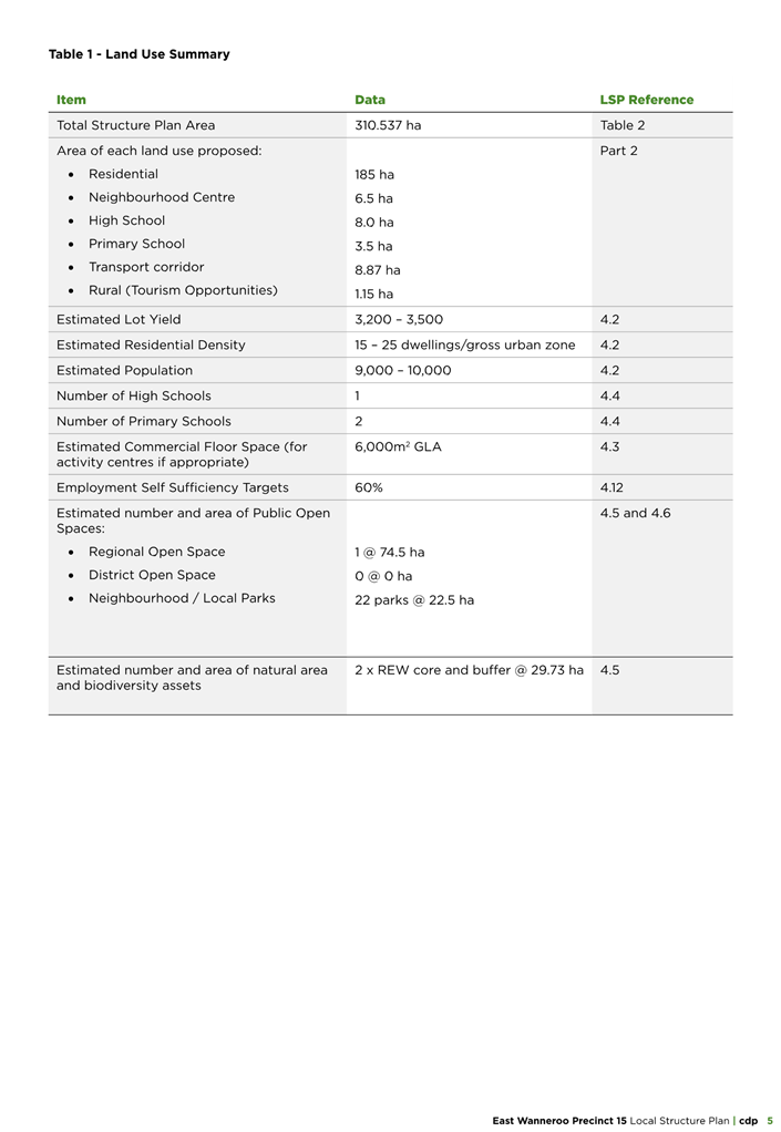
310.537ha |
|
MRS Zoning |
Urban Deferred/Rural – Water Protection |
|
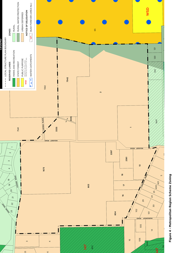
DPS 2 Zoning |
Rural |
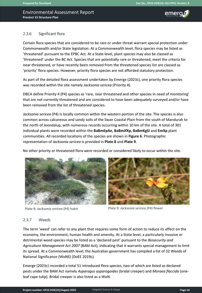
Background
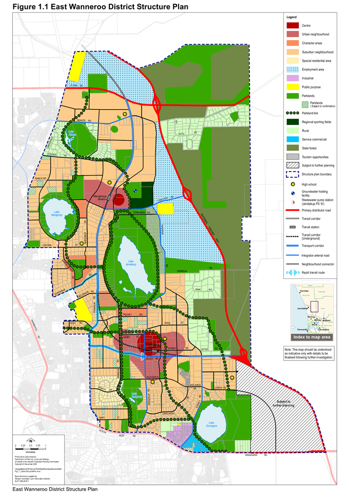
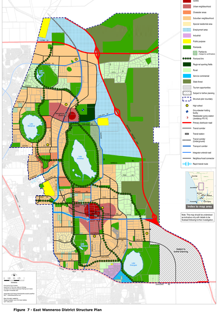
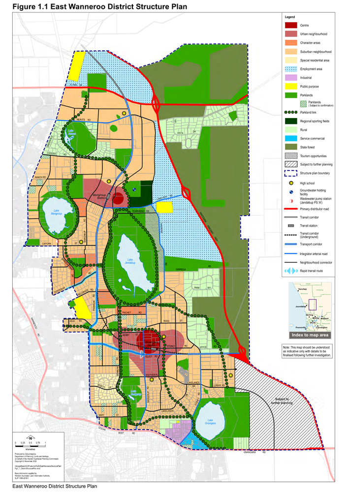
The land subject of the East Wanneroo District Structure Plan (EWDSP) was identified in the North-West Sub-Regional Planning Framework dated March 2018 as land subject to Urban Expansion. As a result of this, the Department of Planning, Lands and Heritage (DPLH) prepared and adopted the EWDSP in August 2021.
The EWDSP provides a long-term vision for urban development in Perth’s north metropolitan corridor and is the culmination of extensive investigations and consultation with community, local and State government, and service providers.
The EWDSP is a strategic instrument, guiding future land uses, coordination of major community infrastructure, development of activity centres, distribution of regional open space and the protection of environmental assets. It identifies the obligations to be addressed by subsequent planning stages and provides the basis for preparation of local structure plans.
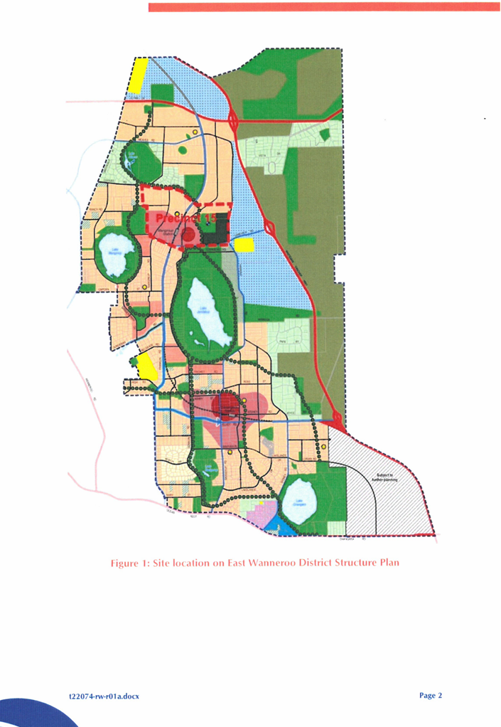
The EWDSP area covers 8,300 hectares of land and includes the following localities (from north to south): a small portion of Pinjar, most of Mariginiup and Jandabup, the eastern part of Wanneroo, Gnangara and south-west Lexia. The district is approximately 25 kilometres north of the Perth Central Business District. It currently has a mix of mainly rural land uses such as market gardens, equestrian activities and rural lifestyle properties surrounding regional parks and wetlands (many with significant environmental values) and some State Forest. A copy of the EWDSP is included as Attachment 1.
As set out in the EWDSP, a range of district level matters are required to be addressed including; integrator arterial roads, community facilities and wetland management plans. A District Development Contributions Plan (DDCP) is required to be incorporated into District Planning Scheme No.2 (DPS 2) to facilitate the development and delivery of these district matters and this was approved by Council for community consultation at the August Ordinary Council Meeting (OCM).
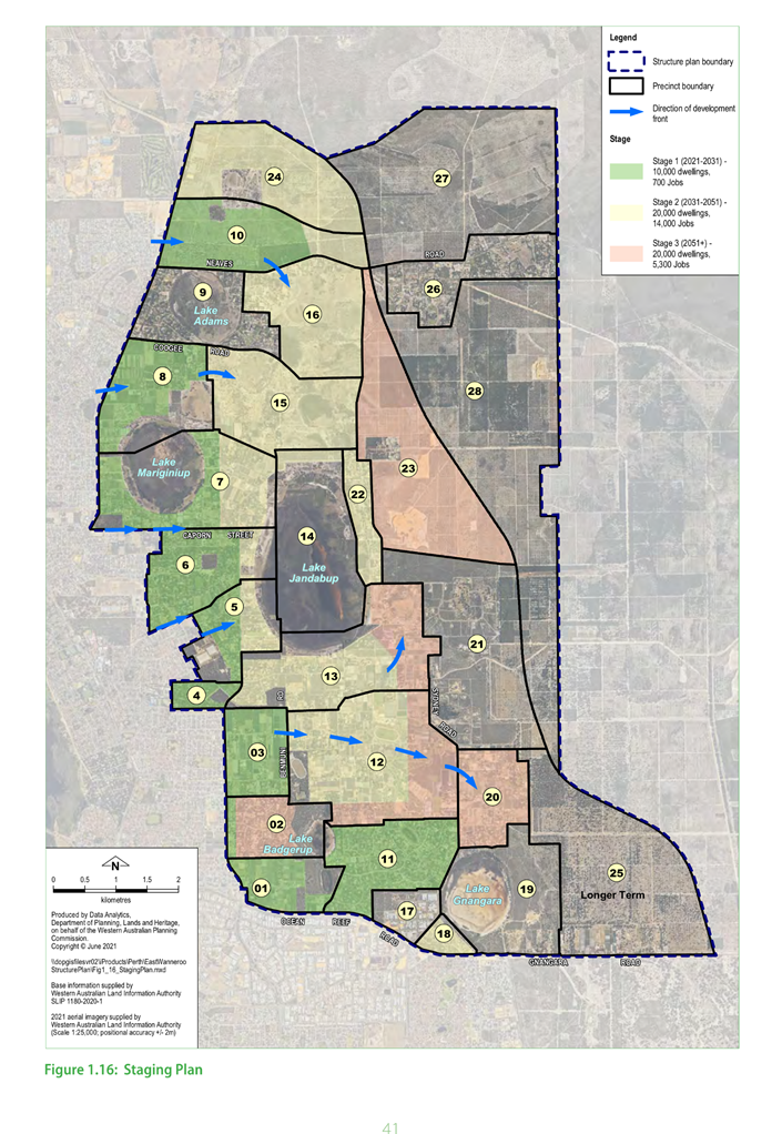
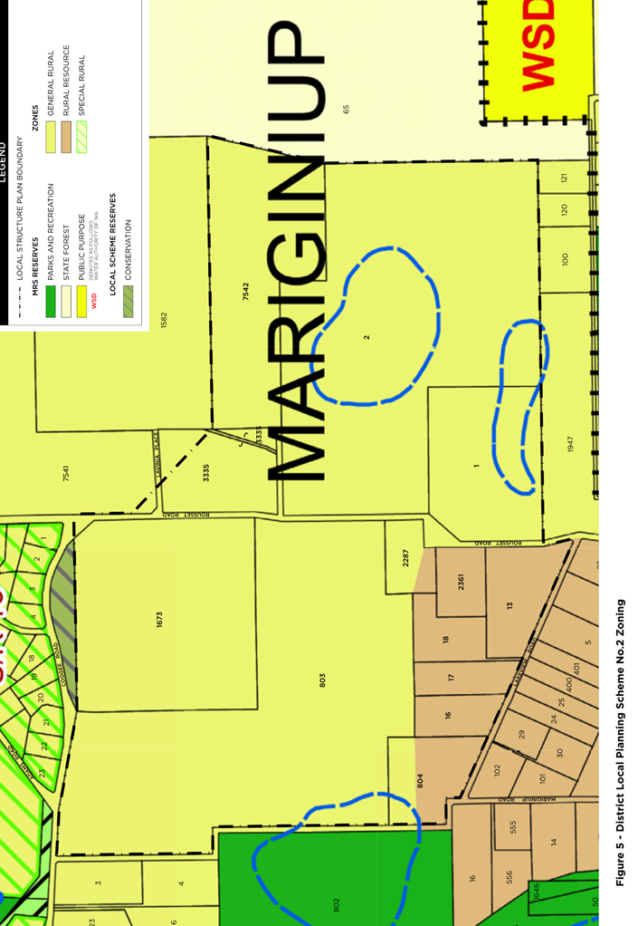
The EWDSP area is divided into 28 local precincts. Each Precinct is required to have its own Local Structure Plan (LSP) prepared and approved to deliver the outcomes stipulated by the EWDSP. The Precincts are separated across three stages of development, with the anticipated development front generally expected to move from west to east subject to availability of servicing infrastructure.
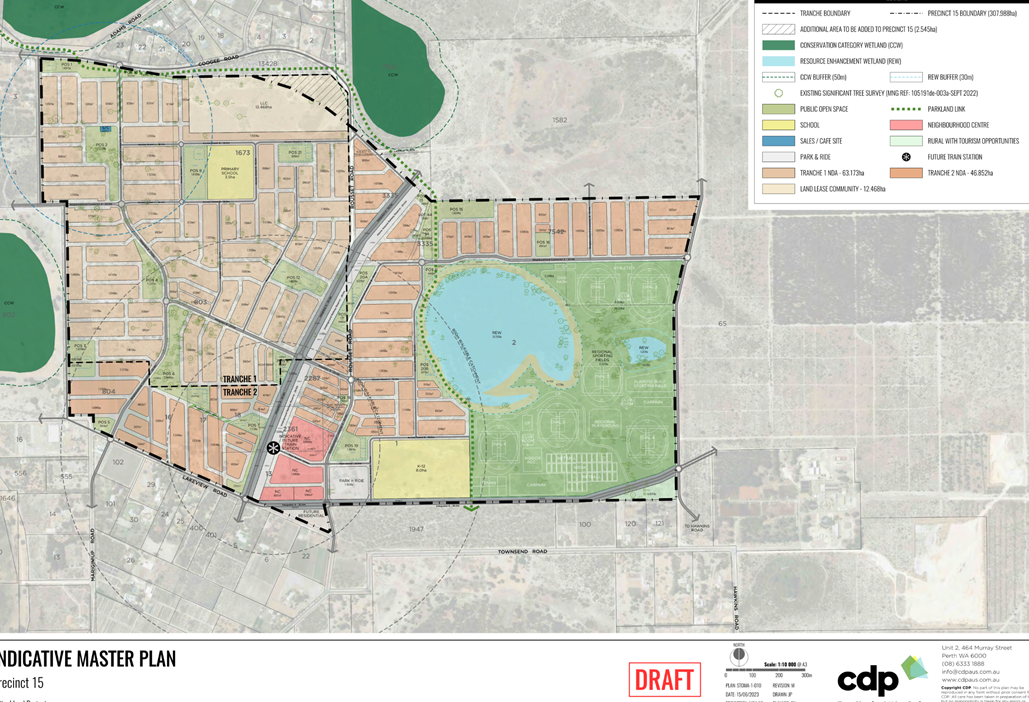
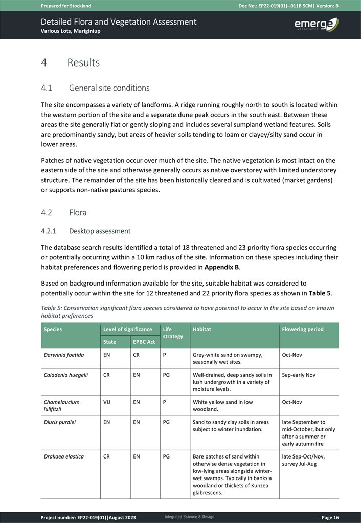
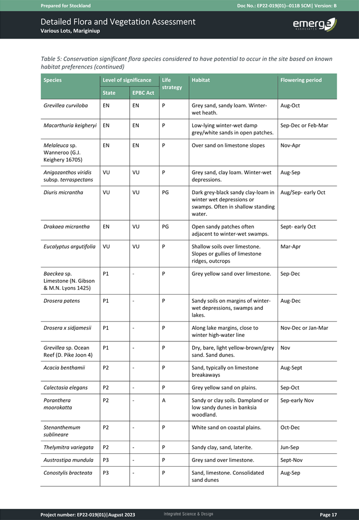
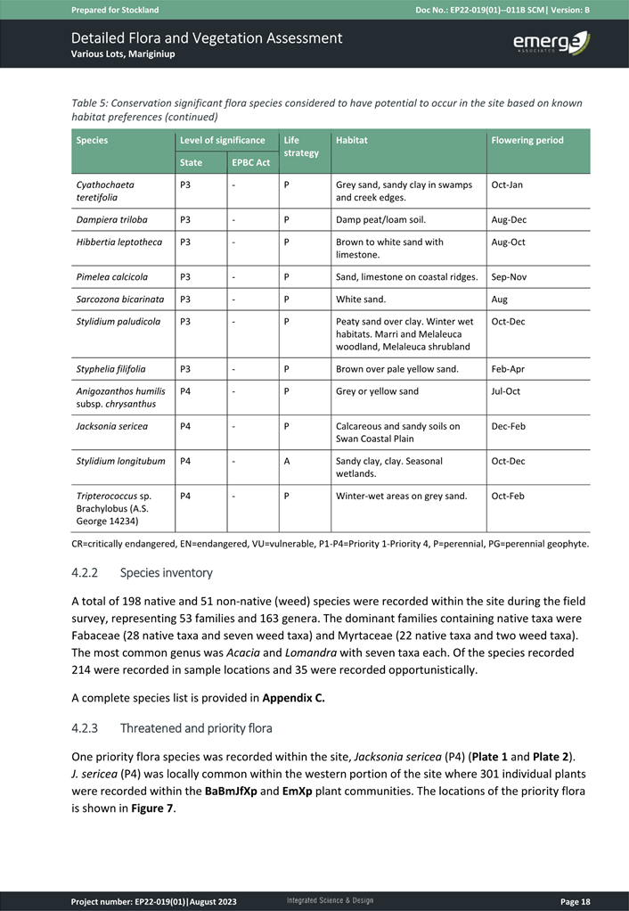
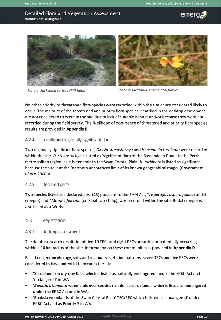
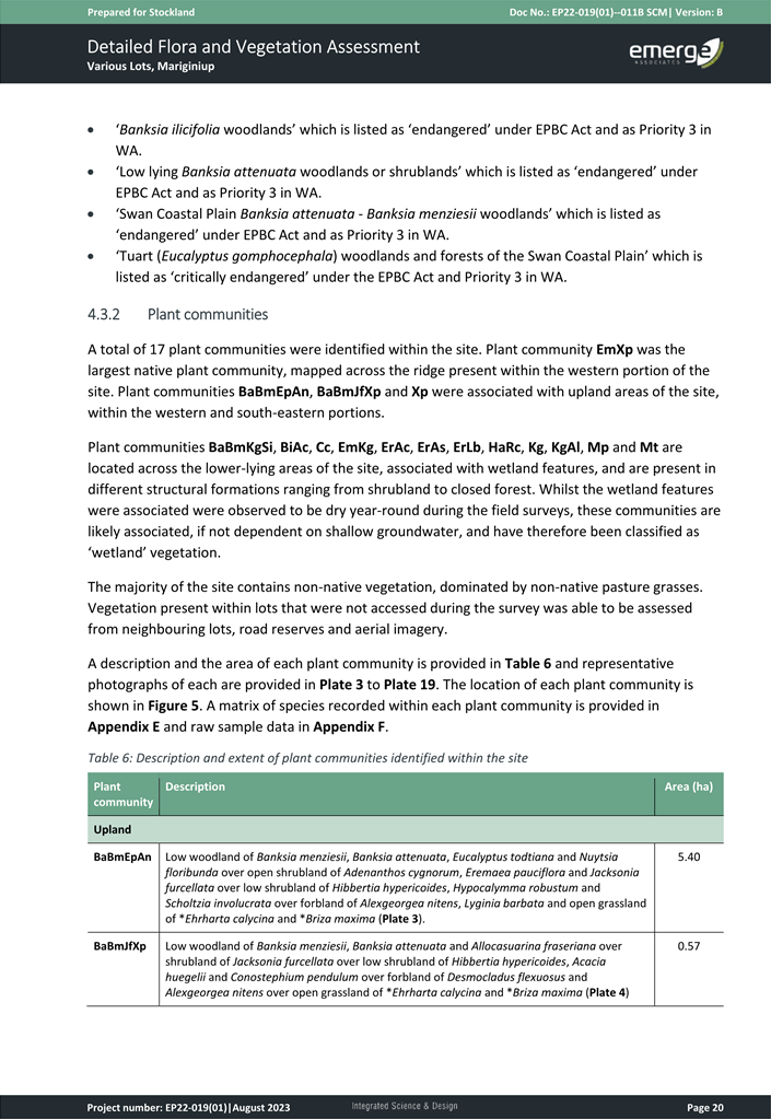
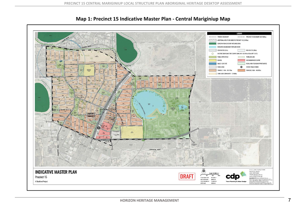
On 20 December 2023, Administration accepted submission of the LSP for ‘Precinct 15 – Central Mariginiup’ prepared by CDP Town Planning & Urban Design, on behalf of Stockland Development Pty Ltd (Attachment 2).
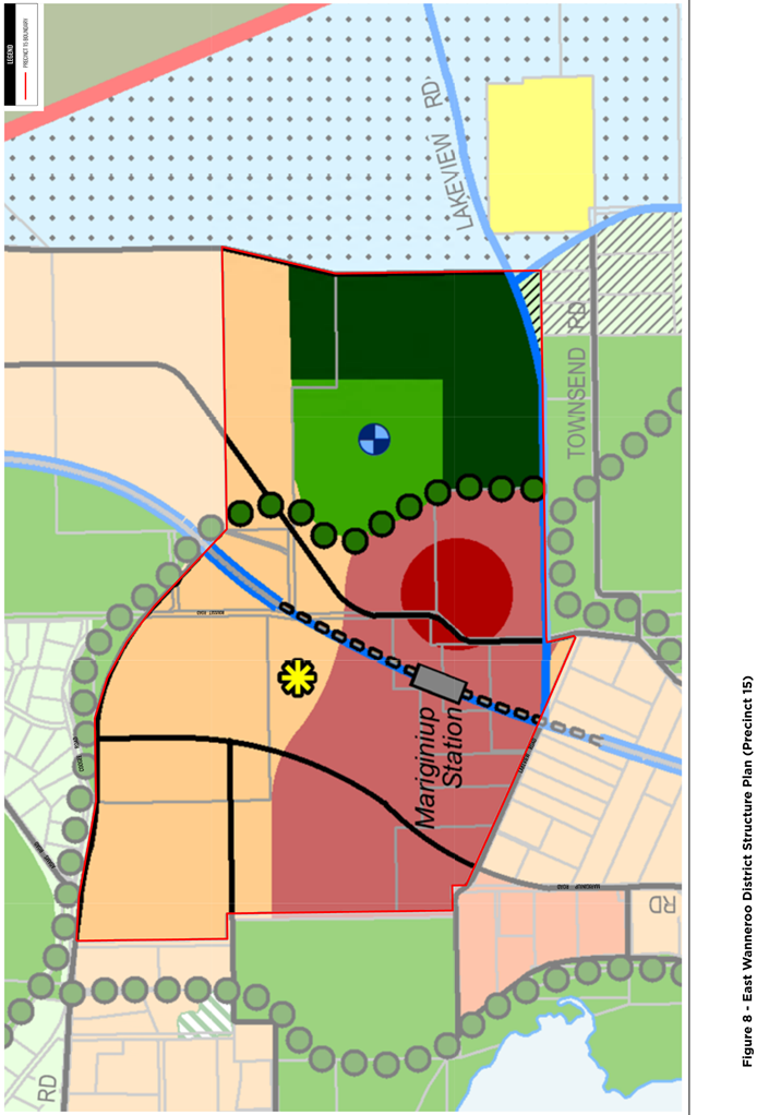
Precinct 15 is identified within the EWDSP (Attachment 2) as being expected to be developed as part of Stage 2. This is nominated to be between 2031 and 2051. A copy of the staging plan contained within the EWDSP is included in Attachment 3.
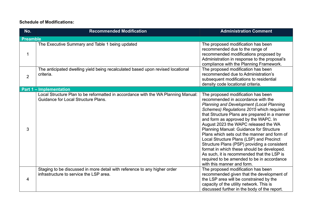
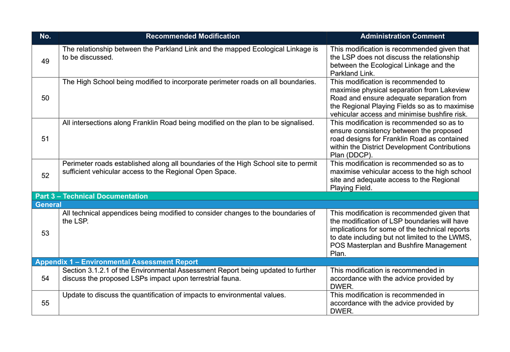
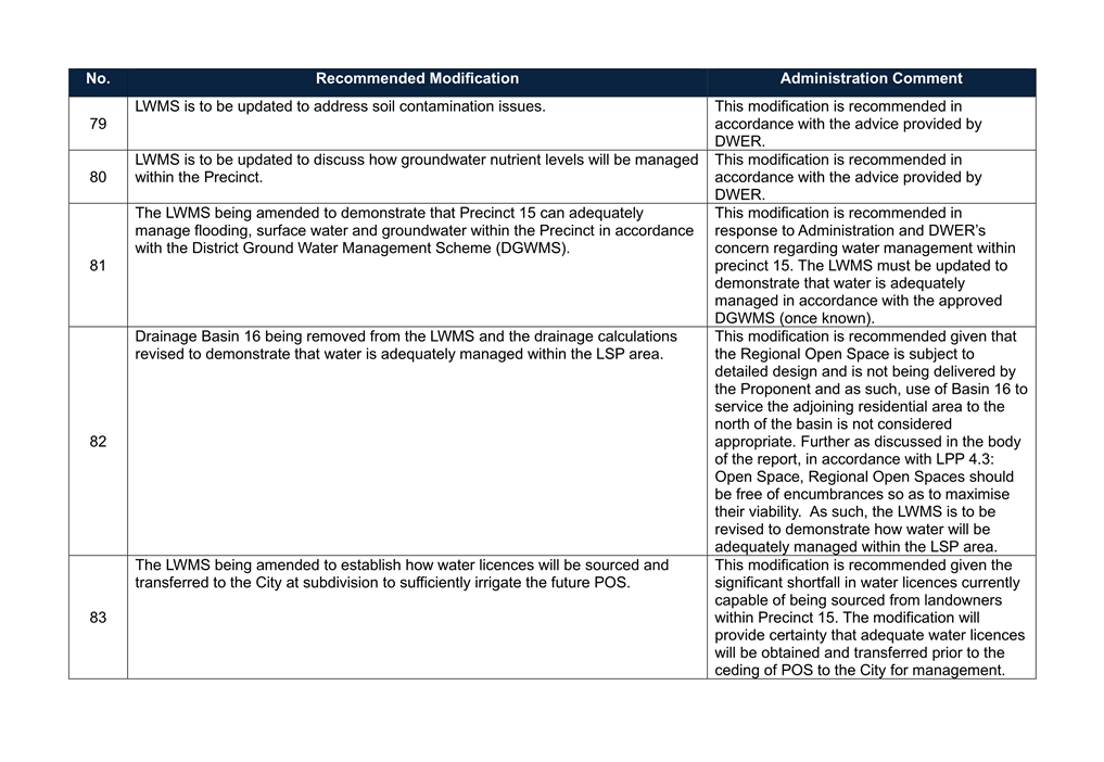
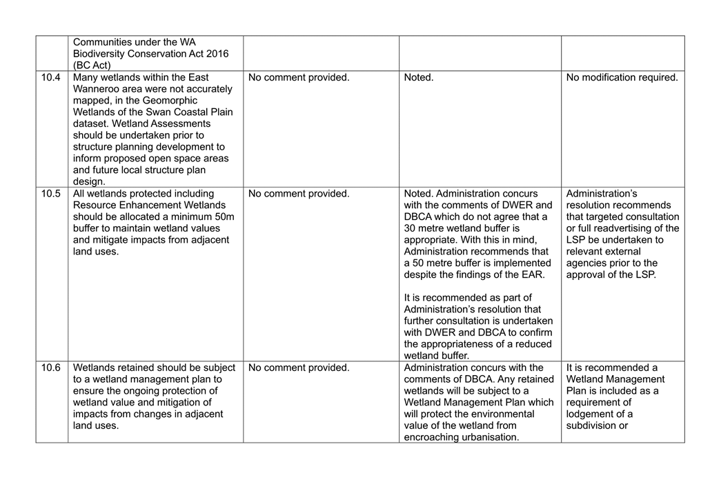
A number of modifications to the LSP documentation are recommended, which are outlined in the Schedule of Modifications included as Attachment 4. This is consistent with the WAPC’s Structure Plan Framework and the Regulations, which require the Local Structure Plan to be submitted to the WAPC along with a separate document outlining any modifications recommended by the local government.
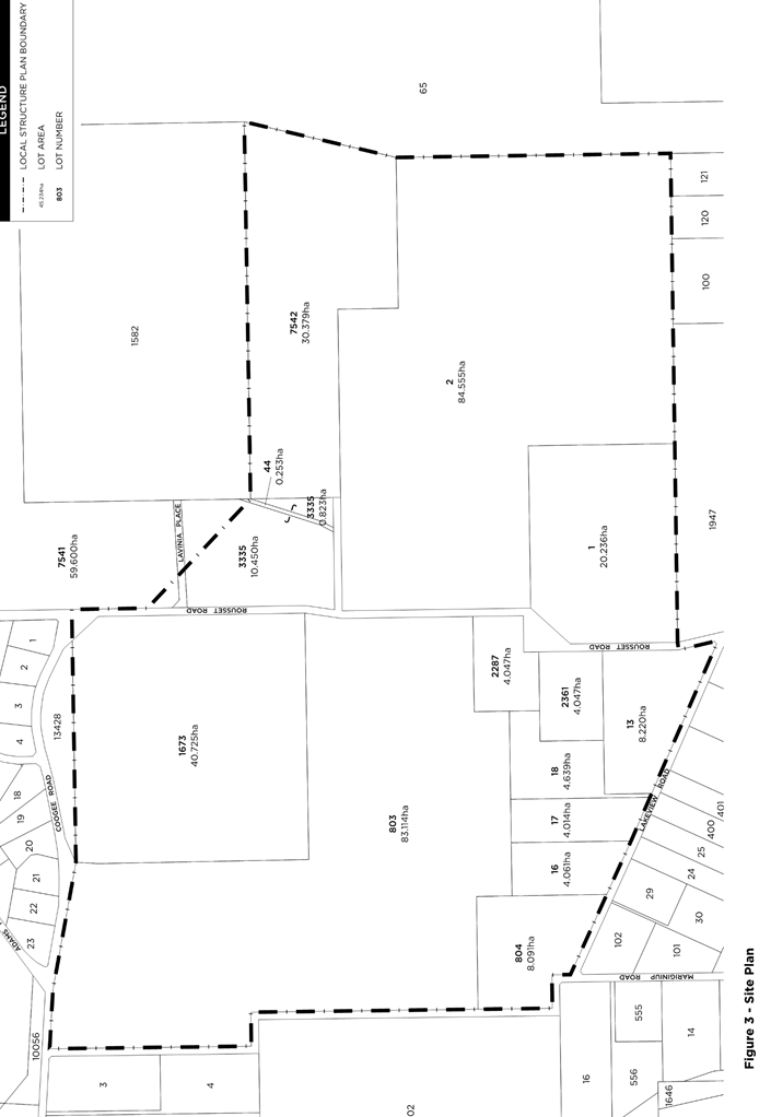
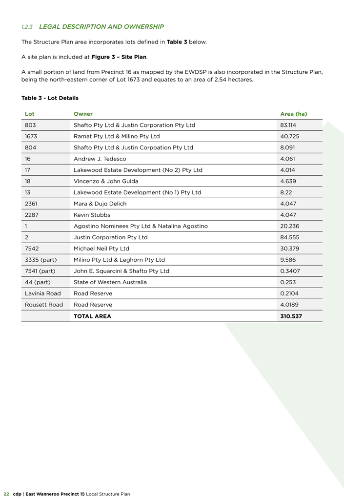
Detail
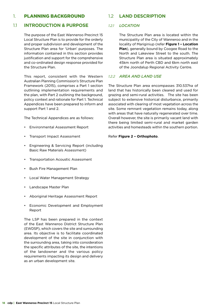
Site Context
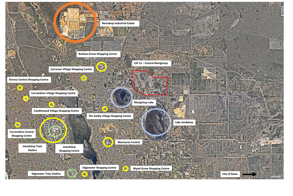
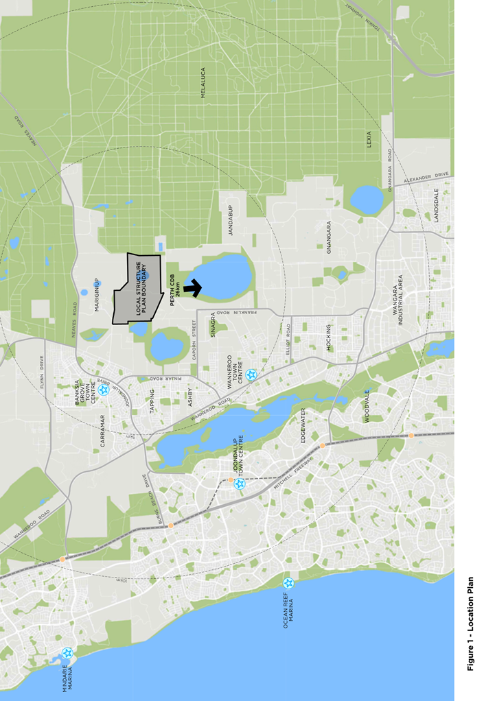
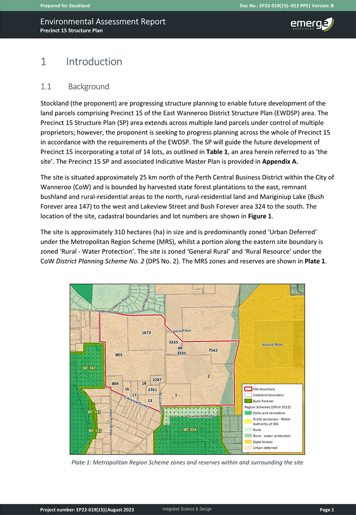
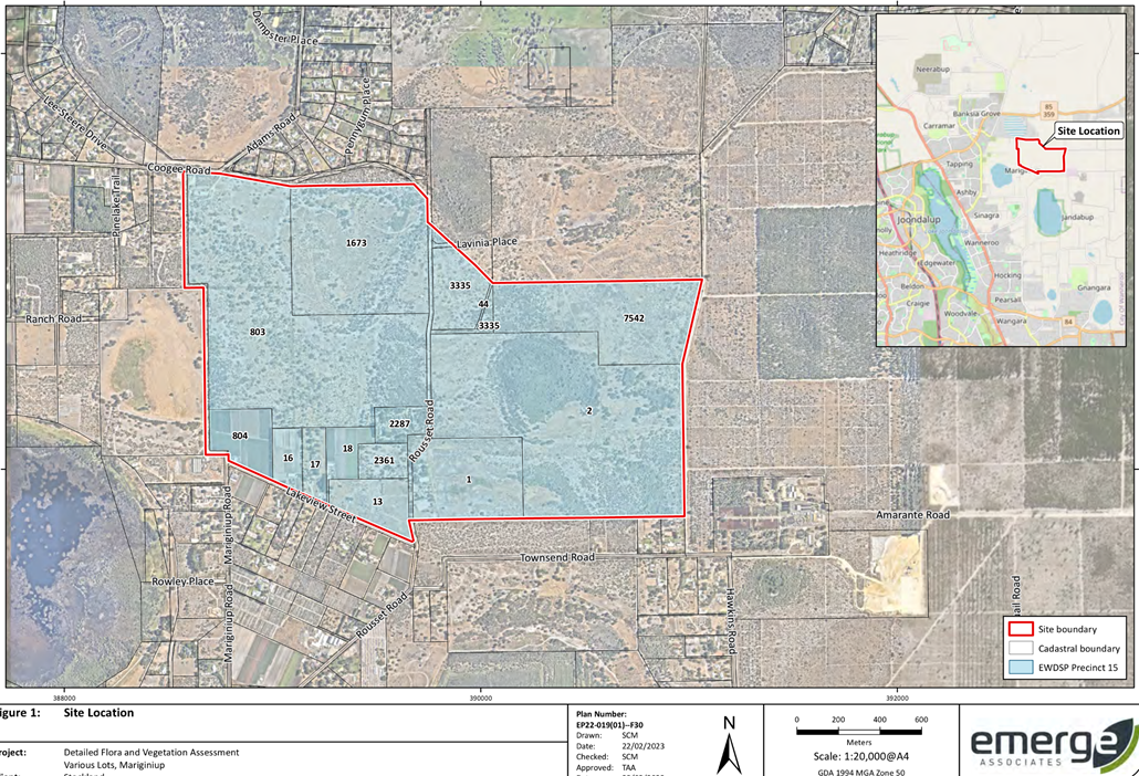
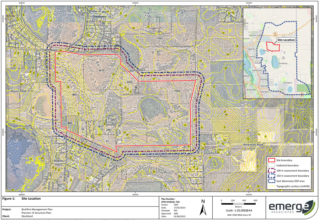
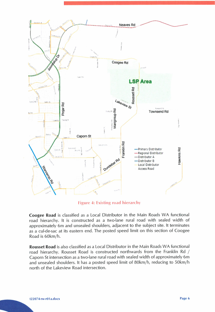
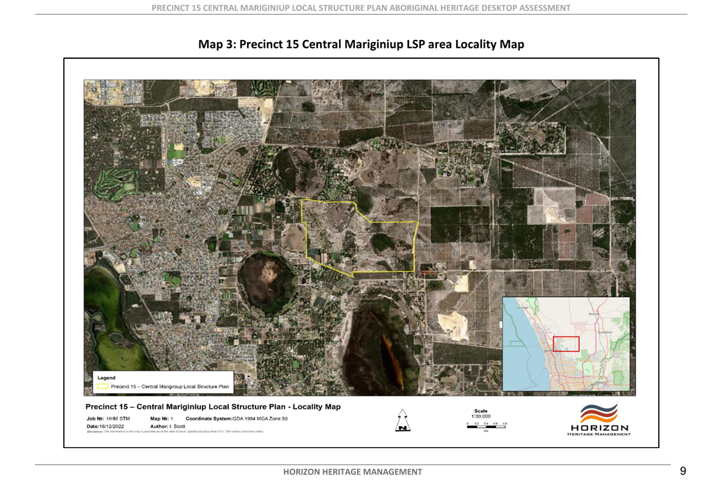
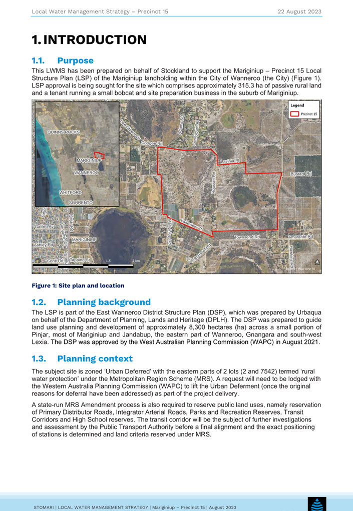
The LSP area is located within the locality of Mariginiup, generally bound by Coogee Road to the North and Lakeview Street to the south. The Structure Plan area is situated approximately 45km north of Perth CBD.
Precinct 15 is surrounded by Precinct 9 and 16 to the north, Precinct 23 to the east, noted as an employment area in the EWDSP and Precinct’s 7 and 8 to the west. At the time of consideration of the subject LSP, Precincts 7 and 8 have been lodged for assessment and will be presented to Council for consideration in due course.
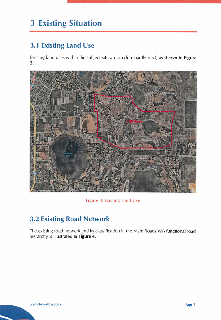
All surrounding land is developed for rural purposes and contains remnant vegetation on site. A location Plan is included in Attachment 5.
Planning Context and Process
Typically a LSP is prepared for land that is already zoned ‘Urban’ under the MRS and ‘Urban Development’ under DPS 2. However, in the case of the EWDSP, there are a number of complex zoning and servicing matters that need to be resolved by the WAPC and other State Government Agencies before the Precinct 15 area can be zoned in DPS 2 and the LSP adopted by the WAPC.
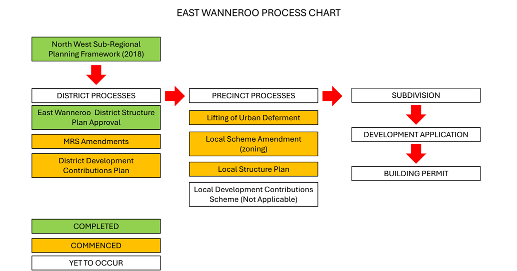
The process has three sequential parts which are discussed below and illustrated in Attachment 6:
1. District level processes:
a) District Structure Plan (EWDSP) approval;
b) Metropolitan Region Scheme (MRS) Amendments; and
c) District Development Contributions Plan approval.
A MRS Amendment (1308/41) was approved in 2018 rezoning a portion of the land within Precinct 15 as urban deferred. The remain portion remained as Rural – Water Protection. This is discussed further in the comment section of this report.
The DDCP for the entirety of the district structure plan area has been prepared by the WAPC, in accordance with State Planning Policy 3.6 Infrastructure Contributions, for the following items:
· Acquisition of land and construction of integrator arterial roads;
· Construction of district level community facilities as set out in the Community Facilities Plan;
· Groundwater management systems as described in the District Water Management Strategy; and
· Wetland and foreshore management plans.
The DDCP is to be adopted as an amendment to DPS 2. The DDCP will require all ‘Urban’ or ‘Industrial’ zoned land, to pay contributions in respect of these items. The amendment to DPS 2 to adopt the DDCP must be substantially commenced prior to the rezoning of any precinct to Urban or Industrial under the MRS.
Amendment 214 – East Wanneroo District Development Contribution Plan was lodged by the WAPC in December 2023. Amendment 214 intends to provide for equitable sharing of costs of district infrastructure and administrative costs between owners. The items which form part of the DDCP are as follows:
· Acquisition of land and construction of integrator arterial roads;
· Construction of district level community facilities as set out in the Community Facilities Plan set out in the EWDSP; and
· Wetland and foreshore management plans.
Amendment 214 was adopted by Council at the 13 August 2024 Council Meeting. Noting however that the groundwater management systems as described in the District Ground Water Management Strategy, have not been included in the current version of the DDCP. It is anticipated that this work will be completed and the City will receive a further amendment to DPS 2 by the end of 2024 to progress this matter.
2. Precinct level processes:
a) Lifting of Urban Deferment;
b) Local Scheme Zoning;
c) Local Structure Plan; and
d) Local Development Contributions Scheme.
Point b) addresses the rezoning of the land within the DPS 2 from ‘Rural’ to ‘Urban Development’ to allow for approval of the Local Structure Plan.
3. Subdivision and development approval.
Subdivision and development applications would then follow from the completion of all of the above processes.
In general terms, all district level processes relevant to a precinct, must be completed prior to the formal commencement of any precinct level process and likewise all precinct level processes must be completed prior to subdivision and development within that precinct. However, the EWDSP encourages processes to be undertaken in parallel or concurrently where possible, in line with the principles of orderly and proper planning, which is the intended process in this instance. The MRS amendment, District Development Contribution Plan and Ground Water Management considerations are discussed in the comment section of this report.
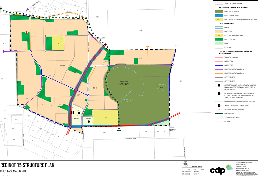
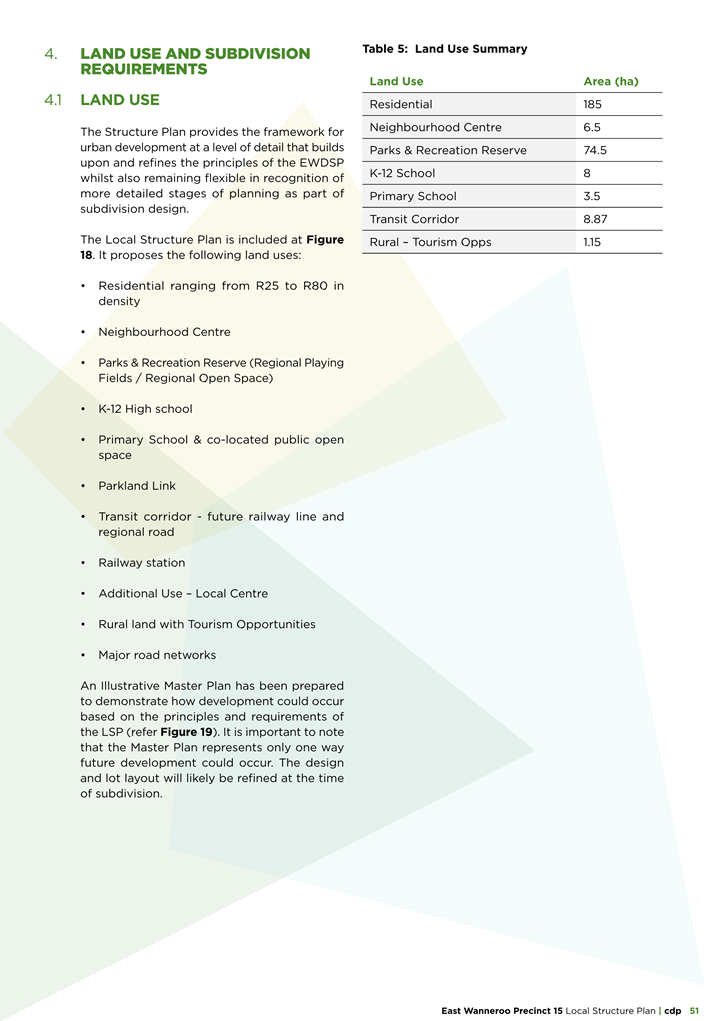
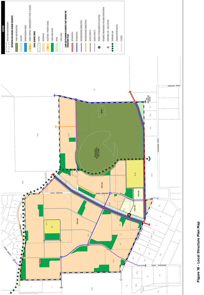
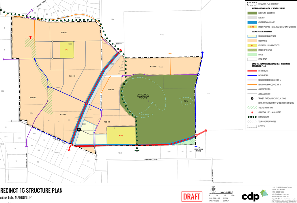
Proposal
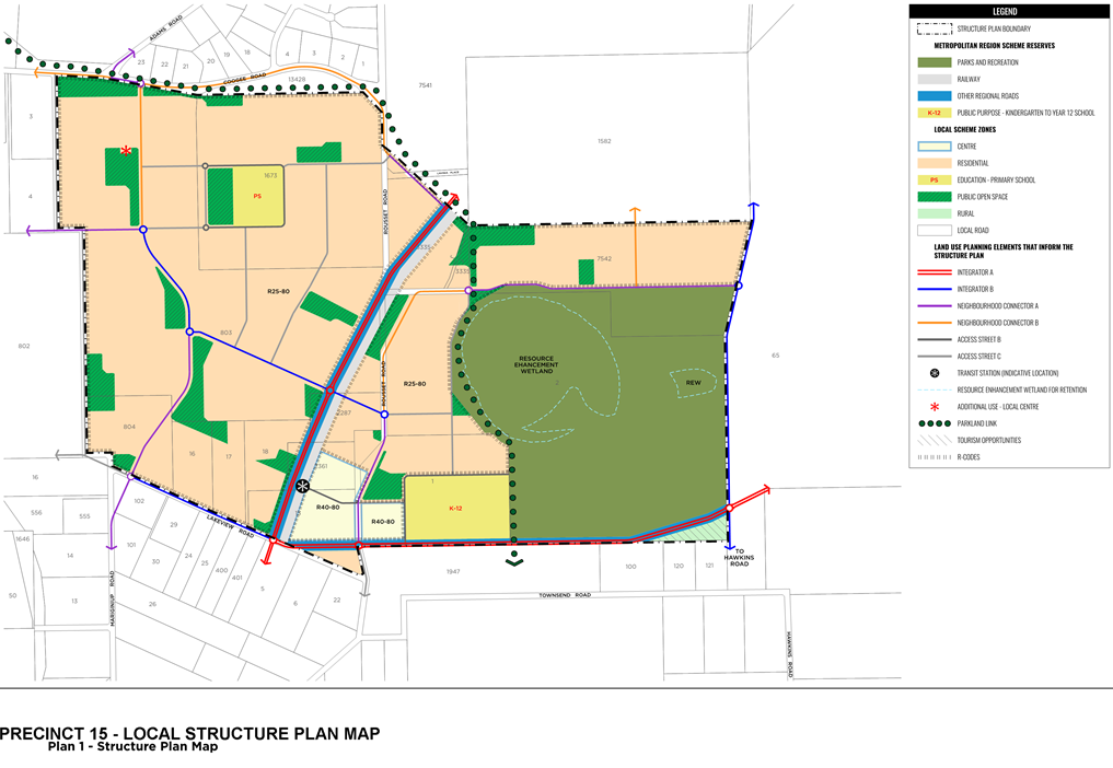
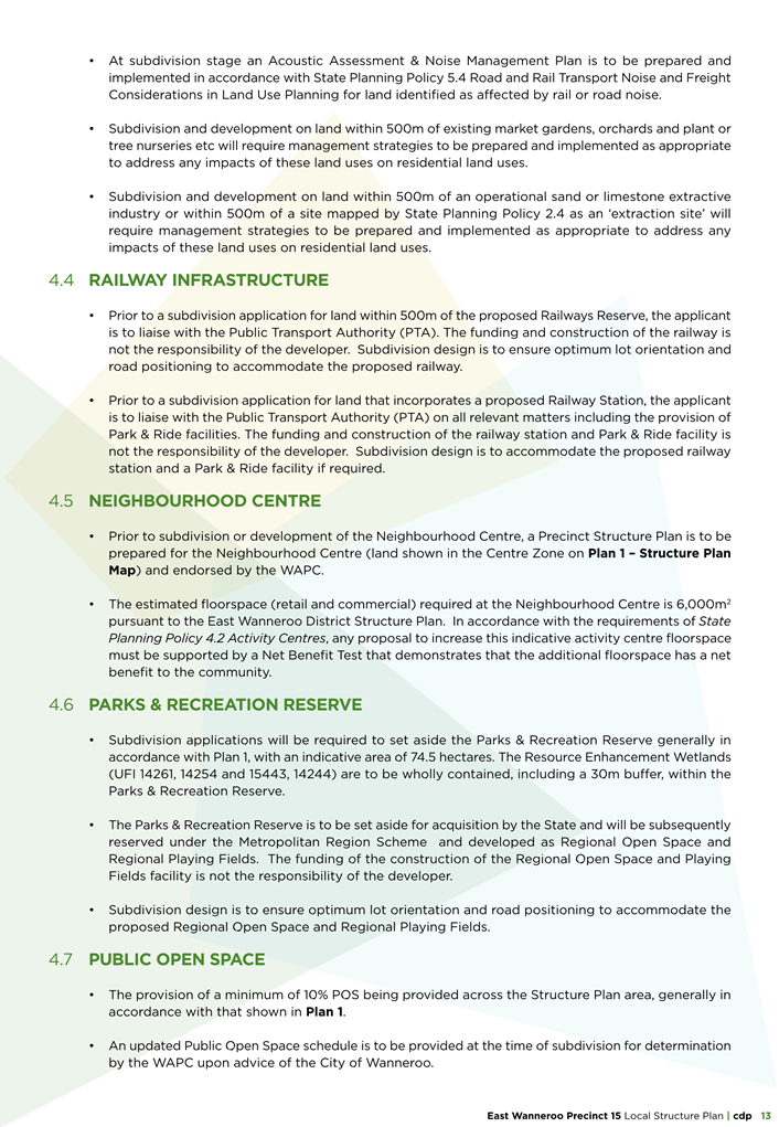
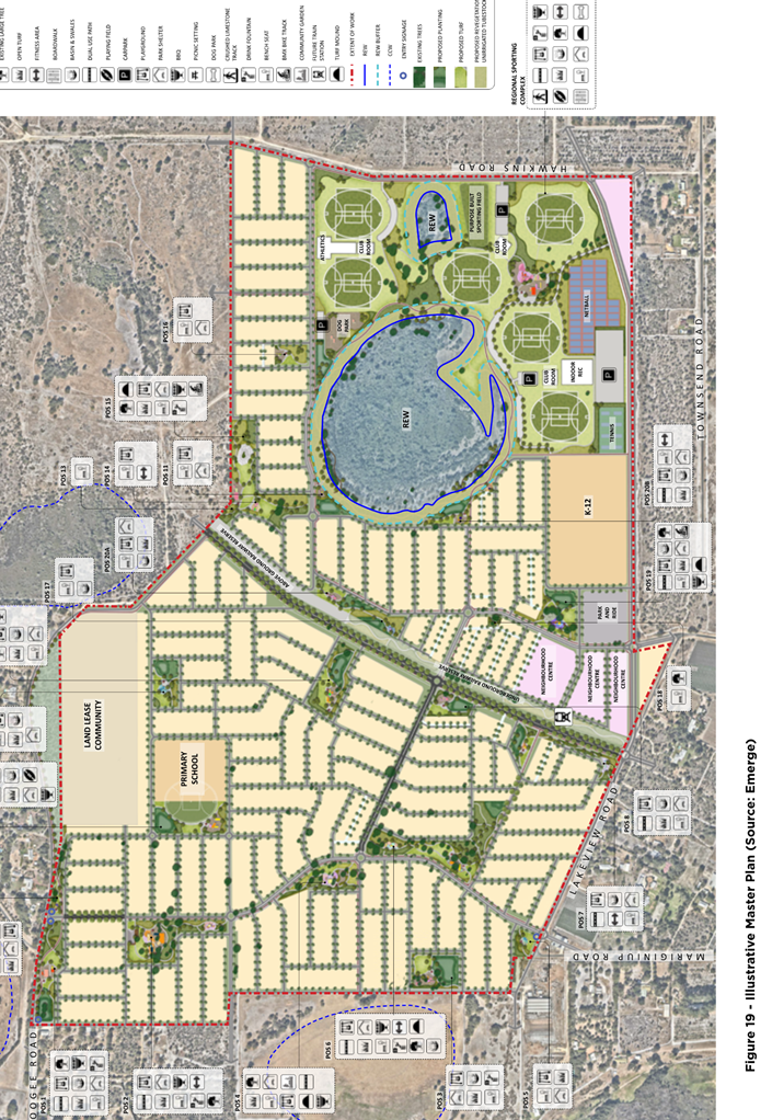
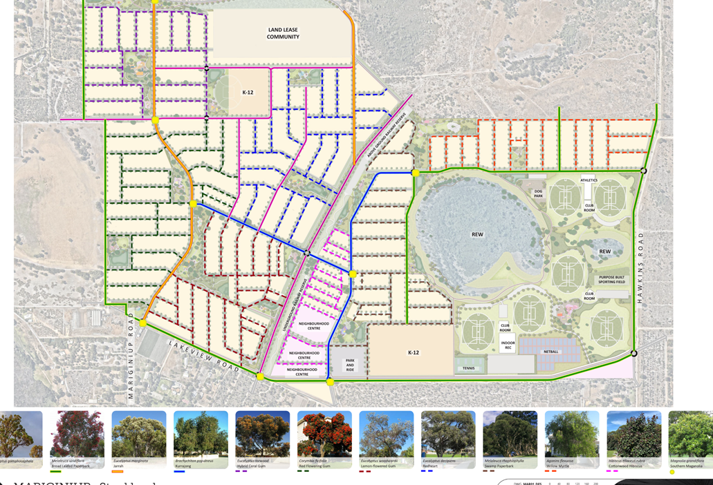
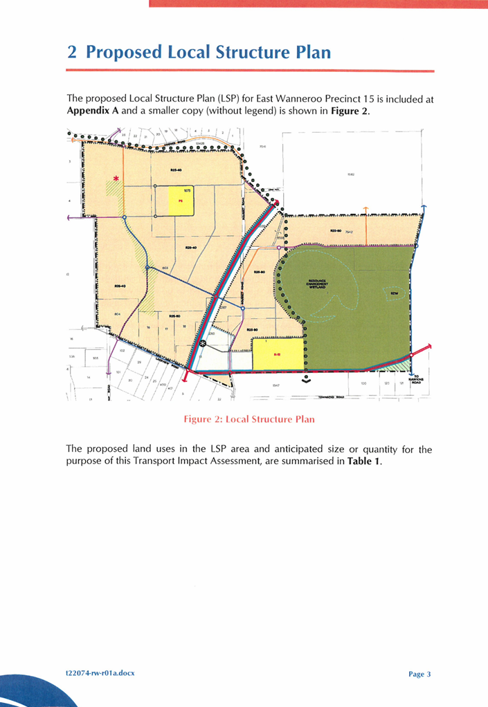
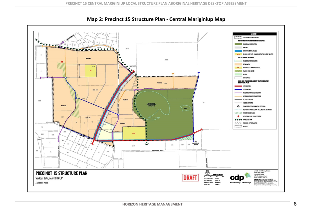
The proposed LSP provides the framework for urban development at a level of detail that builds upon and refines the principles of the EWDSP whilst also remaining flexible in recognition of more detailed stages of planning as part of subdivision design. It proposes the following outcomes:
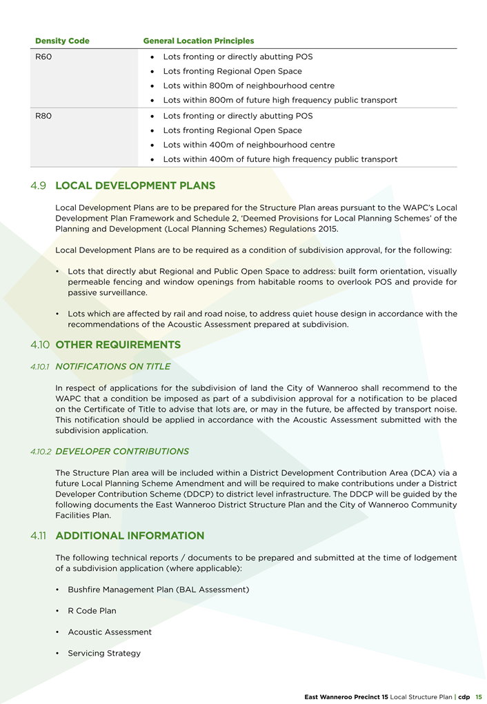
· Residential density ranging from R25 to R80 in density;
· A Neighbourhood Centre (6000m2 retail NLA approximately);
· Parks & Recreation Reserve (Regional Playing Fields / Regional Open Space);
· A Consolidated Primary and Secondary School site;
· A Primary School & co-located public open space;
· A north south Parkland Link;
· Transit corridor - future regional road;
· Transit Station;
· Additional Use – Local Centre;
· Rural land with Tourism Opportunities; and
· Neighbourhood connector road network.
The complete LSP is included in Attachment 7.
Consultation
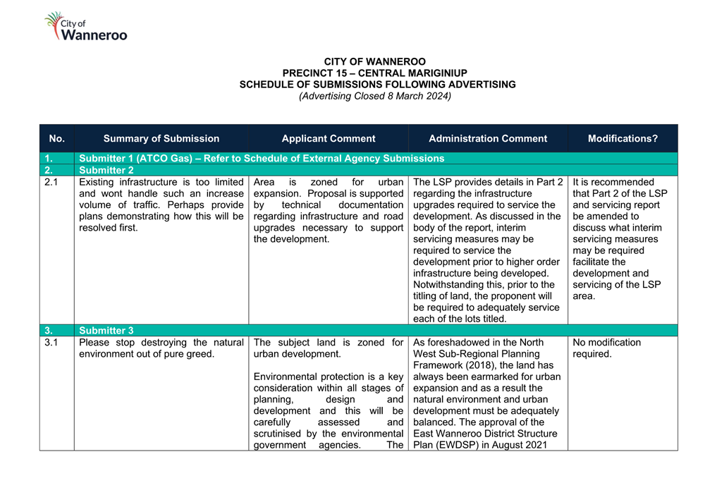
Elected Members were notified on 12 January 2024 of the proposal and of the City’s intent to advertise the application from 25 January 2024 for a period of 42 days concluding on 8 March 2024. The LSP consultation was advertised by means of two signs on site, an advertisement in Perth Now - Wanneroo and letters sent to landowners located within and up to 500 metres from the Precinct boundaries. Following completion of the advertising period, a total of 35 submissions were received with three submissions in support, 14 objecting, 10 commenting and eight from external agencies. Of the eight submissions received from external agencies one supported the proposal, three objected and four provided advice.
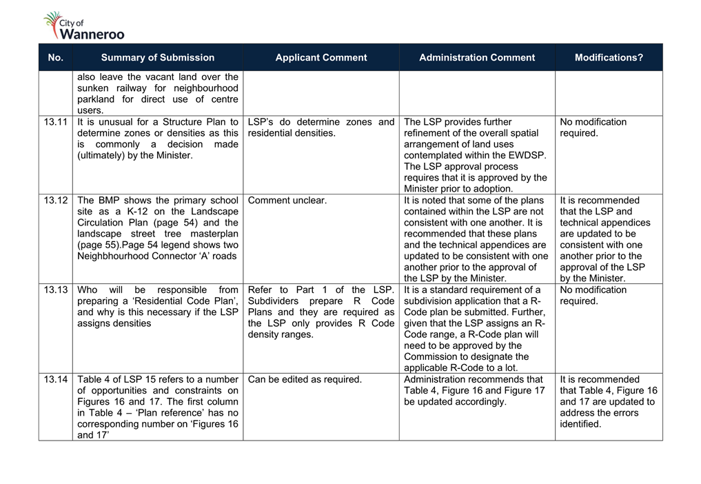
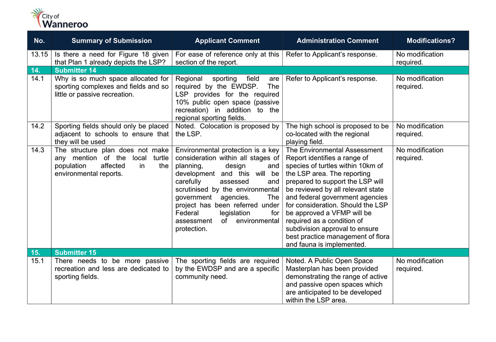
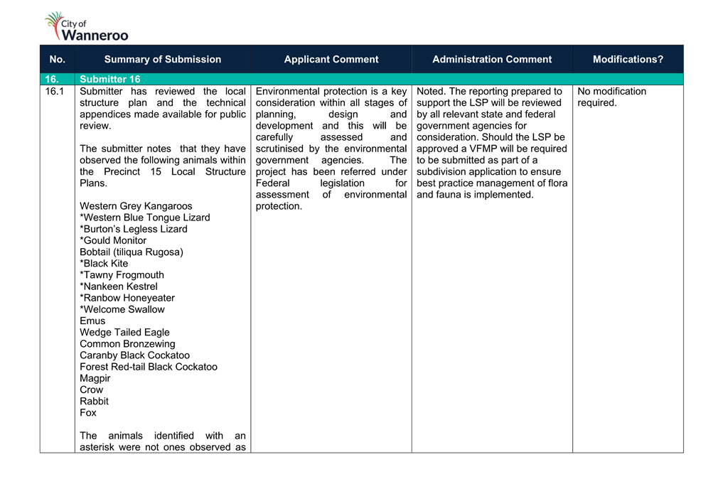
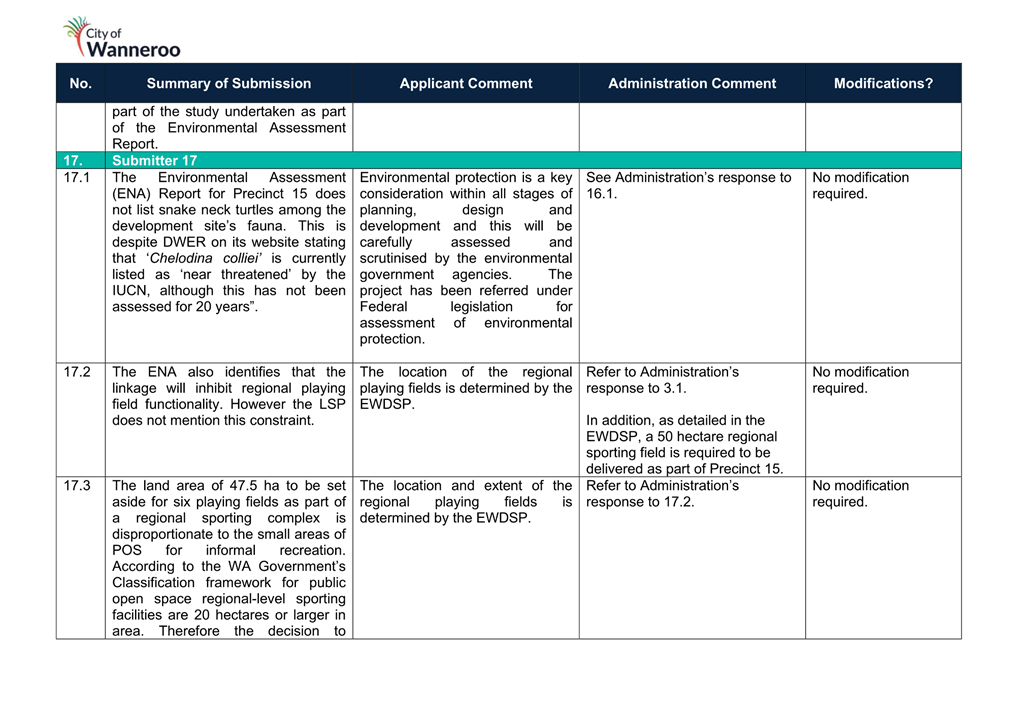
A summary of submissions from the public, the Proponent’s response and Administration’s comment is included in Attachment 8.
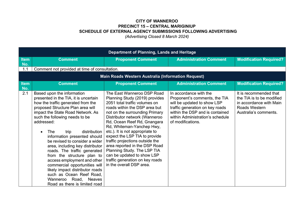
A summary of the submission’s received from External Agencies, the Proponent’s response and Administration’s assessment is included in Attachment 9. The applicable comments provided by government agencies are discussed below.
Following the conclusion of the advertising period, Administration requested an updated plan be provided in response to Administration’s assessment and the submissions received. An amended LSP Map dated 6 August 2024 was then provided by the Proponent which included the following modifications:
· Realignment of the Transit Corridor in accordance with the latest advice from the Public Transport Authority (PTA); and
· Locations identified for the following community facilities within the Neighbourhood Centre:
o District Community Centre; and
o District Indoor Recreation Centre.
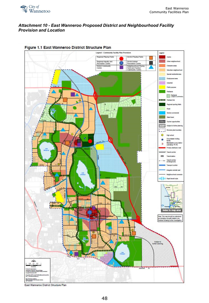
The amended LSP dated 6 August 2024 is included as Attachment 10. The amended LSP is discussed further in the comment section of the report.
Further changes to the LSP are anticipated as a result of possible changes to the alignment of high frequency transit corridor, the requirements of state agencies and implementation of Administration’s schedule of modifications (Attachment 4). As such, Administration recommends that the resolution include a recommendation for the WAPC undertake either targeted or full readvertising of the LSP to an extent determined in consultation with the City prior to its approval.
Comment
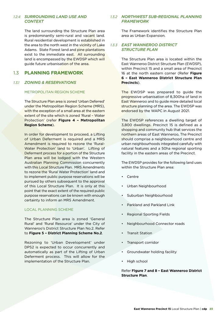
Metropolitan Region Scheme Zoning
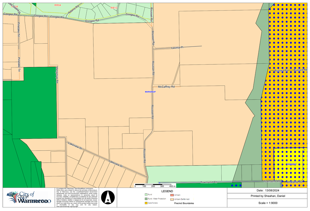
Precinct 15 is predominantly zoned ‘Urban Deferred’ under the MRS with a portion on the eastern edge of the precinct zoned ‘Rural – Water Protection’ (Attachment 11). The entire Precinct 15 area is zoned ‘Rural’ under the City’s DPS 2.
Schedule 2, cl.16 of the Planning and Development (Local Planning Scheme) Regulations 2015 (Regulations) states that a structure plan can be prepared where a scheme identifies the area as suitable for urban development. Scheme zones that can trigger the preparation of a structure plan include Urban Development, Industrial Development, Centre, and Special Use.
In accordance with the Regulations prior to the endorsement of the proposed LSP, all land zoned ‘Urban Deferred’ or ‘Rural – Water Protection’ must be rezoned to ‘Urban’ under the MRS and subsequently to ‘Urban Development’ under DPS 2.
The land within Precinct 15 was rezoned to ‘Urban Deferred’ as part of the broader MRS Amendment 1308/41 for the EWDSP area, the corresponding Amendment Report outlined requirements to be met prior to lifting the deferred status. In addition, the EWDSP also identifies issues to be addressed as part of the process of lifting of urban deferred status. Further advice on information required to satisfy the WAPC that the land is suitable for urban development is outlined in the WAPC’s Lifting of Urban Deferment Guidelines, November 2019 (the Guidelines).
These requirements predominantly relate to proper planning documents like the EWDSP being adopted, essential servicing being provided or ready, a DDCP being adopted, and ground water management being resolved among other requirements.
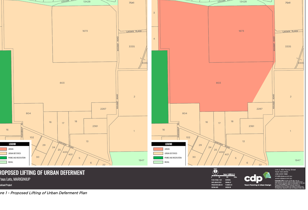
The Proponent has submitted a request to the WAPC to lift the urban deferment of only a portion of the proposed LSP area (Attachment 12), while also seeking a concurrent normalisation of DPS 2 to apply the ‘Urban Development’ zone to the same area.
The proposed LSP report states that the remaining areas of the LSP still zoned ‘Urban Deferred’ and ‘Rural – Water Protection’, will be rezoned to ‘Urban’ by “others” at a later date. The eastern portion of the site is designated ‘Rural – Water Protection’ and a separate MRS Amendment has not yet been progressed. This is required in addition to the Lifting of the Urban Deferment request given that urban development is incompatible with Priority 2 (P2) Public Drinking Water Supply Areas (PDWSA).
As stated above, once a LSP is adopted over the land, applications for subdivision and development in accordance with the LSP can be considered. However, in this case, this would mean that the underlying requirements of the land to be transferred or rezoned to ‘Urban’ will be unresolved and the LSP would have no effect over the land zoned ‘Rural’ in DPS 2.
Therefore, it is recommended that Council’s resolution state that the Precinct 15 LSP should not be formally adopted by the WAPC until the following occurs:
a) the MRS is amended to such that all of the LSP area is zoned ‘Urban’; and
b) the land under District Planning Scheme No. 2 is zoned ‘Urban Development’.
Alignment with East Wanneroo District Structure Plan
Under the EWDSP, ‘Precinct 15 – Central Mariginiup’ is planned to provide a shopping and community hub serving the northern areas of East Wanneroo. This mainly comprises a neighbourhood centre and urban neighbourhoods integrated with natural features of the land. It provides for a 50ha regional sporting facility and various community facilities. It is predominantly characterised by future suburban neighbourhoods which are planned to transition from medium to low-rise built form.
Administration has assessed the proposed LSP against the relevant required outputs for Precinct 15 as set out in the EWDSP and the relevant planning framework, including Liveable Neighbourhoods Policy (LN) and the City’s Local Planning Policy 5.3: East Wanneroo (LPP 5.3).
Following the adoption of the EWDSP in August 2021, Administration progressed an amendment to LPP 5.3 which was implemented in November 2023. LPP 5.3 provides guidance to Proponent s regarding the City’s consideration of Structure Plans within East Wanneroo. As part of this amendment, a District Sense of Place Statement (DSoPS) was developed to aid Proponents with establishing a sense of place for their LSP. In addition, specific road cross-sections providing a local interpretation of road reserve widths were established for roads within East Wanneroo. With this in mind, the City’s consideration of the proposal also has regard to the proposal’s response to these items.
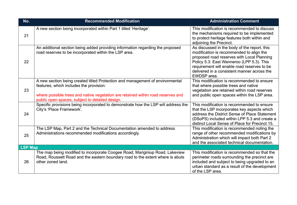
The boundaries of the proposed LSP are largely in accordance with the EWDSP with the exception of Coogee Road. The LSP boundary should include the future Coogee Road alignment to ensure that future subdivision and development in the precinct results in the upgrade and realignment of this Neighbourhood Connector road.
The variation of the alignment of Coogee Road as shown in Attachment 7 is supported by Administration given this outcome reduces impacts on the surrounding rural residential area to the north of the Precinct which is not subject to further urbanisation. However, to ensure that all boundary roads are upgraded to an urban standard, Administration recommends the following:
· That Coogee Road, Mariginiup Road, Roussett Road, Lakeview Street, and the eastern boundary road are incorporated within the LSP area.
Given the range of items required to be addressed as part of the LSP, not all items have been actioned as detailed in the City’s assessment. As previously mentioned, the LSP will be required to be submitted to the WAPC along with a separate document outlining any modifications recommended by Administration. In some cases the modifications cannot be addressed until such time as the District Level processes have occurred. Administration has therefore expanded on these particular issues and others pertinent to the assessment of the proposed LSP below.
Local Structure Plan Outputs
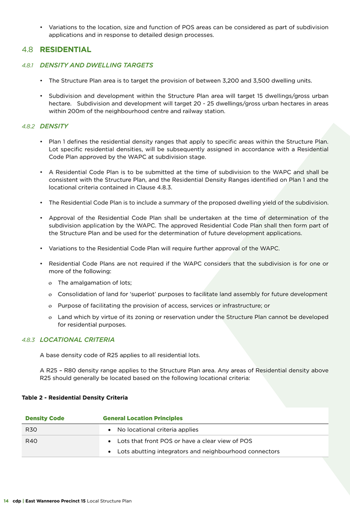
Residential Areas
The EWDSP provides for a large ‘urban neighbourhood’ in the southwestern area of Precinct 15 surrounding the neighbourhood centre and the future transit station with the balance of the residential areas being nominated as ‘suburban neighbourhood’.
The EWDSP states that the ‘suburban neighbourhood’ should be low to medium density with R Codes ranging from R5 – R60, whilst the ‘Urban neighbourhood’ should be medium to high density with R-code densities ranging from R25 – R-AC4.
The LSP states that it will accommodate 3,200 to 3,500 dwellings and achieve an estimated residential density of 15 – 25 dwellings per gross hectare. This outcome is less than the estimated 3,800 dwellings targeted in the EWDSP however it is generally in line with the residential density targets established in the EWDSP. Irrespective of this, Administration has not been provided the assumptions underpinning the proposed dwelling yield. It is estimated that the dwelling yield has been forecast based upon the R25 density code. Therefore, it is anticipated that development of significant portions of the structure plan area at densities up to R80 will yield a significantly greater number of residential lots which may require further the planned 3 primary school sites to be provided within the LSP area.
The LSP proposes a blanket residential density range of R25 – R80, with the exception of the Neighbourhood Centre which has a R40 – R80 density range. The application states that it is intended that the highest densities are located in proximity to the future station, proposed neighbourhood centre and the regional open space. This is proposed to be implemented via locational criteria included in Part 1 of the proposed LSP.
The current criteria provides substantial flexibility to the Proponent in establishing higher residential density in the locality. The locational criteria currently proposed by the Proponent permits approximately 50% of the Precinct’s residential areas to be developed in accordance with the R60 development standards. Whilst this is unlikely to occur, more detailed locational criteria are needed to provide an improved and balanced approach to establishing higher density in the Precinct. This will also be more in line with the intended outcomes of the EWDSP.
For neighbourhood centres, SPP 4.2 sets a desirable residential density target of 25 dwellings per gross hectare. Liveable Neighbourhoods - Element 1 prescribes 20 to 30 dwellings per site hectare for areas within 400m of neighbourhood centres.
Given the broad density code range proposed by the LSP, it is unclear whether the proposed LSP will adequately achieve these recommended minimum dwelling yields. Without refinement of the Locational Criteria it is expected that the dwelling yield will increase as a result of subdivision and more detailed design, similar to other LSP areas across the City where higher average densities are achieved. Irrespective of this, SPP 4.2 stipulates that the preferred residential dwelling types are low to medium rise apartments/multiple dwelling or townhouses/grouped dwellings. An R80 density code could accommodate this built form outcome which in accordance with the Planning Codes would enable up to four storey residential building height which achieves a medium rise development outcome. It is recommended that the revised density code ranges accord with the ranges contained within the WA Planning Manual: Guidance for Local Structure Plans. The refined density code ranges and criteria will provide more certainty and ensure that higher dwelling densities are appropriately focussed in areas with greater amenity and convenience such as near public open spaces, high-frequency public transport stops or stations and commercial centres.
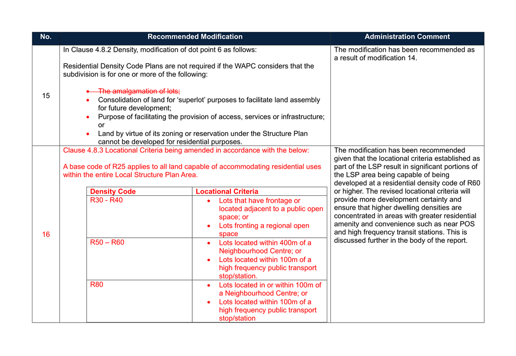
Based upon the above, Administration recommends the following modifications:
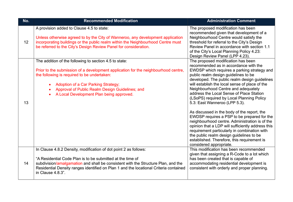
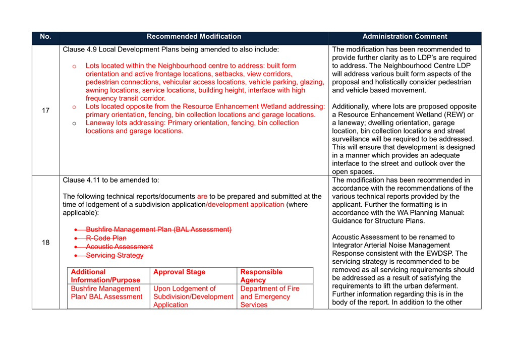
· Administration recommends that the locational criteria proposed by the Proponent in Part 1 of the LSP (Clause 4.83) be modified to the following:
A base code of R25 shall apply to all land capable of accommodating residential uses within the entire Local Structure Plan Area.
|
Residential Density Code |
Locational Criteria |
|
R30 – R40 |
· Lots that have frontage to or located adjacent to a public open space; or · Lots fronting a regional open space. |
|
R50-R60 |
· Lots located within 400m of a Neighbourhood Centre; or · Lots located within 100m of a high frequency public transport stop/station. |
|
R80 |
· Lots located in or within 100m of a Neighbourhood Centre; or · Lots located within 100m of a high frequency public transport stop/station. |
· Dwelling yields envisaged as a result of the development of the LSP area are recalculated following implementation of the revised locational criteria.
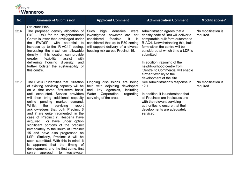
Activity Centres
Neighbourhood Centre
The EWDSP identifies the requirement for a Neighbourhood Centre in Precinct 15 which will accommodate 6,000m2 of total commercial floorspace, encompassing approximately 4,200m2 shop/retail floorspace, with the balance 1,800m2 accommodated by office uses.
The Neighbourhood Centre is described as a significant mixed-use area in proximity to the planned transit station, forming a shopping and community hub servicing the daily needs of local residents. It is to provide residential living within medium-rise development.
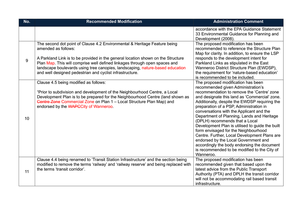
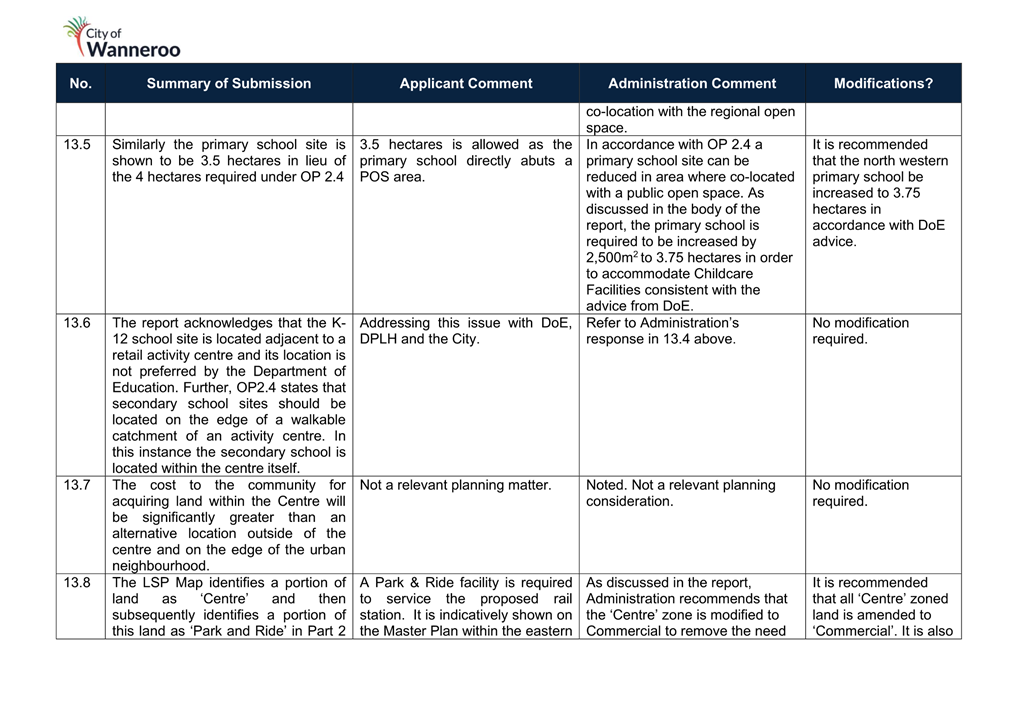
Consistent with the EWDSP, a Neighbourhood Centre is proposed for a site immediately east of the future transit station. This location will offer proximity and accessibility for residents within the East Wanneroo area. Positioned at the corner of Lakeview and Franklin Roads, both of which are integrator arterial roads, the centre will benefit from passing trade opportunities as well as providing local convenience and retail needs.
A District Community Centre and District Indoor Recreation Centre are also proposed to be located within the Neighbourhood Centre. Despite these community facilities occupying a portion of the Neighbourhood Centre, Administration is comfortable that the extent of land area occupied by these Community Facilities will still permit sufficient opportunity to realise the anticipated 6000m2 of commercial floorspace.
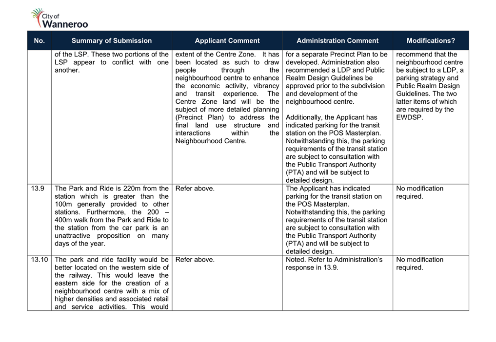
The EWDSP also requires a separate Precinct Structure Plan (PSP) be prepared for the Neighbourhood Centre. A PSP addresses all matters of a standard structure plan including but not limited to street blocks, roads, open spaces, proposed zones or land uses and public reserves with major transport or utility infrastructure. In addition to this, a PSP is required to provide guidance for the design of the built form and public spaces. Notwithstanding this requirement, further discussions between the Proponent, Administration and the WAPC have confirmed that these matters can be satisfied without the need for a further PSP being prepared. Instead, these can be addressed through preparation of a Local Development Plan (LDP).
A LDP would impose similar controls to guide the built form outcome of the centre. A LDP can be required as a condition of subdivision approval and is required to be approved by the City prior to any development occurring within the Neighbourhood Centre.
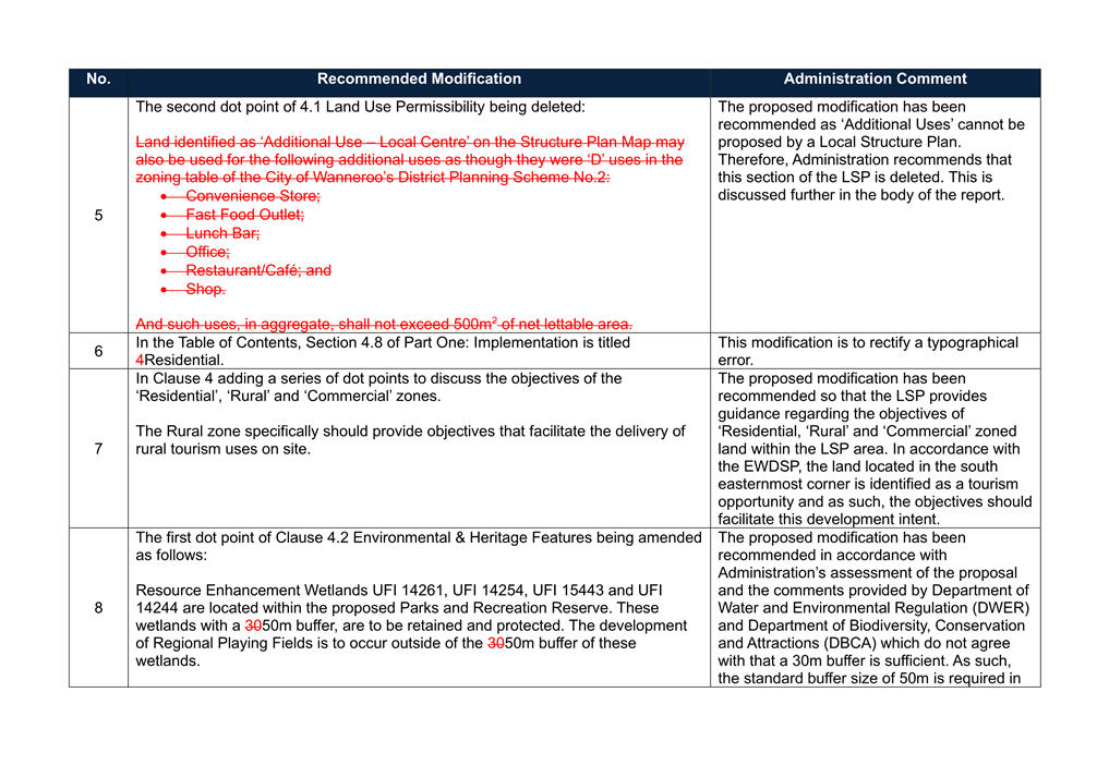
Based upon the above, Administration recommends the following modification:
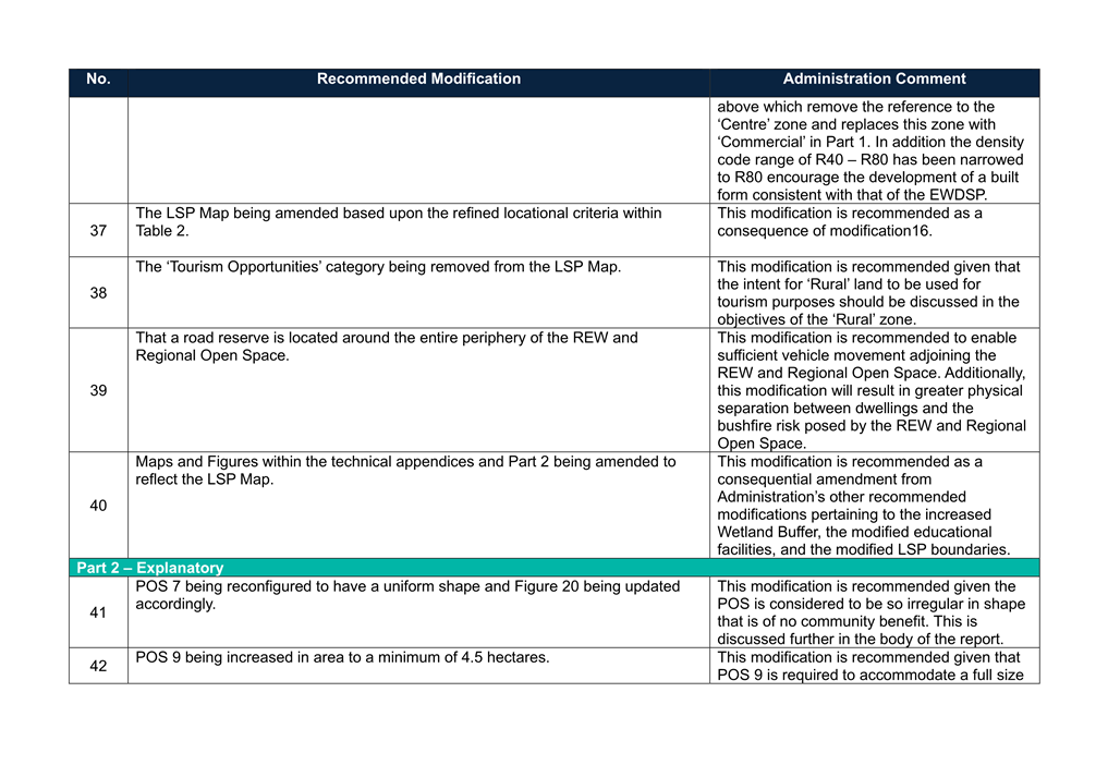
· That Part 1 of the LSP is amended to remove the requirement for a PSP and replace it with the need to prepare a LDP prior to any subdivision or development occurring within the Neighbourhood Centre.
Additional Use – Local Centre
The EWDSP states that each neighbourhood is intended to have a focal point of social interaction provided in the form of a recreation node, parkland, primary school, local centre/corner store or a combination of these.
The proposed LSP provides many of these focal points in the form of parklands, schools and recreation facilities. However, the LSP also proposes via an asterisk on the plan an 'Additional Use – Local Centre' in its northwestern corner, co-located with POS 2. However, as per the WA Planning Manual - Guidance for Structure Plans, Structure Plans are unable to incorporate additional uses which vary the land use permissibility of DPS 2. The use of an asterisk to mark the location is not an acceptable method as the subject area should be zoned in the LSP.
The Proponent has outlined to Administration that the north western portion of the LSP will likely be the first developed area of Precinct 15. The 'Additional Use – Local Centre' is only intended by the Proponent to accommodate a café/restaurant as part of a future Sales Office and Display Home Village.
Further conversations between the Administration, the Proponent and the WAPC have confirmed that this outcome sought by the Proponent is better realised through a development application at a later stage which would consider the use on its merit. Any such use would be on a temporary basis and be undertaken prior to the Public Open Space (POS) being ceded to the City for management. Should there be a long term desire to retain the café/restaurant on the site, this would be subject to further approval.
Administration recommends the following modification:
· That the ‘Additional Use – Local Centre’ clause of the LSP be deleted and the map amended to remove the corresponding asterisk.
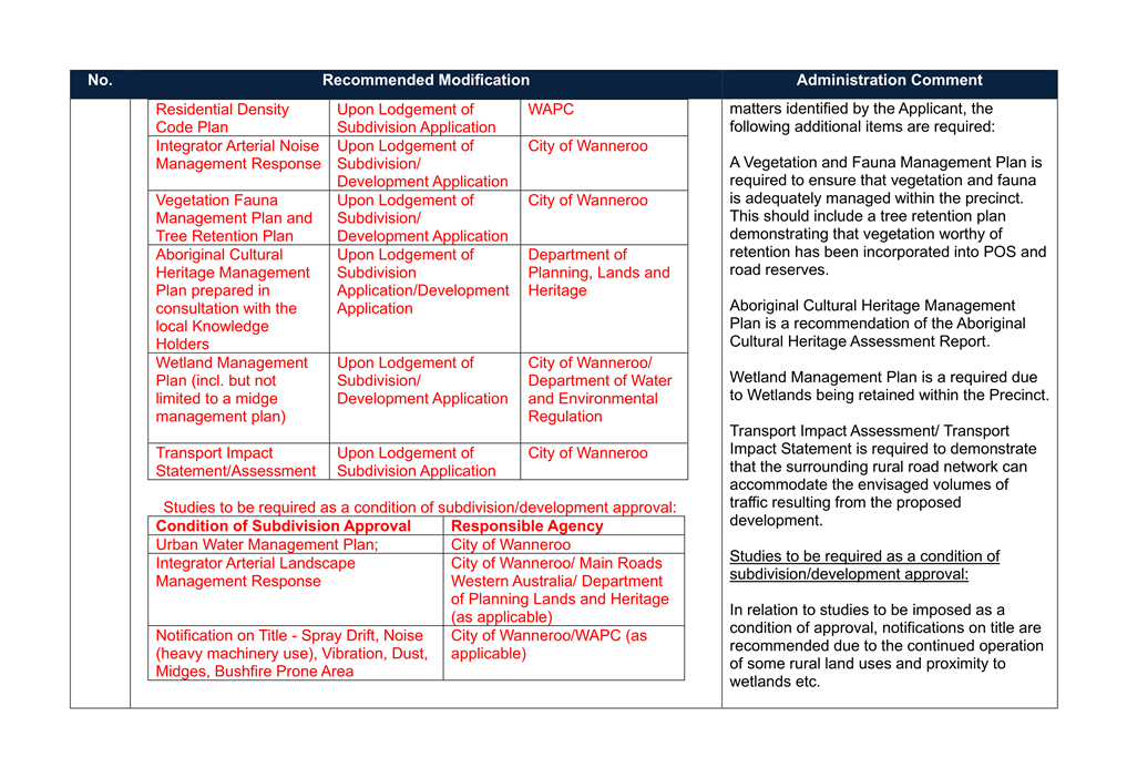
Community Facilities
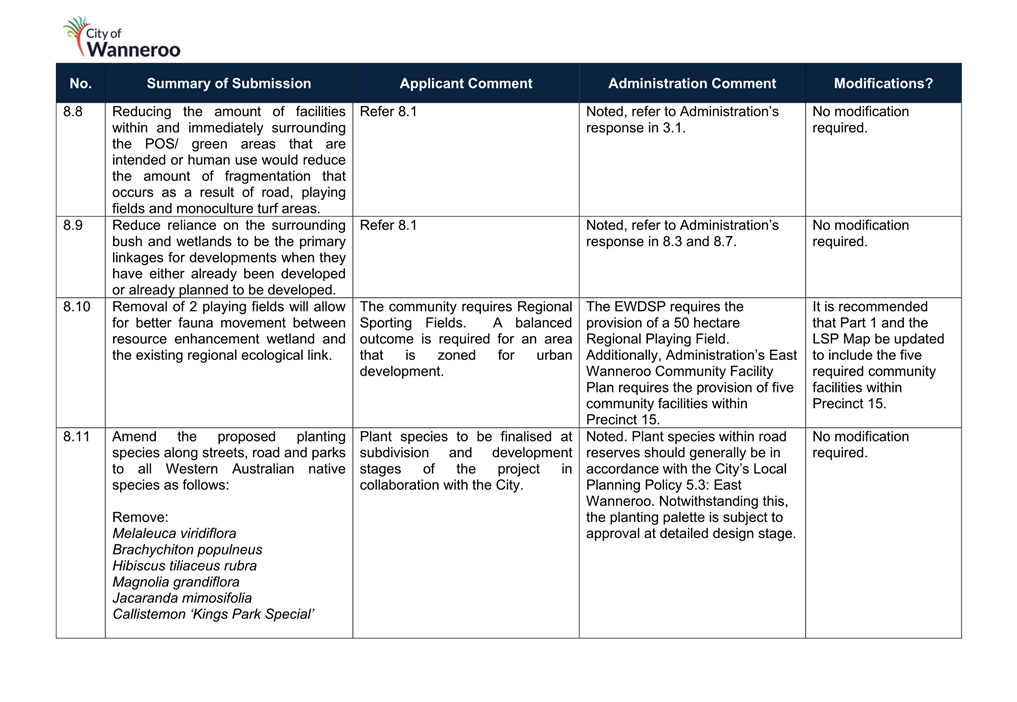
In accordance with the East Wanneroo Community Facilities Plan (Attachment 13) prepared by the City of Wanneroo to support the EWDSP, the following community facilities are required to be provided within Precinct 15.
· Regional Playing Field;
· District Community Centre;
· District Indoor Recreation Centre;
· Neighbourhood Playing Field and Pavilion/Community Centre; and
· District Open Space.
Three community facilities have been identified by the Proponent, including the Regional Playing Field, the District Community Centre and the District Indoor Recreation Centre. The Neighbourhood Playing Field and Pavilion/Community Centre and the District Open Space (DOS) are not identified on the LSP Map in Attachment 10.
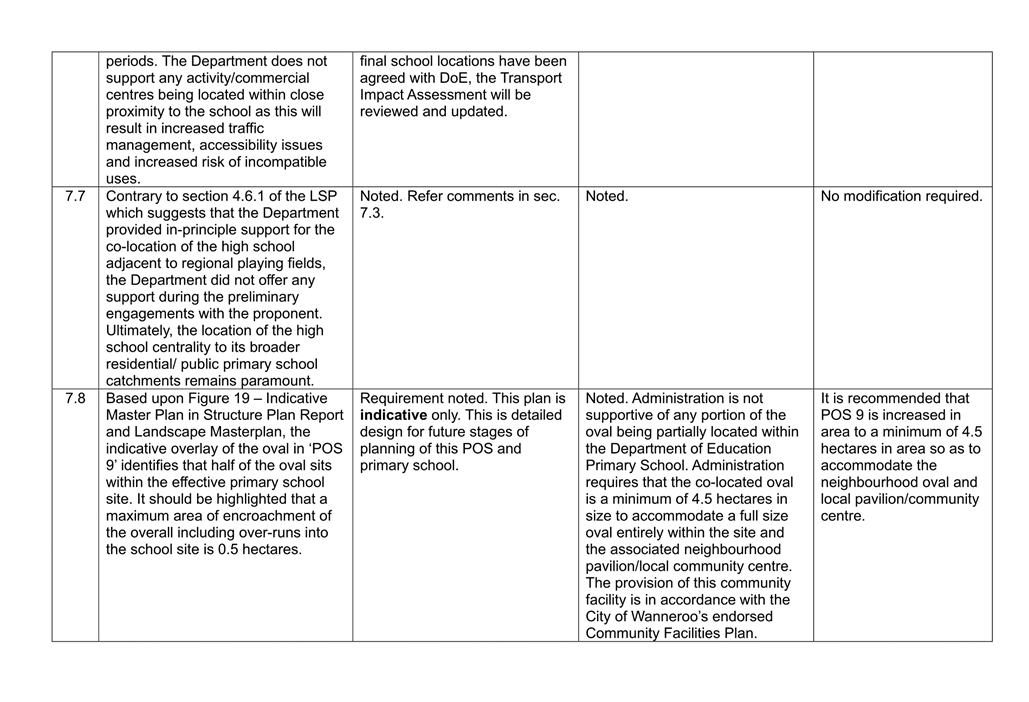
The Neighbourhood Playing Field and Pavilion/Community Centre is capable of being co-located with the Primary School however the POS is required to be increased to 4.5 hectares in order to sufficiently accommodate both the required neighbourhood oval and community facility. The location of this community facility also aligns with the spatial distribution represented in the Community Facilities Plan.
The Community Facilities Plan identifies that a District Open Space is required to be 10 hectares in area. Local Planning Policy 4.3: Public Open Space (LPP 4.3) stipulates that High Schools can be co-located with DOS to create district community hubs. The outcome envisaged by the Local Planning Policy has been implemented previously in Butler with Halesworth Park being co-located with Alkimos College and this reduces the duplication of car parking, drainage infrastructure and maintenance.
The Proponent has not demonstrated the location of the DOS on the LSP map. The
Proponent contends that the DOS should not be incorporated within Precinct 15
for the following reasons:
· They were not aware of the requirement to provide this facility until June 2024 and as such, could not be accounted for as part of the preparation of the LSP;
· The DDCP doesn’t cover the acquisition cost of land required for the DOS;
· POS has already been equitably distributed across the precinct; and
· There are a sufficient number of playing fields within Precinct 15 and as such, the DOS would be more appropriately located in another Precinct.
Notwithstanding the above, the Proponent was made aware of the need for multiple DOS site within the East Wanneroo District Structure Plan are as identified in the original Community Facilities Plan 2019 as this was discussed at a meeting with DPLH and the Developers which the City hosted in July 2023. In developing their Local Structure Plan for Precinct 15, Stockland should have consulted with the City and DPLH to understand which of these community facilities were required to be provided in the LSP area.
Despite the view of the Proponent it is considered that the DOS should be provided within the LSP area for the following reasons:
· Precinct 15 is one of the most accessible Precinct’s in the EWDSP;
· DOS provides for a different range of sporting activities than the Regional Open Space;
· The DOS contributes towards the overall provision of 10% POS within the Precinct required in accordance with Development Control Policy 2.3: Public Open Space and LN; and
· The facilities to be provide on the DOS site are to be funded through the DDCP.
Given the above, Administration recommends the following modifications:
· Part 1 of the LSP and the LSP Map being amended to indicate the location of the Neighbourhood Playing Field and Local Pavilion/Community Centre; and
· Part 1 of the LSP and the LSP Map being amended to co-locate the DOS with the High School.
Education Facilities
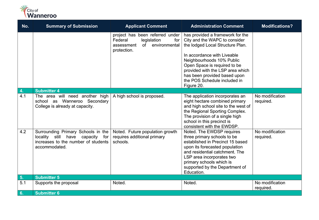
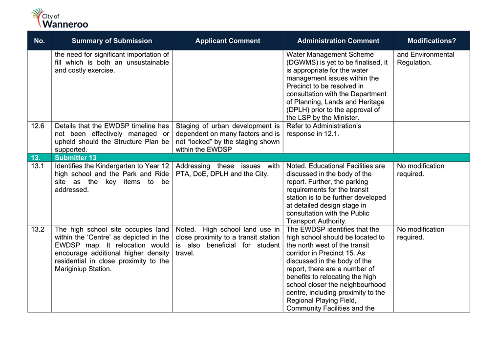
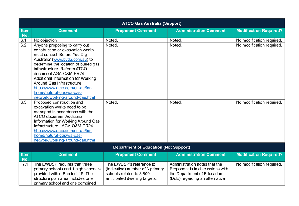
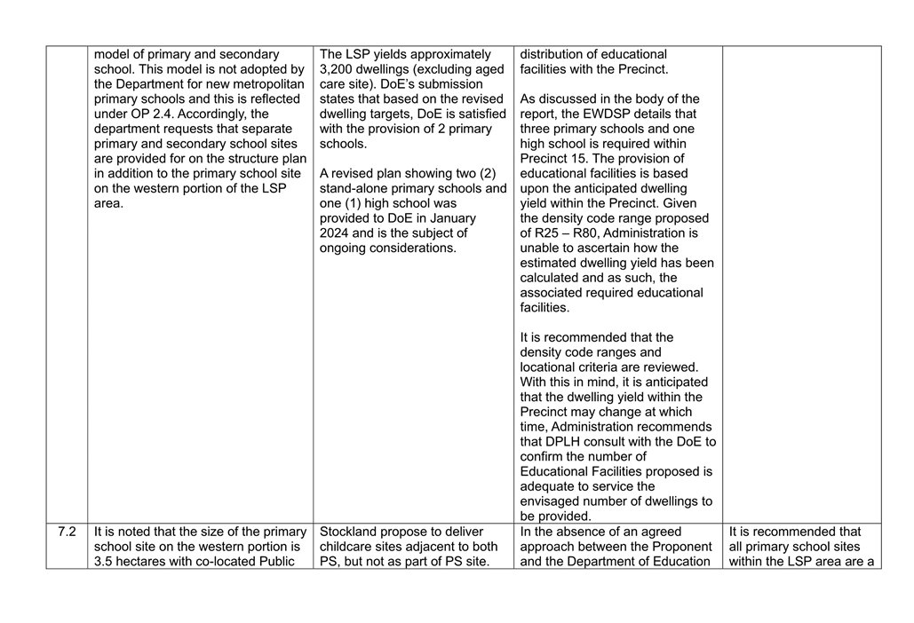
The EWDSP requires Precinct 15 to provide three primary schools and one high school.
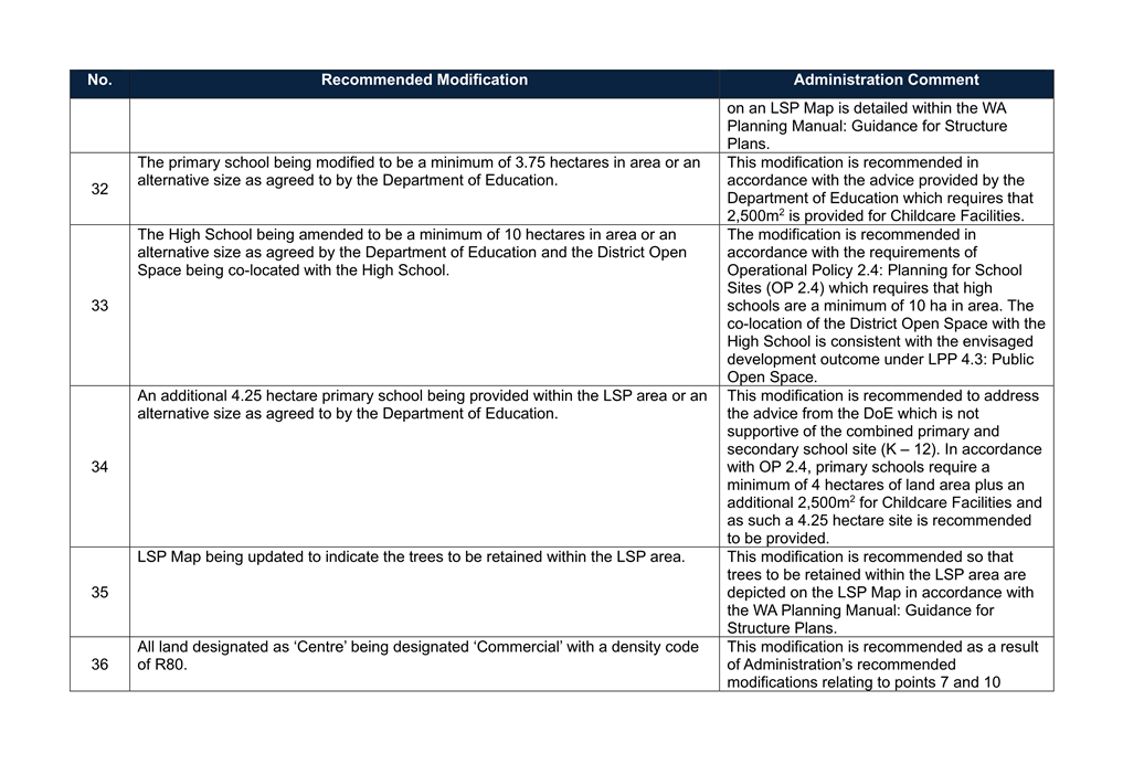
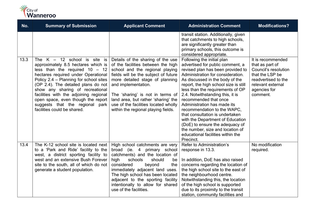
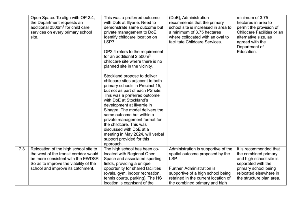
WAPC Operational Policy 2.4 Planning for School Sites (OP 2.4) requires one primary school site for every 1,500 dwellings and one High School for every four to five primary schools. The Policy also requires that the minimum size for a primary school and a high school site is 4ha and 10ha respectively which can be increased by 2,500m2 at the request of DoE for the provision of Childcare Services.
It is also noted, that a school site can be reduced in size where it is co located with public open space, at the discretion of the DoE and the Local Government.
Based on the estimated dwelling yield of 3,200 – 3,500 dwellings, the proposed LSP incorporates one 3.5 hectare primary school site and an eight hectare combined primary and high school site co-located with the regional playing fields. A primary school is required for every 1500 dwellings within the LSP area. Should the dwelling yield increase as a result of the density ranges being modified, an additional primary school may be required within the LSP area.
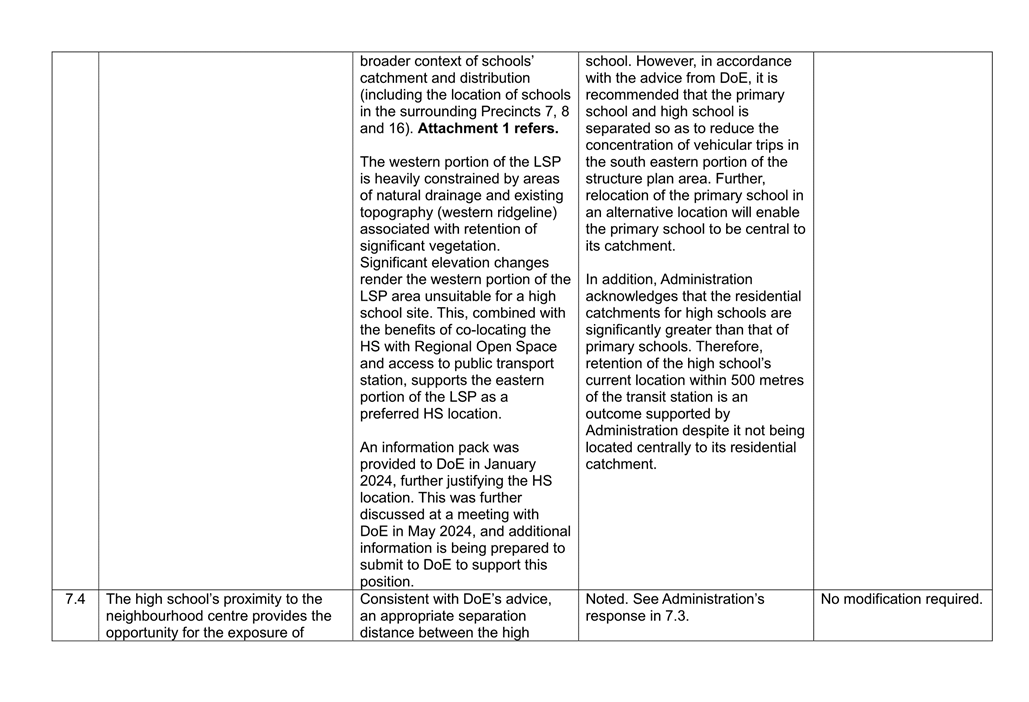
The EWDSP requires the high school site to be located north west of the future transit station and neighbourhood centre. However, the high school is proposed to be located to the east of the transit station and abutting the Regional Playing Fields at the southern boundary of Precinct 15, adjacent to Lakeview Road. The proposed LSP states that the location of the high school creates a co-location opportunity with the regional playing fields and provide for sharing of facilities and infrastructure across these two land uses.
The LSP was referred to the DoE for comment. The DoE has supported the reduced number of primary schools based on the projected dwelling yield. However, the DoE does not support the adequacy, delivery model and size of the school sites proposed. The DoE has also requested that the primary school be at least 3.75 ha to accommodate Childcare Services.
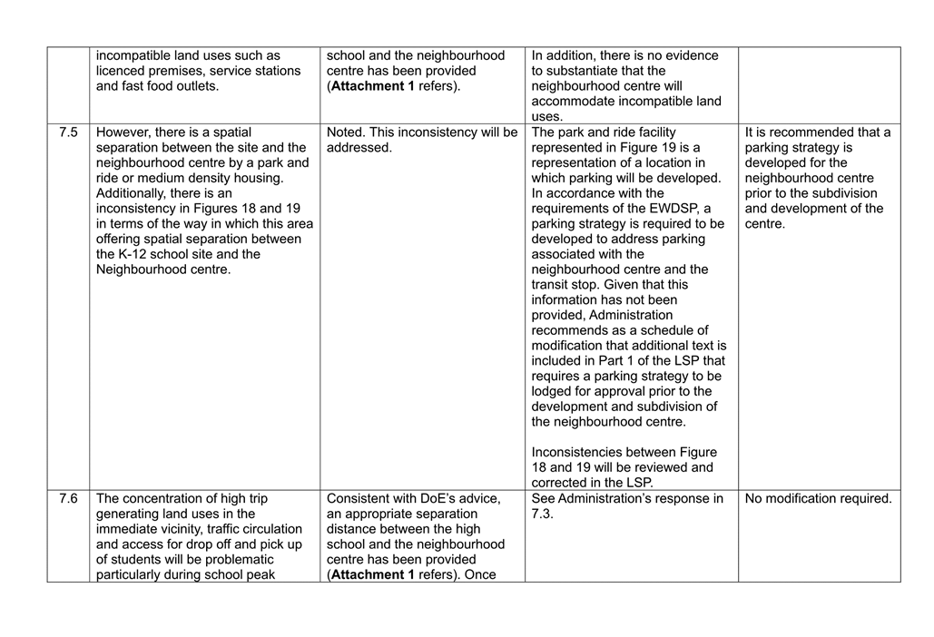
Additionally, the DoE do not support the combined primary school and high school site (combined site). This model for the delivery of educational facilities is not supported under OP 2.4. The DoE has also stated that the location of the combined site is not supported, as the location is not central to the future residential catchment area and its proximity to the Neighbourhood Centres resulting in the potential exposure to incompatible land uses (such as licensed premises, service stations, fast food outlets, etc). Further the DoE identified that the combined site’s location is on an existing wetland which may impact the ability for the site to be developed.
Administration recommend that the combined site be separated and that the primary school is relocated in an alternative location within the LSP area. The current location of the high school is supported, as it is suitably co located with Regional Open Space, transit orientated development and community facilities. The location of the high school will also enable school students to activate the Neighbourhood Centre, creating vibrancy and support future businesses established in the area. High schools have a greater residential catchment when compared to a primary school and therefore its location in proximity to the transit station will maximise accessibility to the site via local public transport. Additionally, whilst it is possible that licensed premises, service stations and fast food outlets and the like could be located within the Neighbourhood Centre it is premature to suggest that this would occur in a way that could affect the operation of a high school. In relation to licensed premises, where an application is received proposing a licensed premises it would be subject to assessment against the City’s Local Planning Policy 2.8 Licensed Premises (LPP 2.8) and would require the relevant approvals by the Department of Local Government, Sport and Cultural Industries (Racing, Gaming and Liquor). DoE’s concerns regarding the adequacy of the site is noted and the Proponent has confirmed that the site will be earth worked in order to accommodate development on the site. As such, Administration is supportive of the high school in its current location.
The current size of the primary school site is not supported and it is recommended that it is modified to comply with the minimum primary school lot size stipulated in OP 2.4 and DoE comments. Further, Administration recommends that the resolution includes a recommendation that the WAPC consult with the DoE to confirm the appropriateness of the educational facility locations and suitability of the sites as the matters remain unresolved.
Based on the above, Administration recommends the following modifications:
· The primary school being increased to 3.75 hectares in accordance with DoE comments;
· The combined high school and primary school site being separated;
· A separate 4.25 hectare primary school site being provided within the LSP area; and
· The high school site being increased in area to a minimum of 10 hectares in accordance with OP 2.4.
In addition to these modifications, it is recommended that Council request the WAPC undertake further consultation with the DoE and the City once dwelling yields are established.
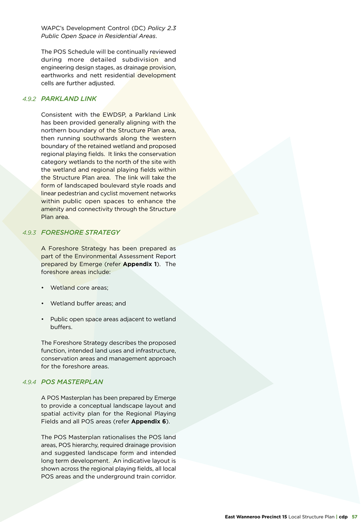
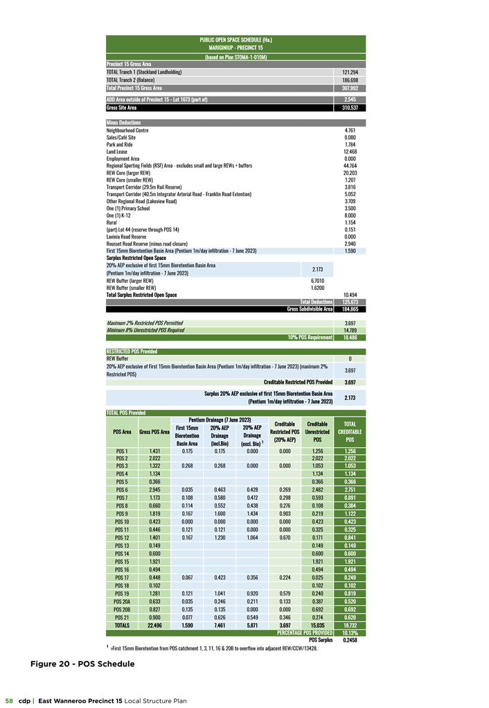
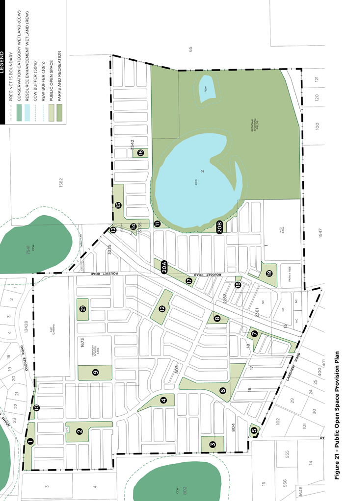
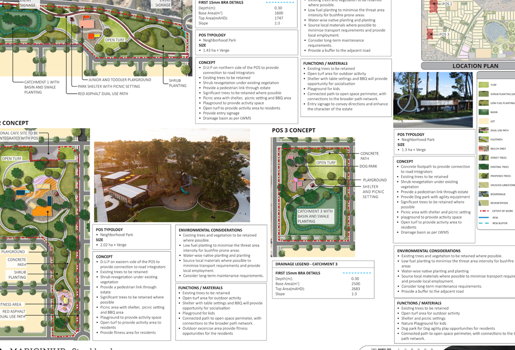
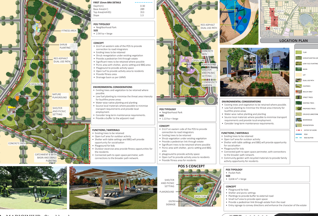
Open Space
Liveable Neighbourhoods requires a minimum contribution of 10 per cent of the gross subdivisible area to be given up free of cost by the subdivider for public open space (POS) and may comprise a minimum of eight per cent active and passive recreational purposes where the remaining two per cent (of the overall minimum 10 per cent, or one-fifth) comprises restricted use public open space. Restricted open space is open space which is constrained in a way which restrict the use of the space for recreational purposes by the general public. This restriction could be a result of drainage, easements, cultural heritage sites and significant topographical features.
The proposal satisfies the requirements of LN providing a total of 10.13% POS. In addition to LN, the City’s LPP 4.3 is intended to provide a local interpretation of these requirements to ensure the delivery of POS which optimises community benefit. Generally speaking, the proposed POS distribution is influenced by topography, existing native vegetation and landownership. As a result of these considerations, drainage opportunities have been identified at natural low points in the land to minimise site works, where possible, and maintain some of the natural topography.
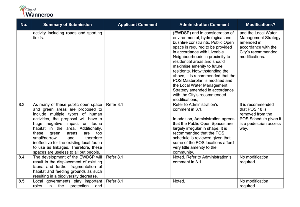
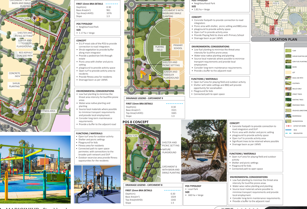
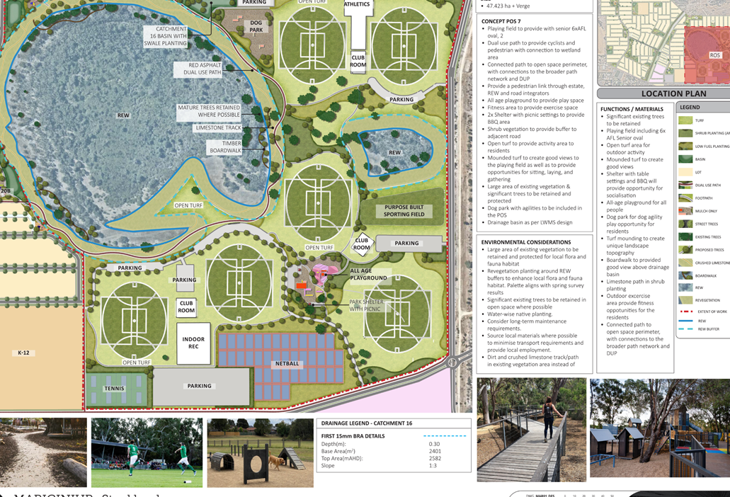
A number of the public open spaces do not appear to maximise community benefit. POS 7, 9, and 18 are either unable to accommodate the standard design requirements of LPP 4.3, irregularly shaped or are so relied upon for the purposes of drainage they offer little benefit to the community.
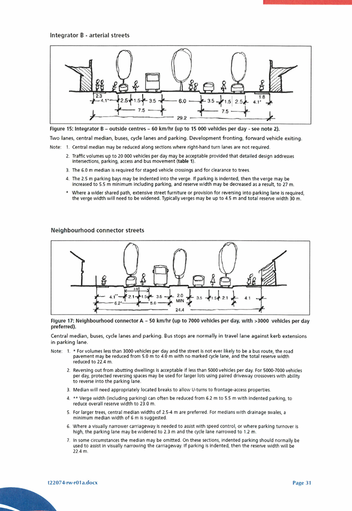
With respect to POS 7, the shape of the POS is irregular and follows the alignment of Franklin Road which is intended to be a six lane road and will carry a volume of 27,800 vehicles per day upon development of the entire EWDSP area. Considering the types of community infrastructure generally provided in POS, its location inadequately responds to its surrounding context.
POS 9 is 1.819 hectares in size and co-located with the north western primary school. In accordance LPP 4.3, a 4 hectare open space site is required to facilitate the development of a playing field to support a primary school. In addition, as stated above, the EWDSP identifies in the Communities Facilities Plan (Attachment 13) that an additional 5000m2 is required to accommodate a Neighbourhood Playing Field and Local Pavilion/Community centre in this location.
The LSP proposes that the recreational facilities will encroach into the DoE primary school site resulting in less land to accommodate the recreational facilities. OP 2.4 states that where a school site is to be co-located with POS, the essential facilities and infrastructure for the functioning of the POS are to be fully incorporated and contained on a separate adjoining open space lot or Crown reserve. This ensures the long term security for the playing fields for the community in locality in the event that following implementation of the EWDSP the primary school site is no longer viable. Therefore, Administration considers POS 9 to be inadequate to accommodate these requirements and not compliant with the Operational Policy.
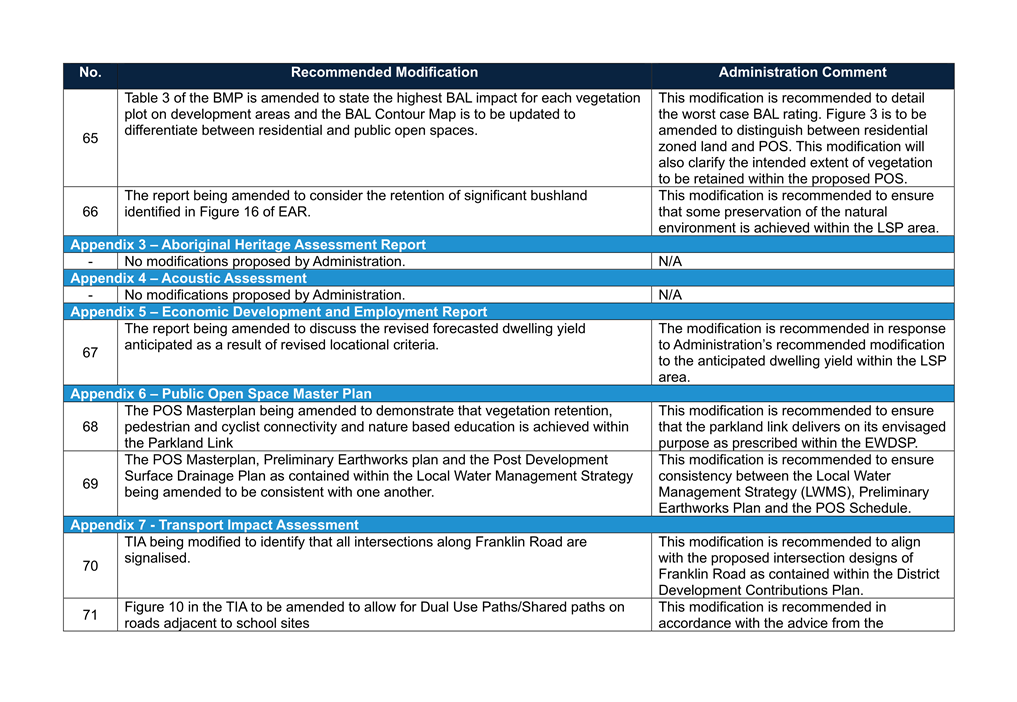
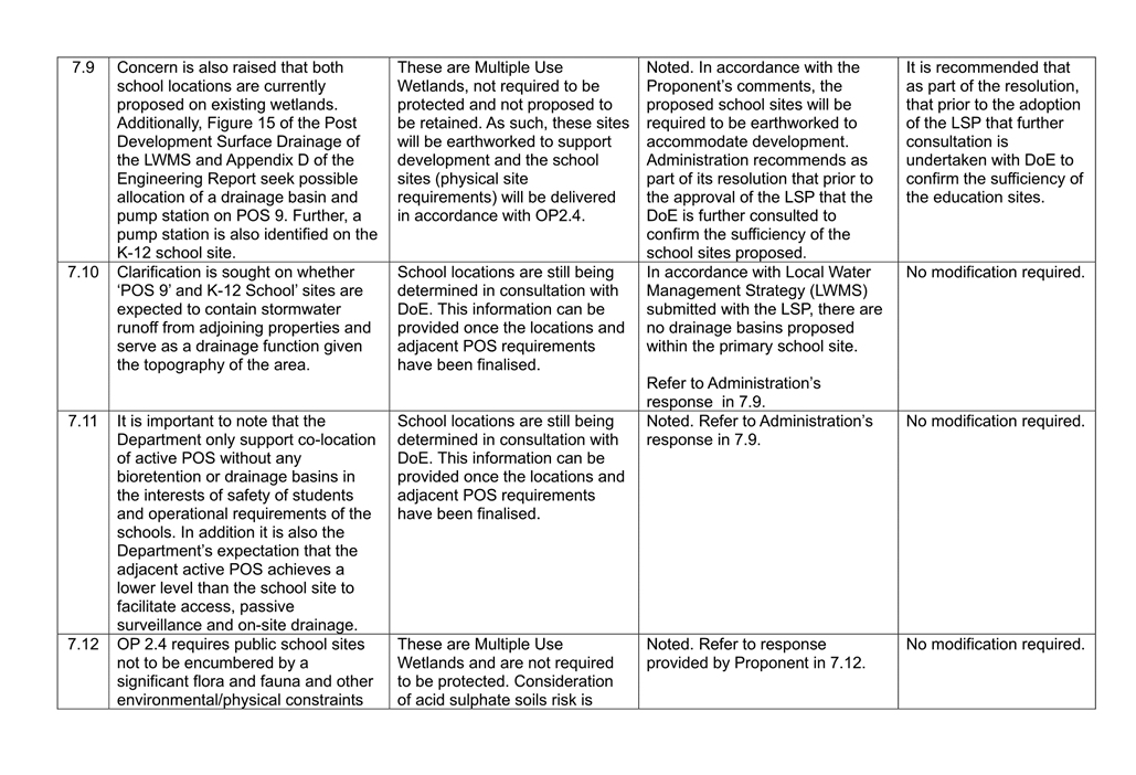
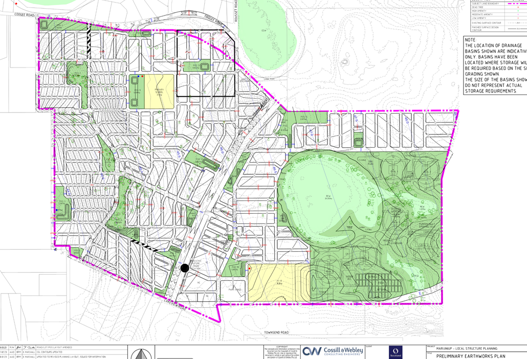
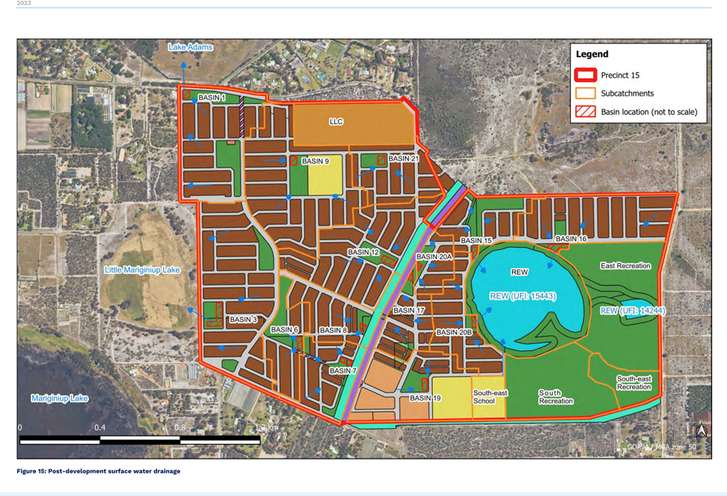
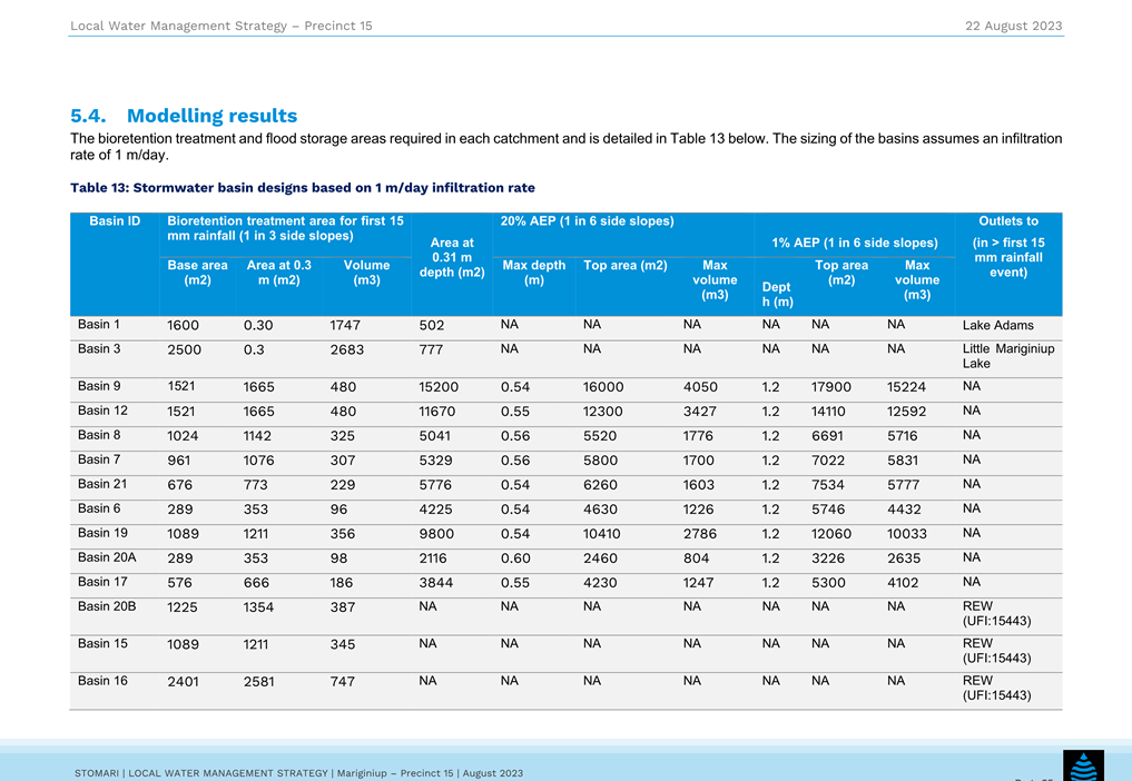
In addition to the above, Administration has identified that the Regional Open Space incorporates a drainage basin (Basin 16) within its north western corner abutting the Resource Enhancement Wetland. This basin is inconsistently represented within the Preliminary Earthworks Plan (Attachment 14) and the Post Development Surface Water Drainage Plan (Attachment 15) as contained within the Local Water Management Strategy (LWMS) and the POS Masterplan (Attachment 16) The location of a basin in this location is not supported given that in accordance with LPP 4.3 site constraints should be minimised so as to maximise the viability of the Regional Open Space. Therefore, it is recommended that the basin be removed from this location and water be managed in an alternative location and the technical appendices and the POS schedule amended to be consistent with one another.
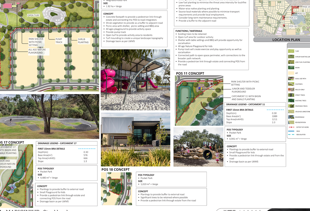
POS 18 is 1020m2 in area and in accordance with LPP 4.3 is classified as a “Pocket Park” which is permitted to be of a size of 5000m2 or less. The Proponent has not demonstrated that the proposed pocket park is able to accommodate the standard development requirements for this POS classification and given its shape and design performs the function of a pedestrian accessway. The POS Masterplan details that POS 18 is intended to retain significant trees however given its relatively small size and its proximity to residential development it is unlikely to achieve this outcome given that the retained trees would likely present a bushfire risk to the adjoining residential properties.
Based on the above, Administration recommends the following modifications:
· Reconfiguration or relocation of POS 7 so that its design responds to the forecast volumes of traffic envisaged along Franklin Road;
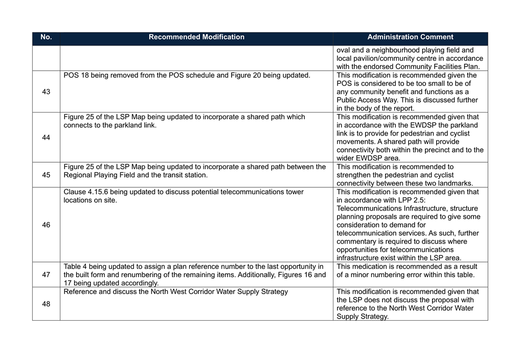
· POS 9 is increased to 4 hectares in area plus an additional 5000m2 for the Local Pavilion/Community Centre totalling 4.5 hectares;
· Removal of Basin 16 out of the Regional Open Space and the LWMS and POS Masterplan being amended accordingly; and
· Removal of POS 18 from the POS schedule as this is a pedestrian access way.
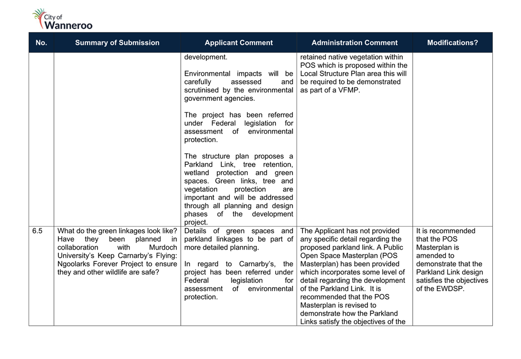
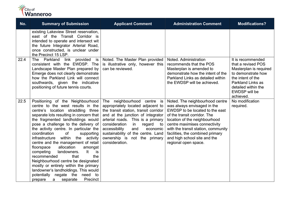
Parkland Links
The EWDSP provides for a range of natural connections that provide a network of landscaped spaces which provide for leisure, recreation, ecology and biodiversity. These ‘Parkland Links’ provide connectivity between Lake Gnangara, Lake Jandabup, Lake Mariginiup and Lake Adams. The EWDSP does not stipulate a particular way in which the Parkland Links are to be delivered and suggests that they may comprise of linear parks or landscaped boulevards. The Parkland Link is located to the east of the transit station providing a north south connection between Precincts 7 and 9 of the EWDSP.
Lakeview Road and Franklin Road present significant challenges to the connectivity of the Parkland Link. Given that the design and construction of Franklin Road and Lakeview Road is yet to be finalised, it is recommended that the DPLH consider pedestrian and cyclist connectivity in further detail as part of the ongoing development of the road designs as part of their consideration of the DDCP.
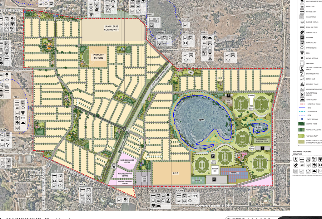
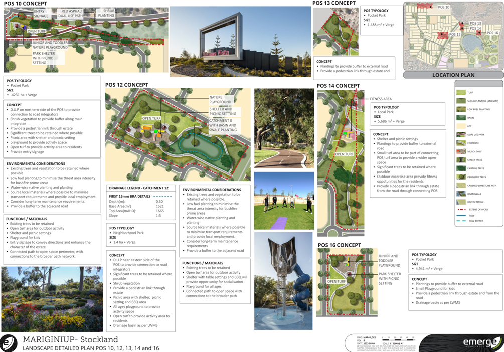
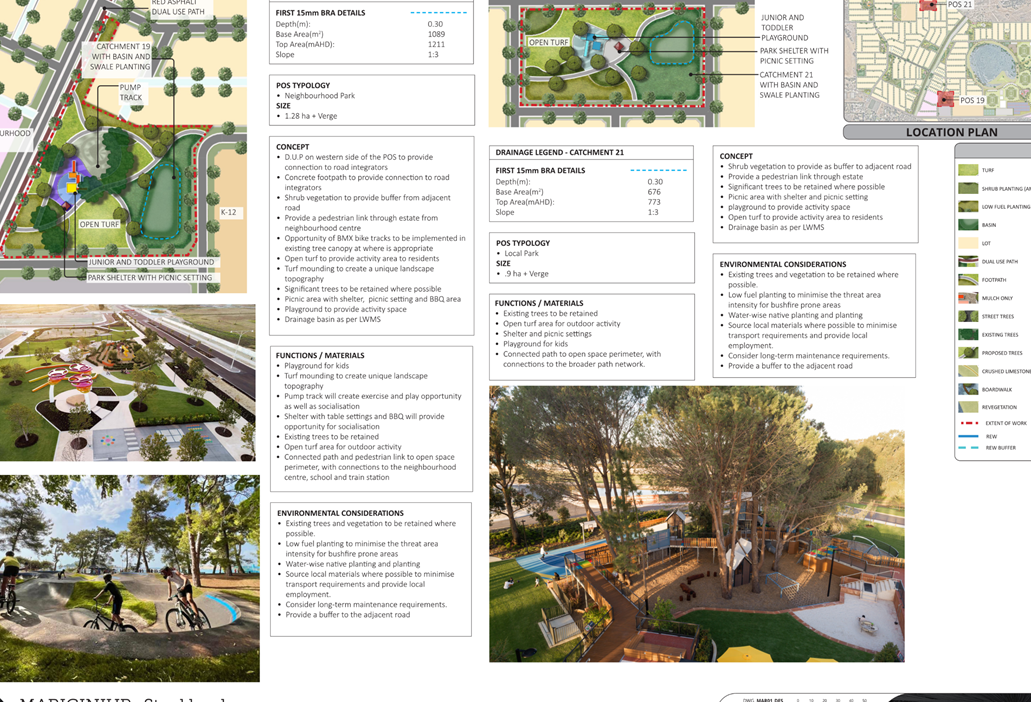
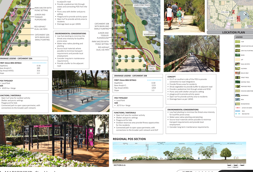
LPP 5.3 provides cross sections on how these approaches could be implemented but these have not been utilised in this instance. Rather, the Proponent has detailed that where possible parkland links will be provided within POS or road reserves. This relationship is represented within the POS Masterplan (Attachment 16). A concept for the Regional Sporting Complex is provided as part of the POS Masterplan which indicates that a dual use path will be provided to the western side of the Resource Enhancement Wetland. Connectivity between POS sites 11 and 15 across a neighbourhood distributor road is yet to be substantiated given the inconsistent identification of drainage basins within the technical reports.
The POS Masterplan does not indicate whether the dual use path continues beyond the northern boundary of the Resource Enhancement Wetland. Additionally, the Preliminary Earthworks Plan indicates that POS 14 is encumbered by a drainage basin at its southernmost point hindering the continuity of the Parkland Link.
Administration recommends the following modifications:
· A revised Parkland Link design in the POS Masterplan be provided demonstrating how pedestrian and cyclist connections are achieved between each Public Open Space; and
· The Preliminary Earthworks Plan and Post Development Surface Water Drainage Plan as contained within the Local Water Management Strategy (LWMS) being updated to ensure consistency between the POS Masterplan and the POS Schedule.
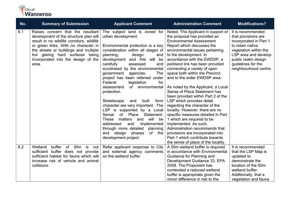
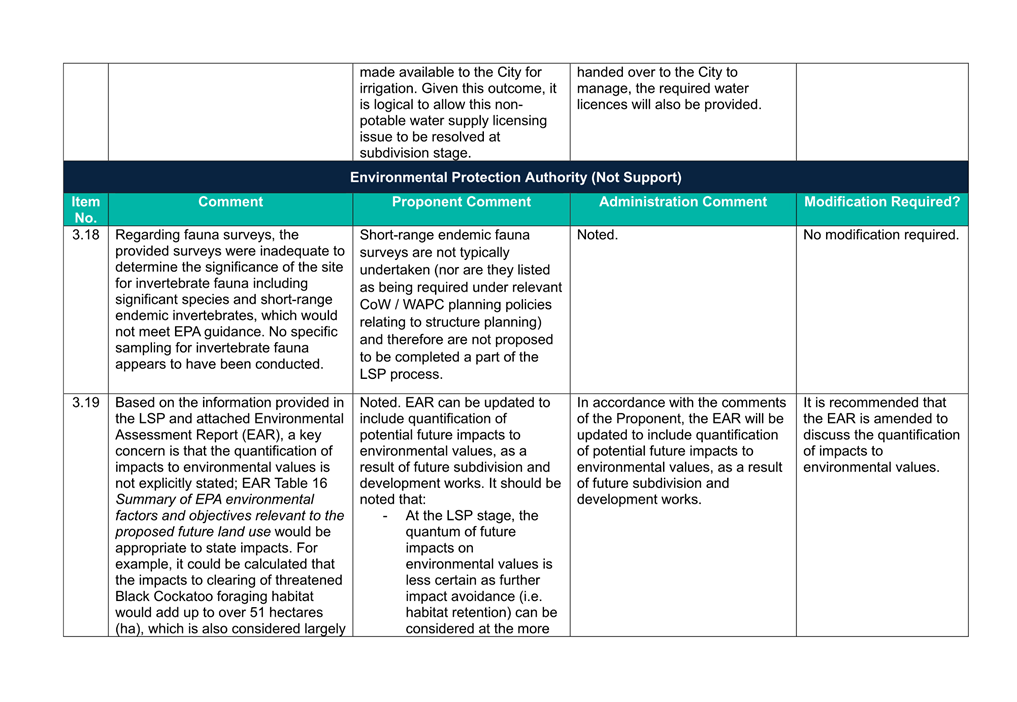
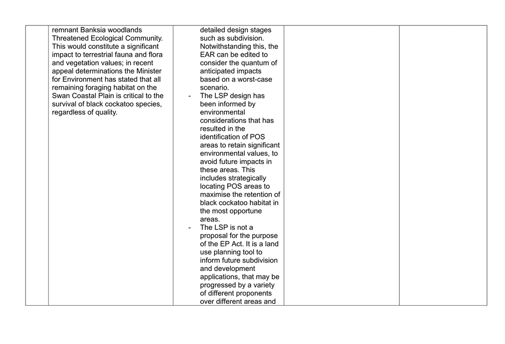
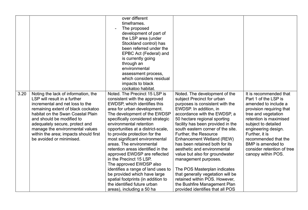
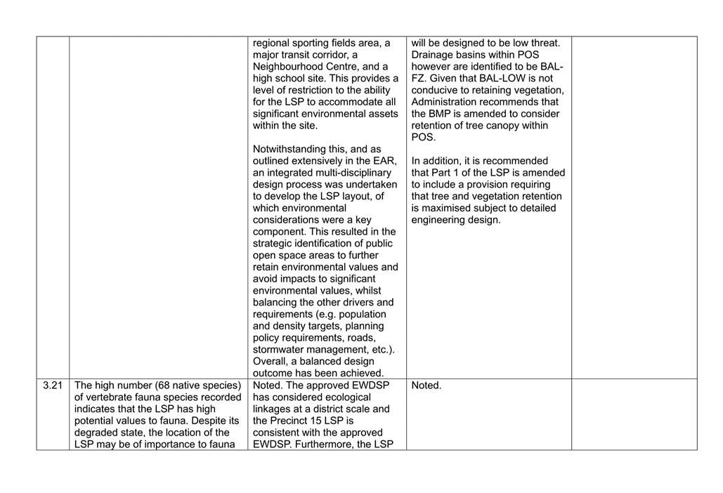
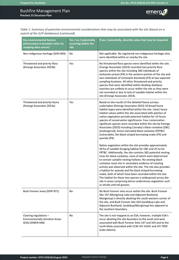
Environmental Considerations
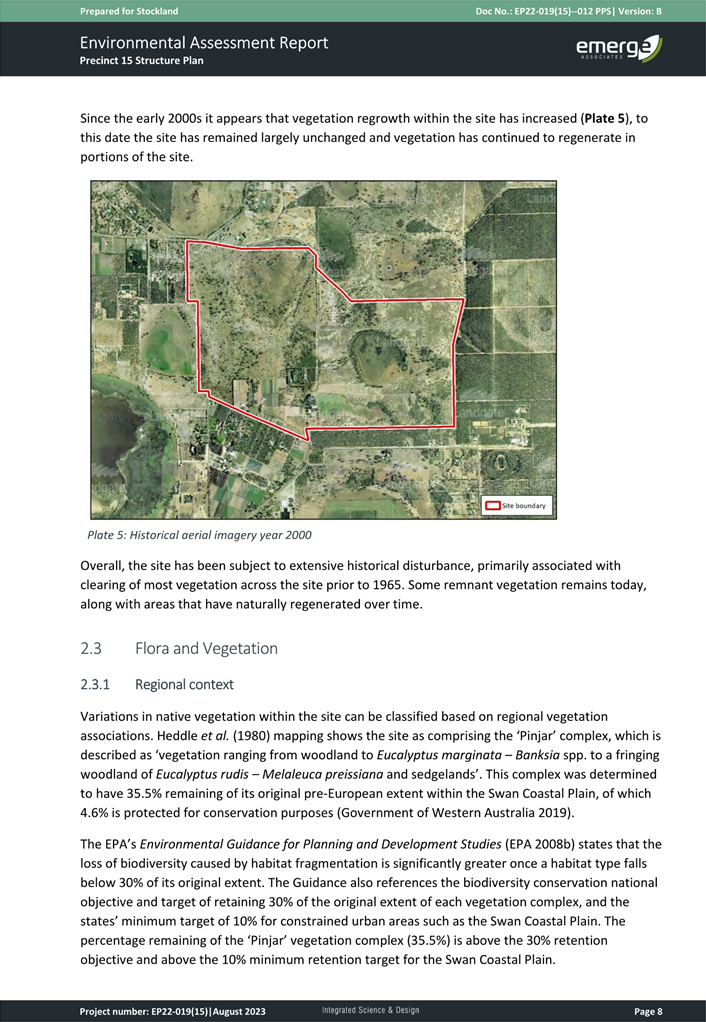
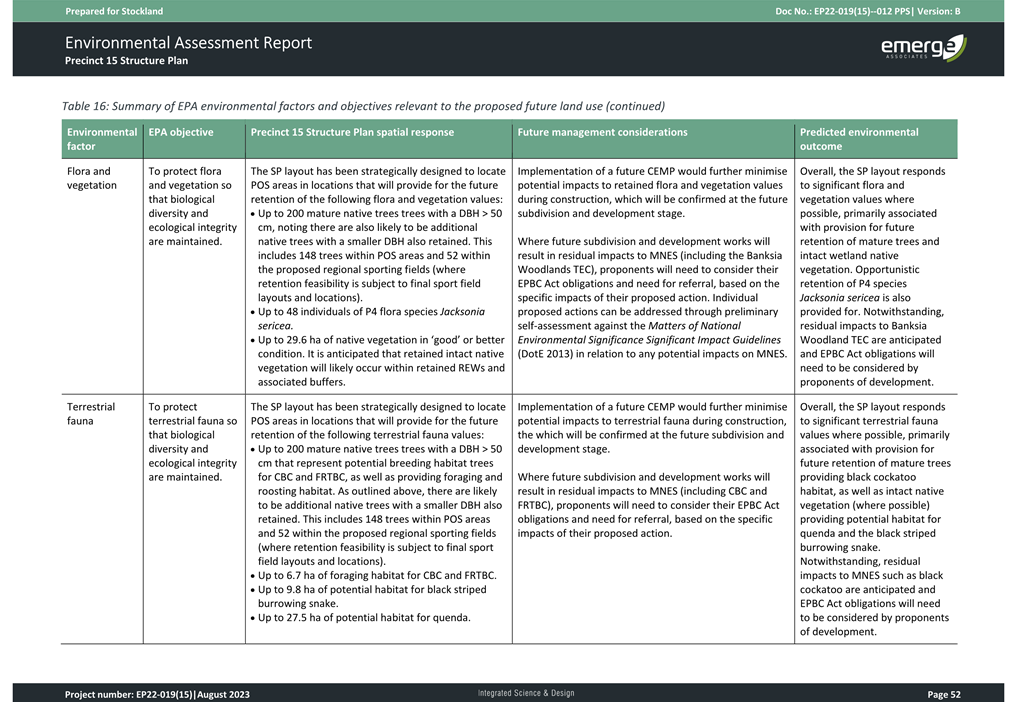
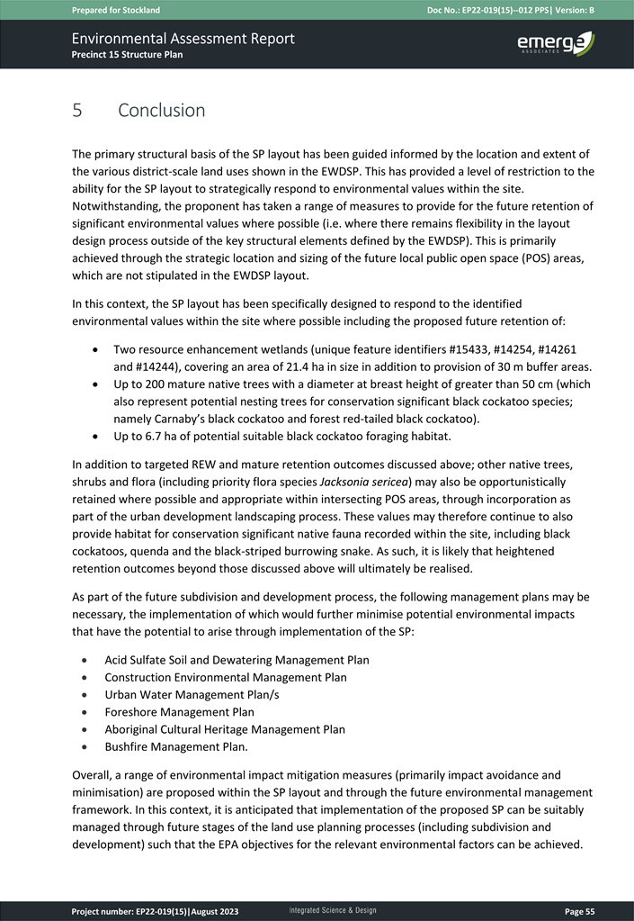
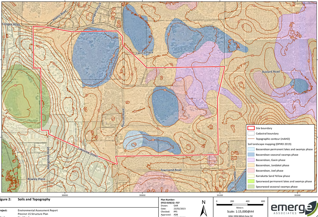
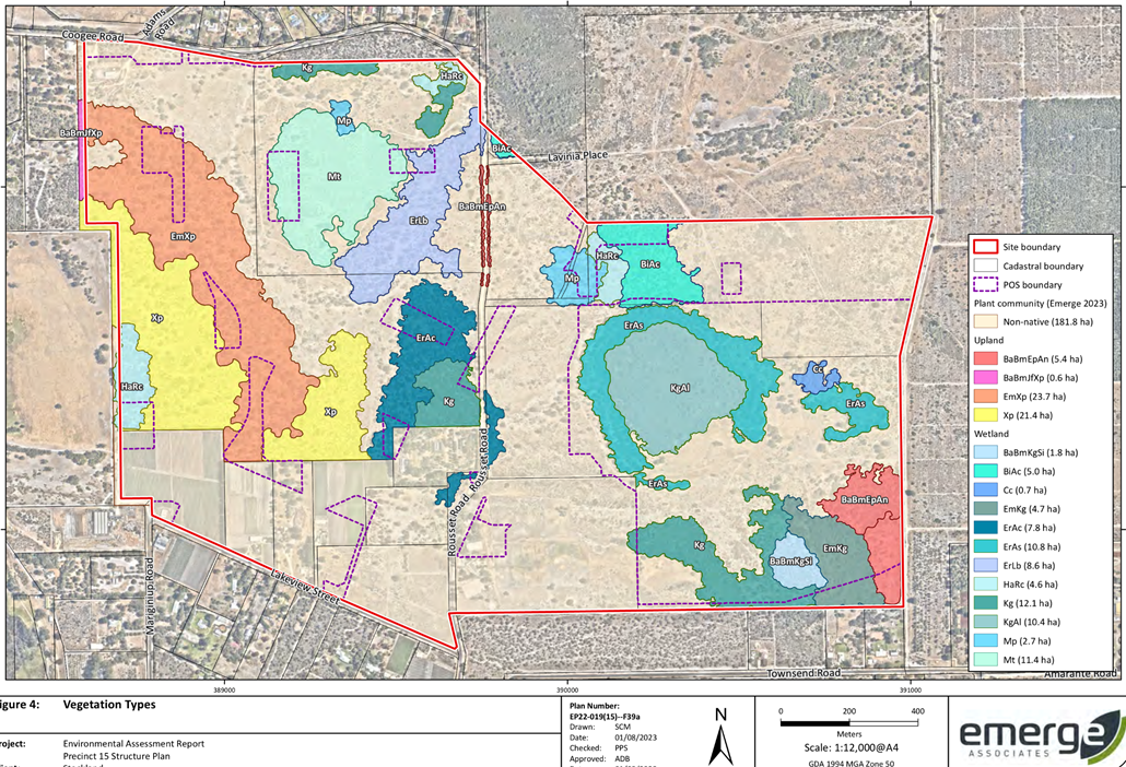
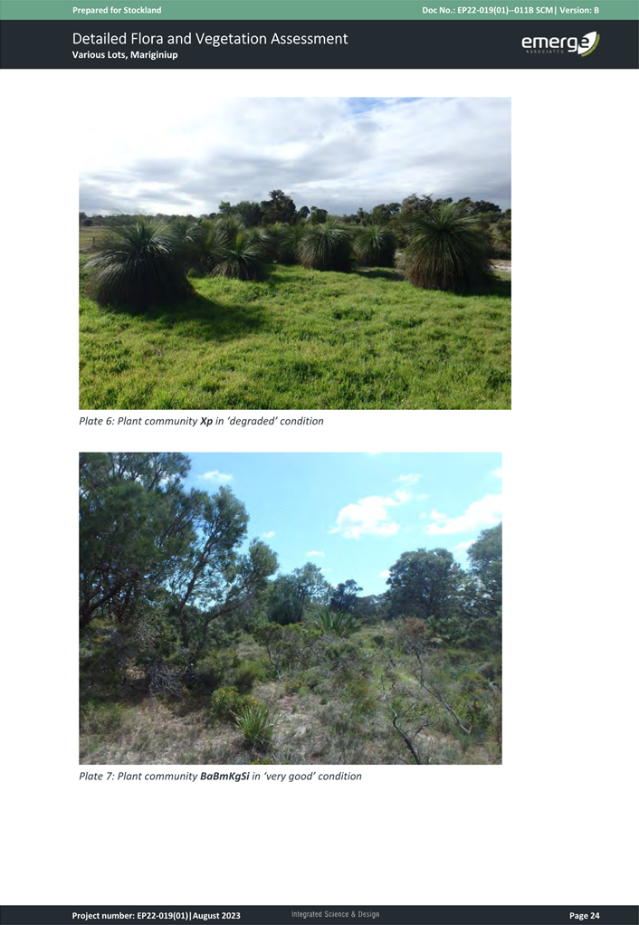
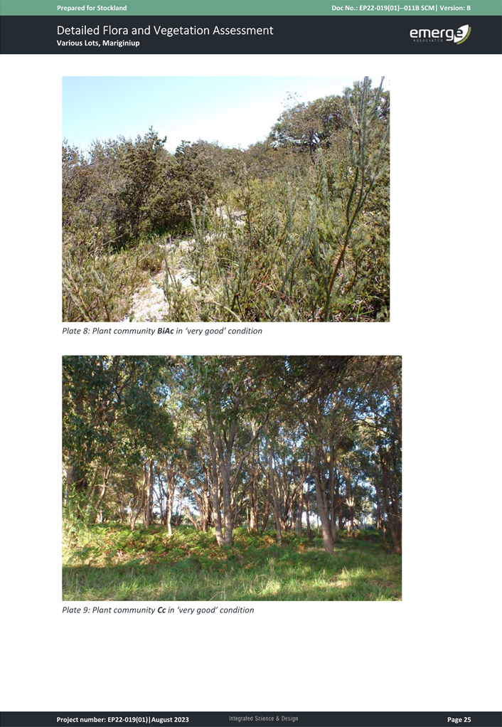
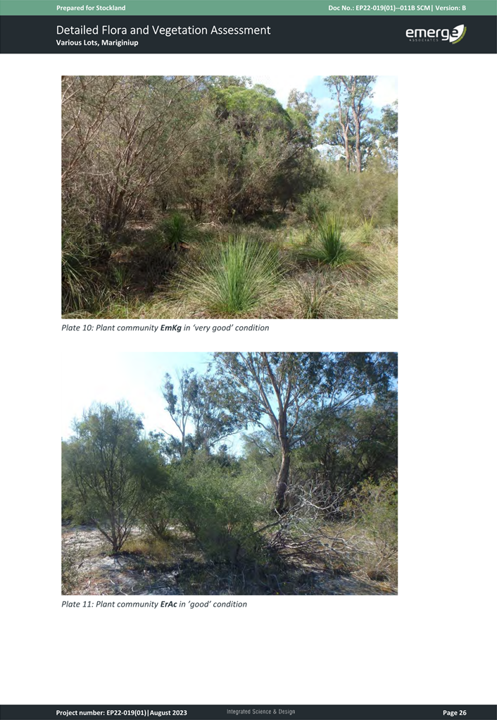
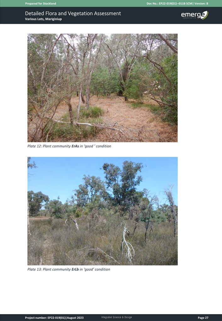
The Proponent has provided an Environmental Assessment Report (EAR) (Attachment 17) which comments on each of the various environmental aspects of the LSP area.
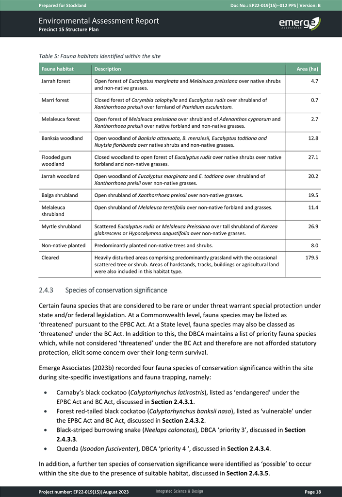
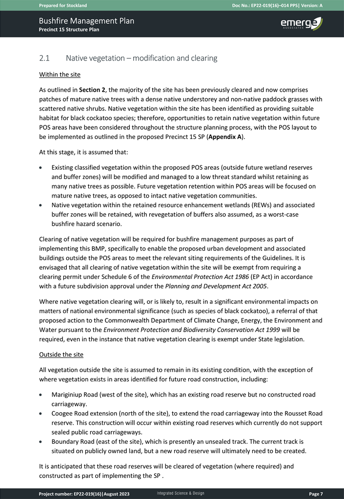
Vegetation and Fauna Management
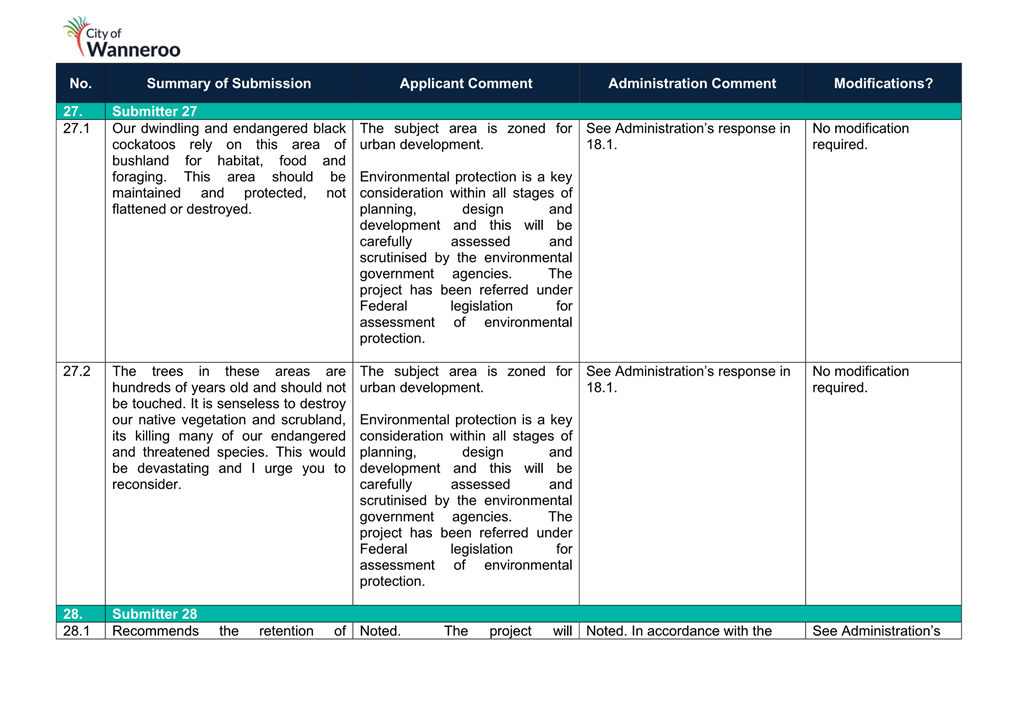
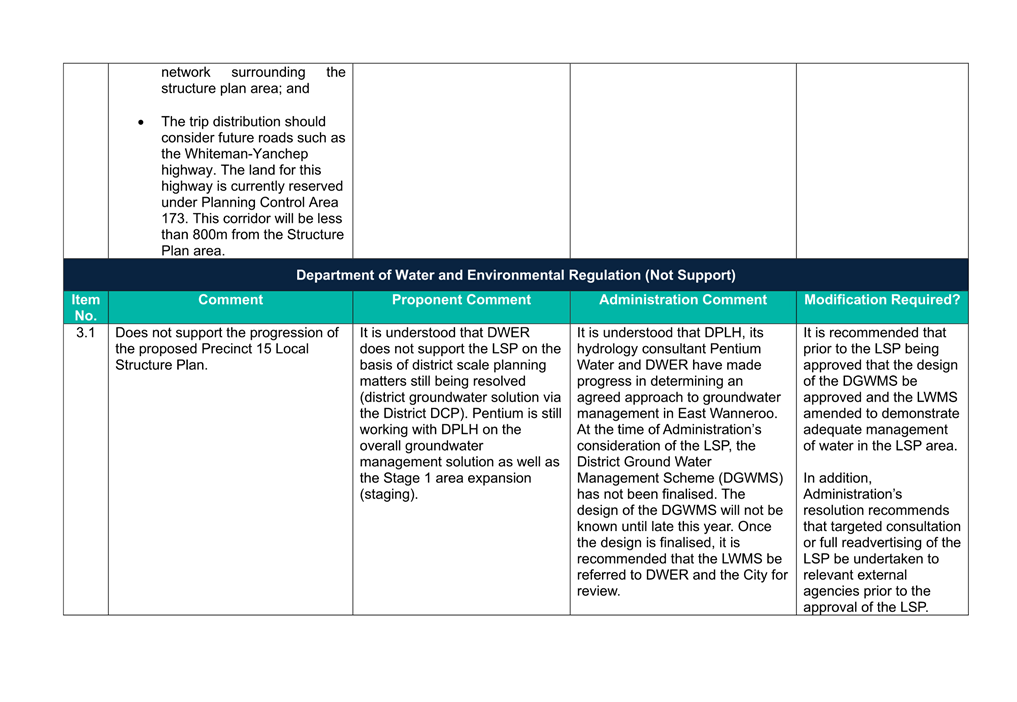
Concerns were raised during the advertising period regarding the removal of vegetation within the proposed LSP by Department of Water and Environmental Regulation (DWER). DWER raised the following concerns in relation to flora and fauna impacts:
· Insufficient of the short-range surveys undertaken for endemic invertebrate;
· Clearing of native vegetation detailing that the overall environmental impact has not been quantified; and
· Further incremental loss of the remaining extent of black cockatoo habitat.
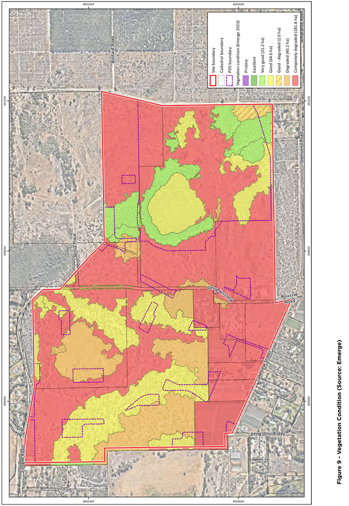
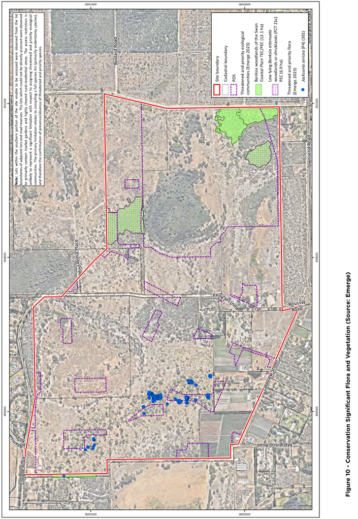
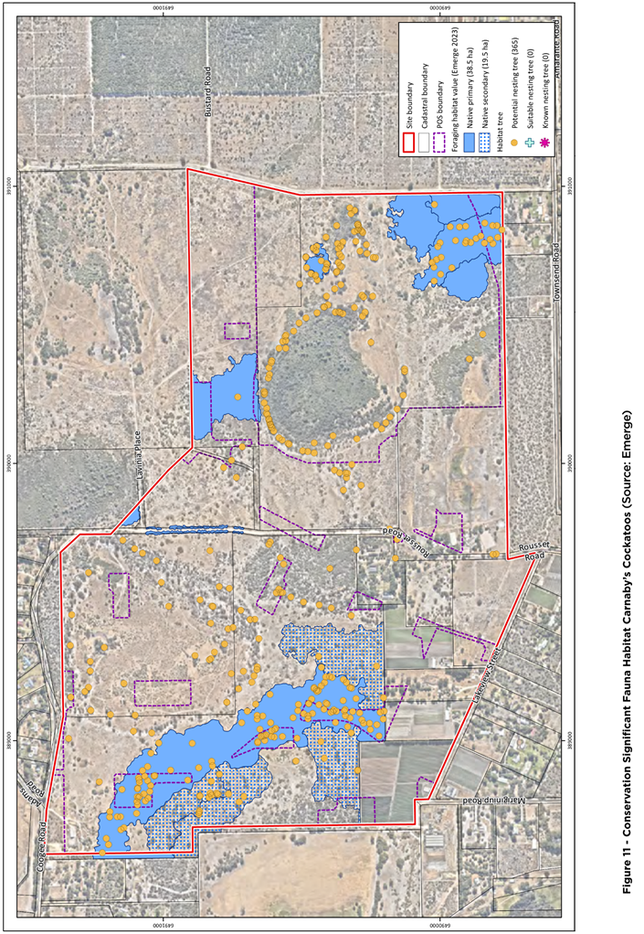
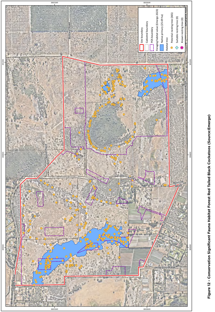
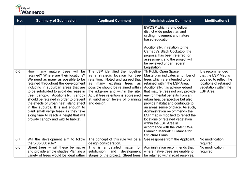
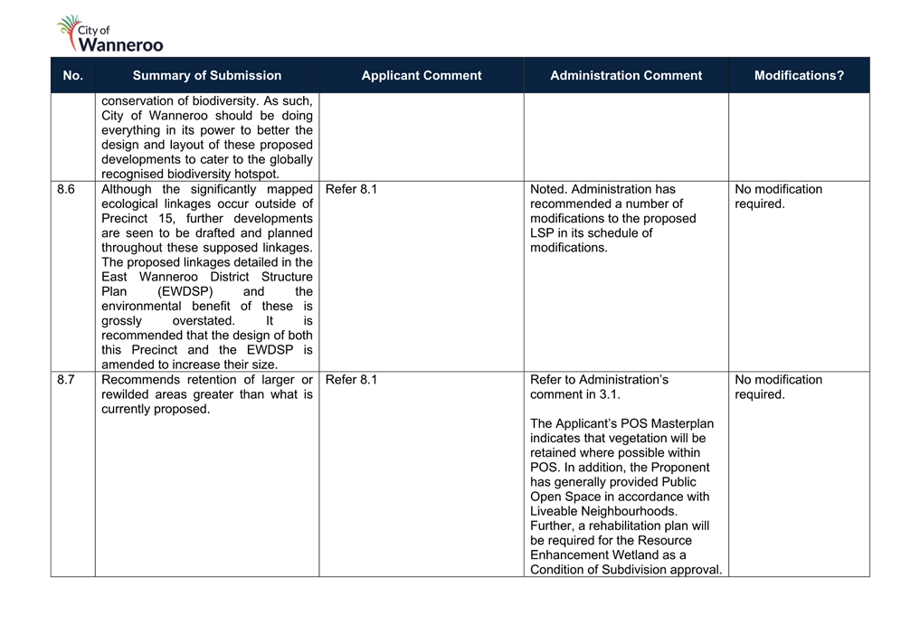
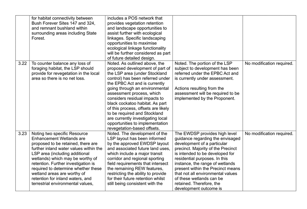
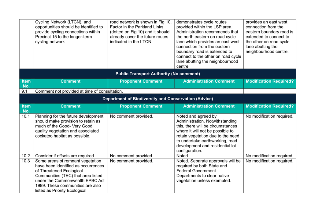
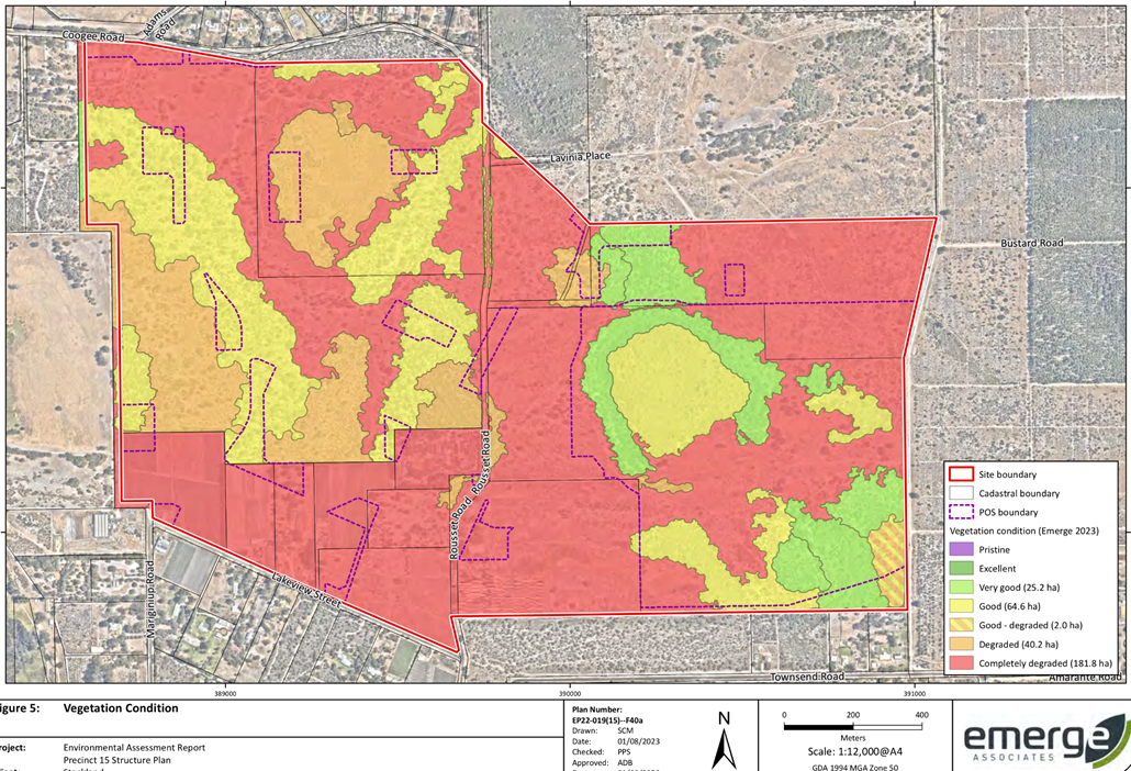
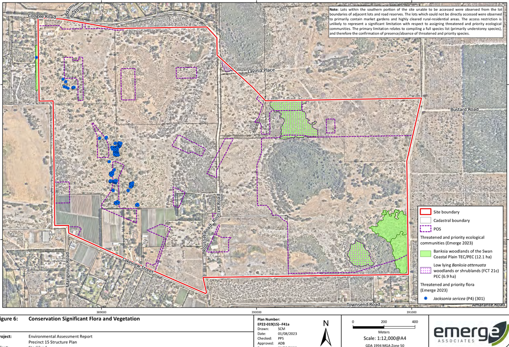
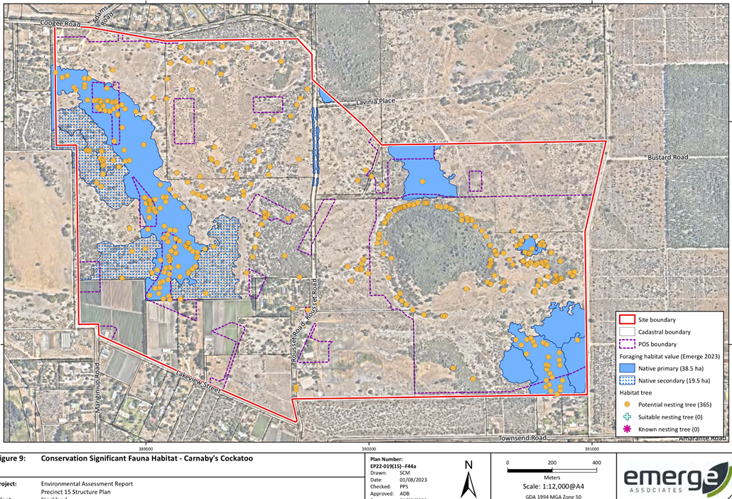
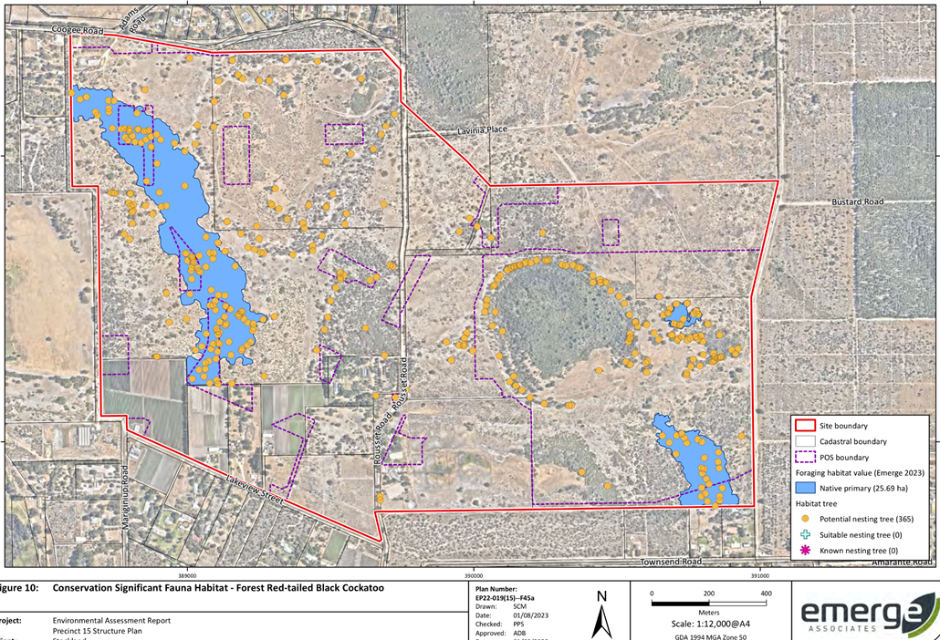
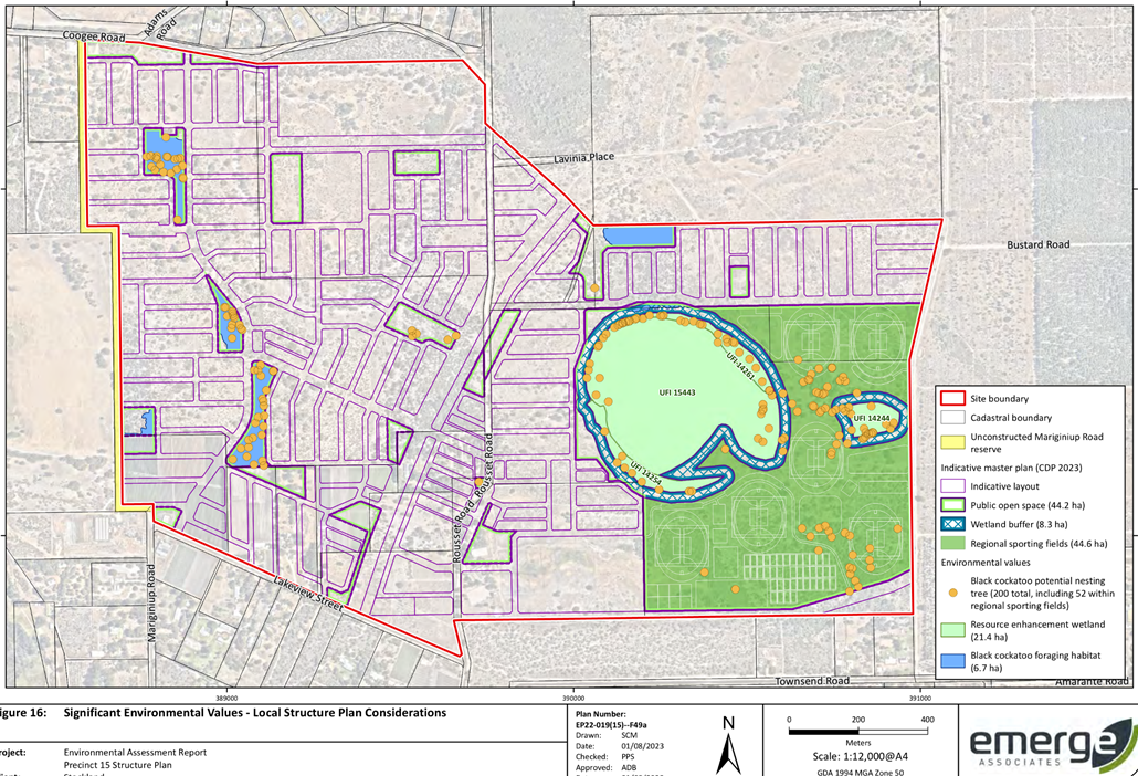
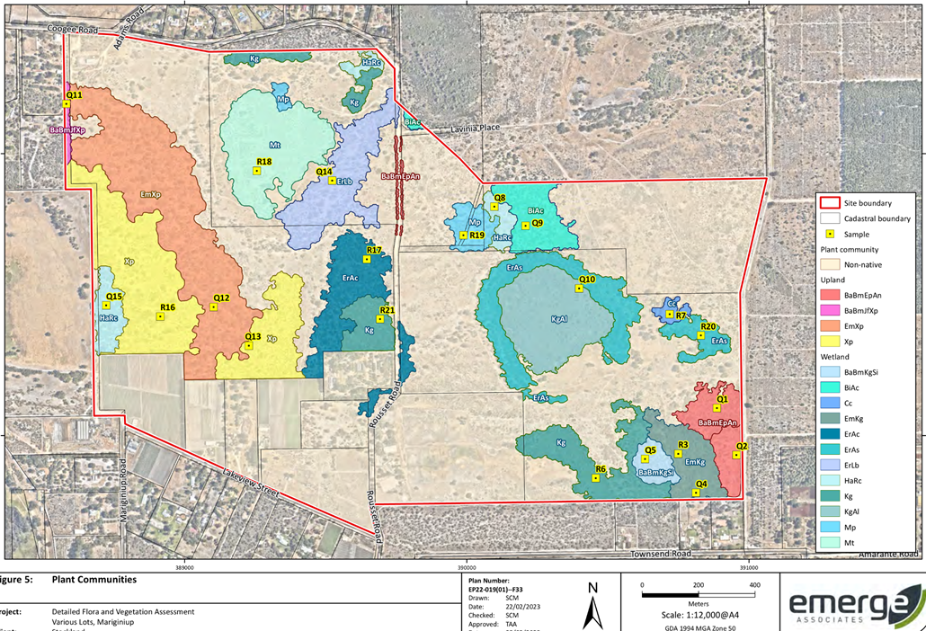
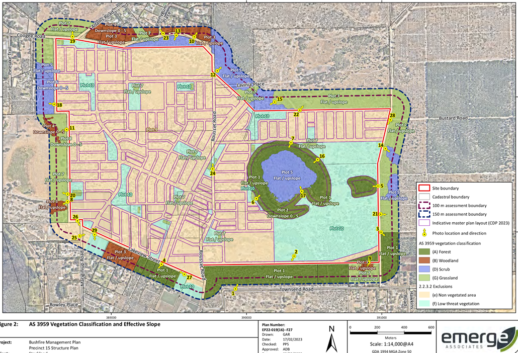
The Proponent has provided responses in relation to each of the concerns raised by DWER which can be viewed in Attachment 9. Administration notes the environmental challenges in retaining vegetation as a result of land transitioning from Rural uses to Urban uses. The EAR provided by the Proponent identifies the areas within the LSP which accommodate the most valuable vegetation in Figure 5. These areas tend to correlate with POS locations with the most valuable vegetation located to the eastern side of the Precinct. Additionally, Figures 9 and 10 of the EAR detail the potential nesting habitats for both the Carnaby’s Cockatoo and the Forest Red-tailed Black Cockatoo. The vast majority of the 365 nesting trees identified within the LSP area are located within the Regional Sporting Complex and any clearing of vegetation on this site is subject to a detailed design of the site. Additional retention of nesting trees is facilitated through allocation of land for the purposes of POS. Given this, Administration recommends the following:
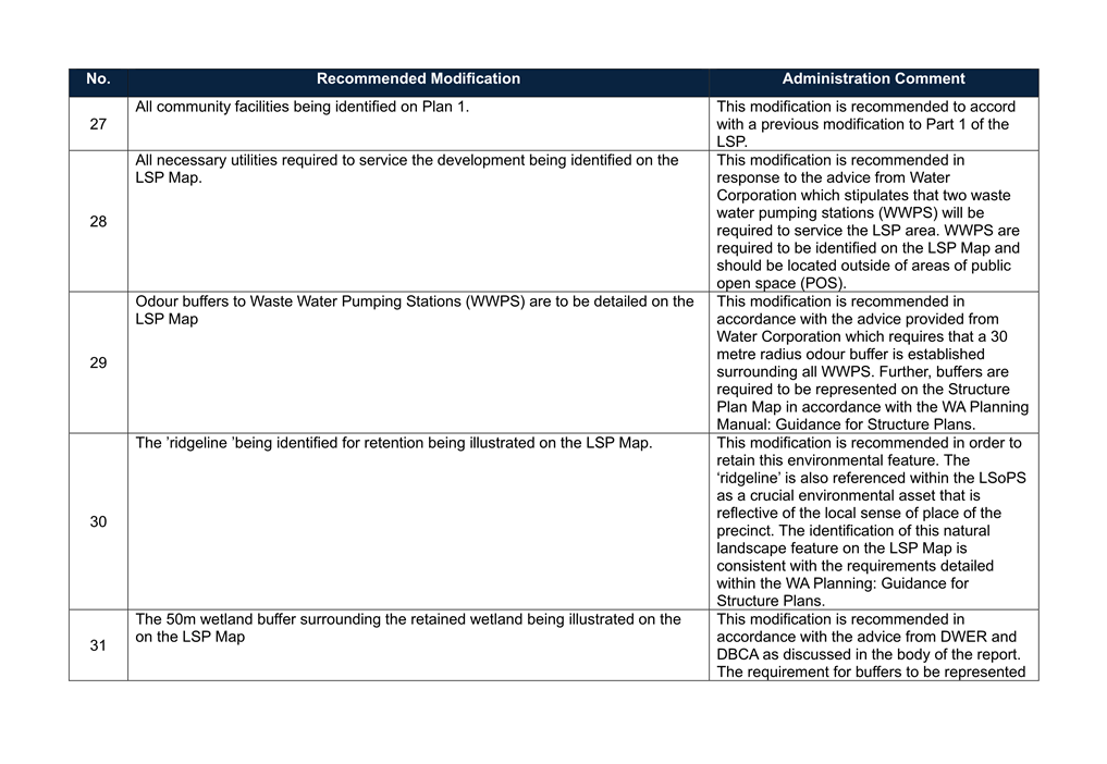
· The LSP Map be amended to identify significant trees identified in the EAR in accordance with the WAPC’s WA Planning Manual: Guidance for Structure Plans; and
· Part 1 be amended to require that a Vegetation and Fauna Management Plan (VFMP) and tree retention plan to be provided upon lodgement of an application for subdivision or development.
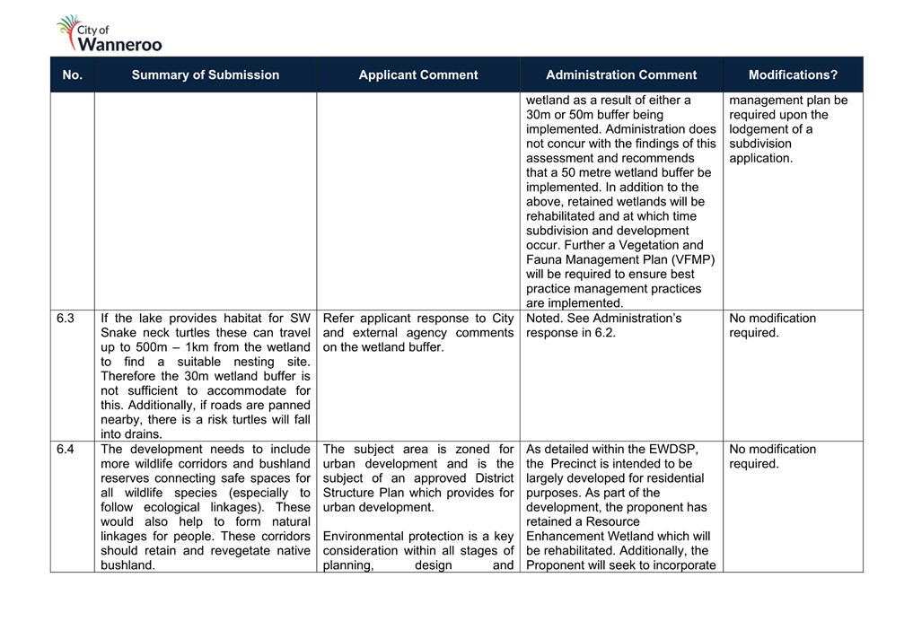
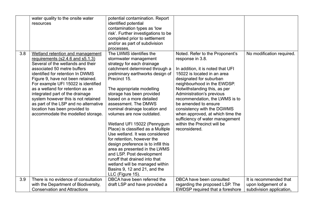
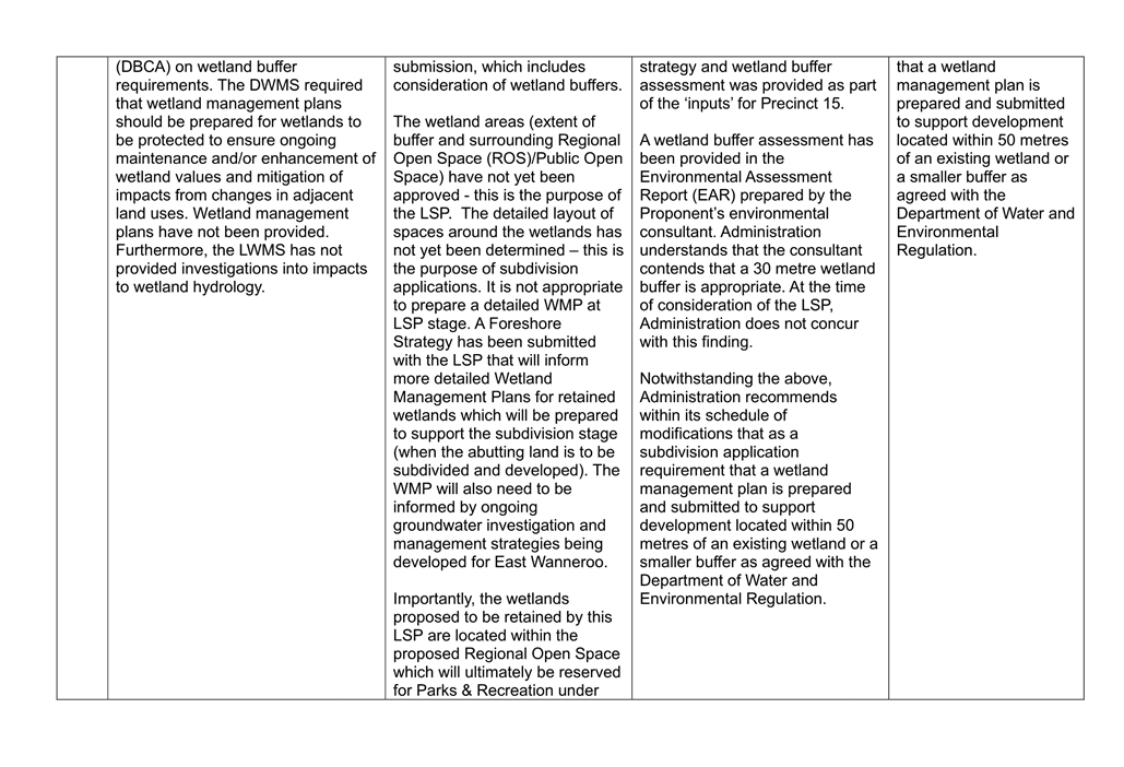
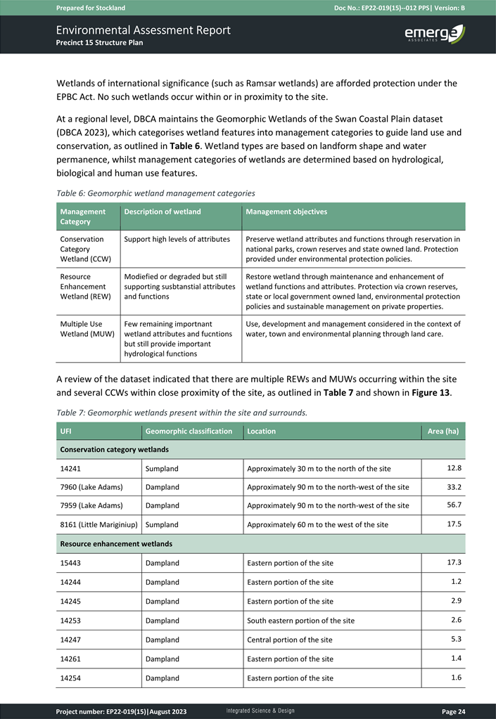
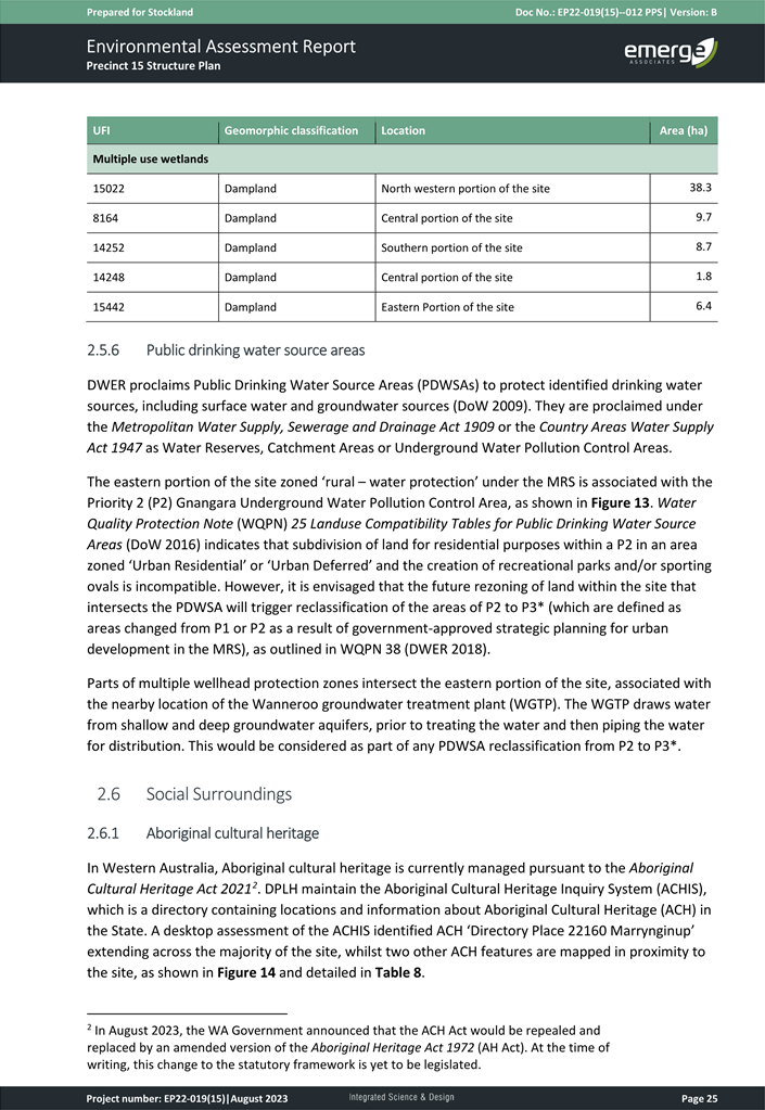
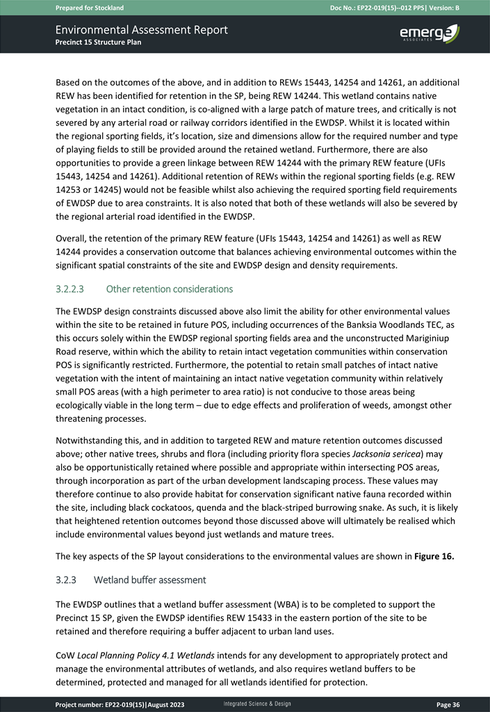
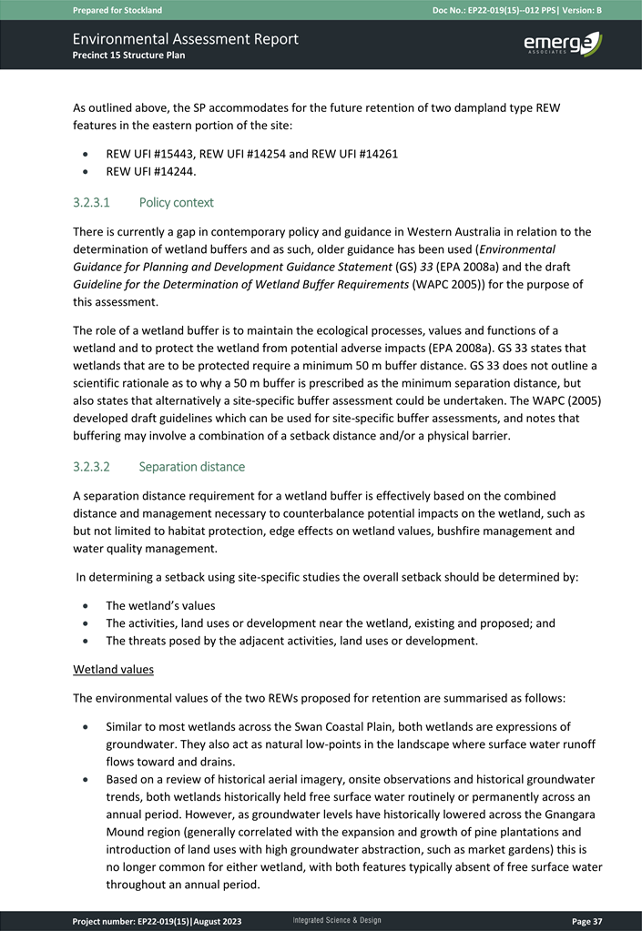
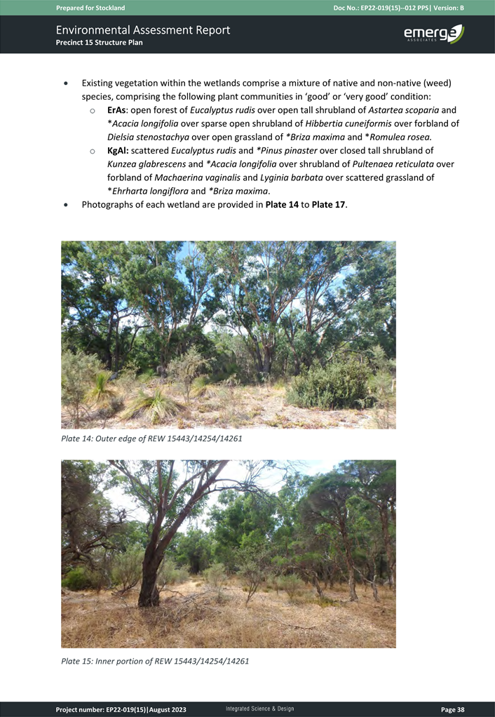
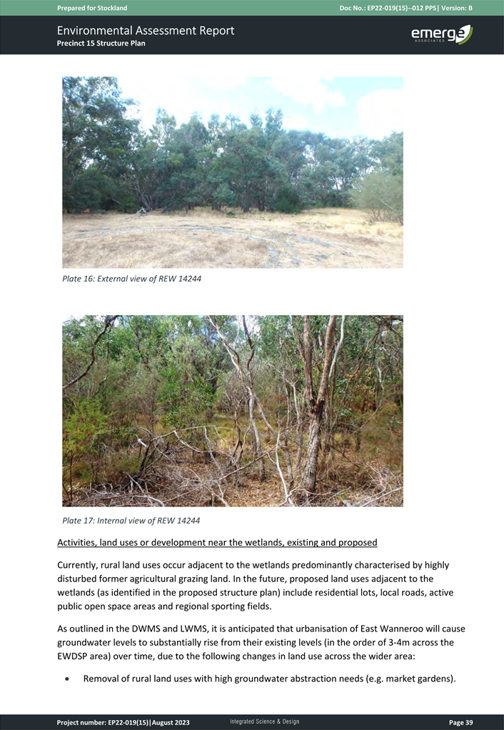
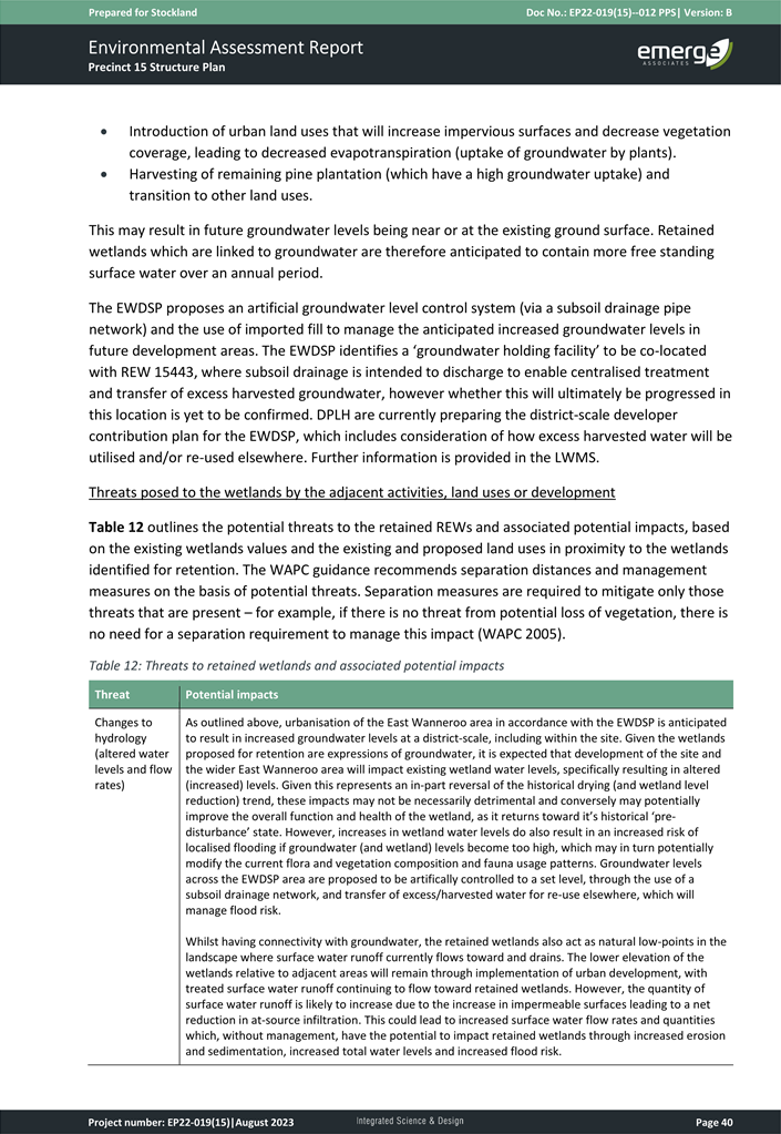
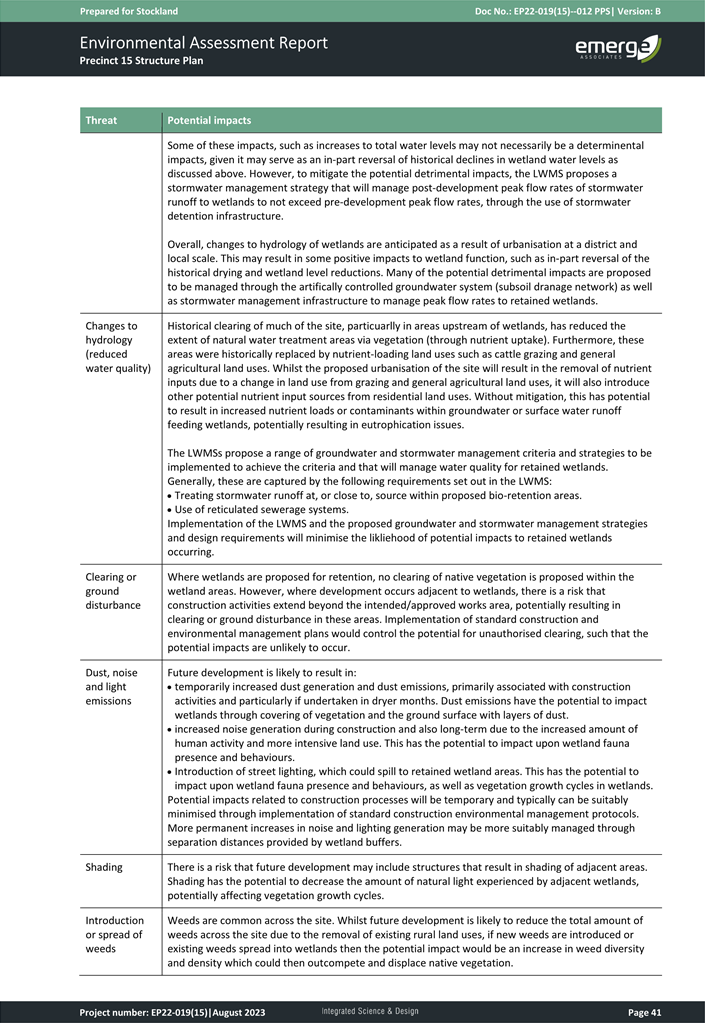
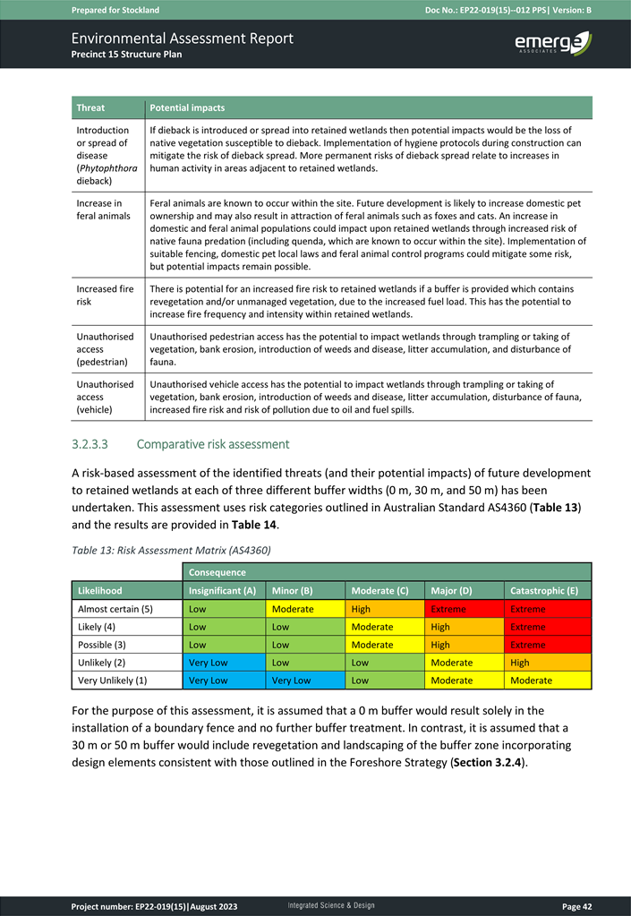
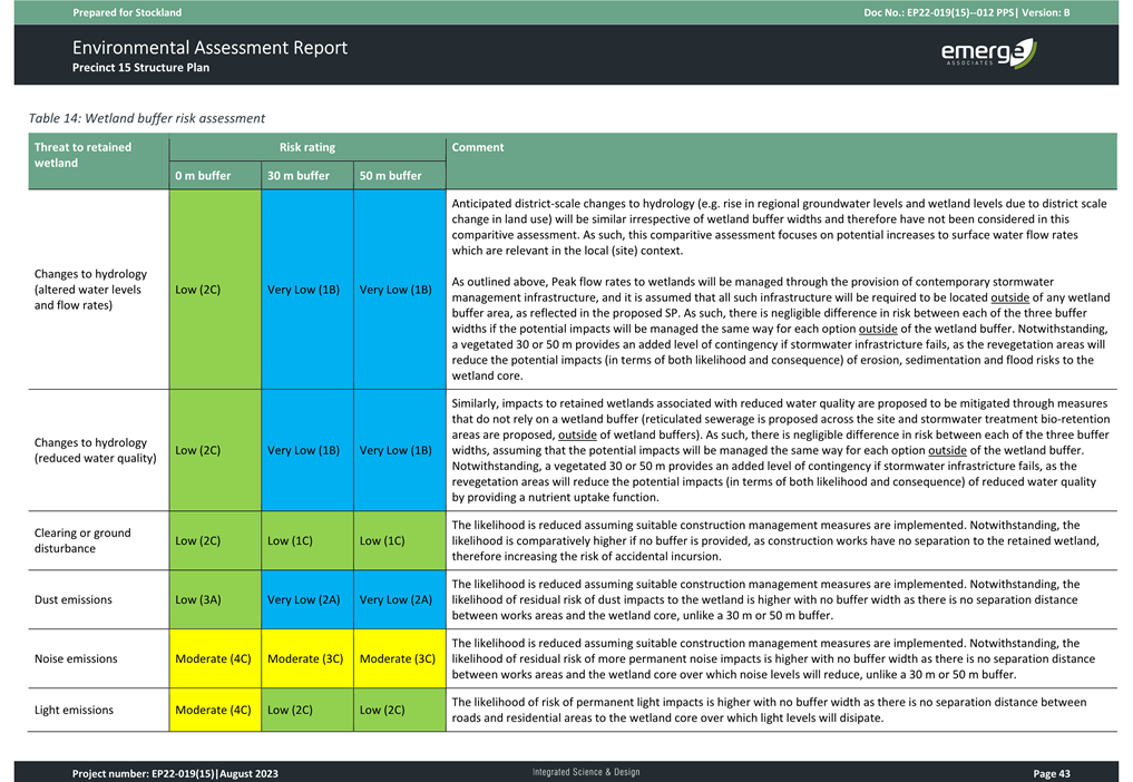
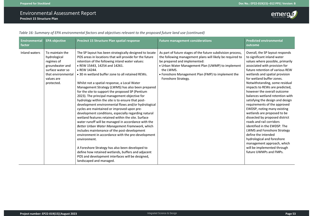
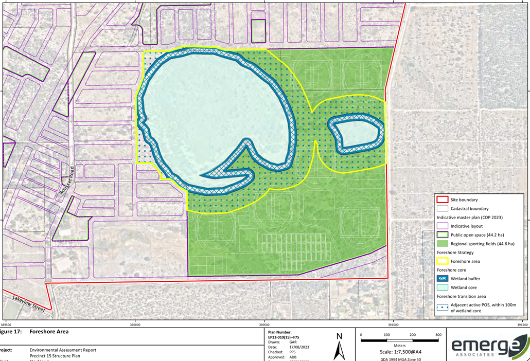
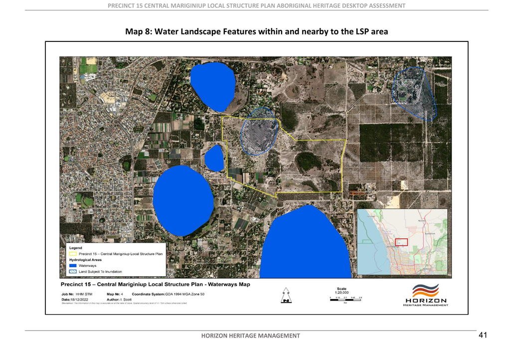
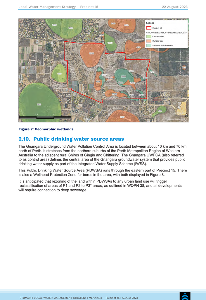
Wetlands
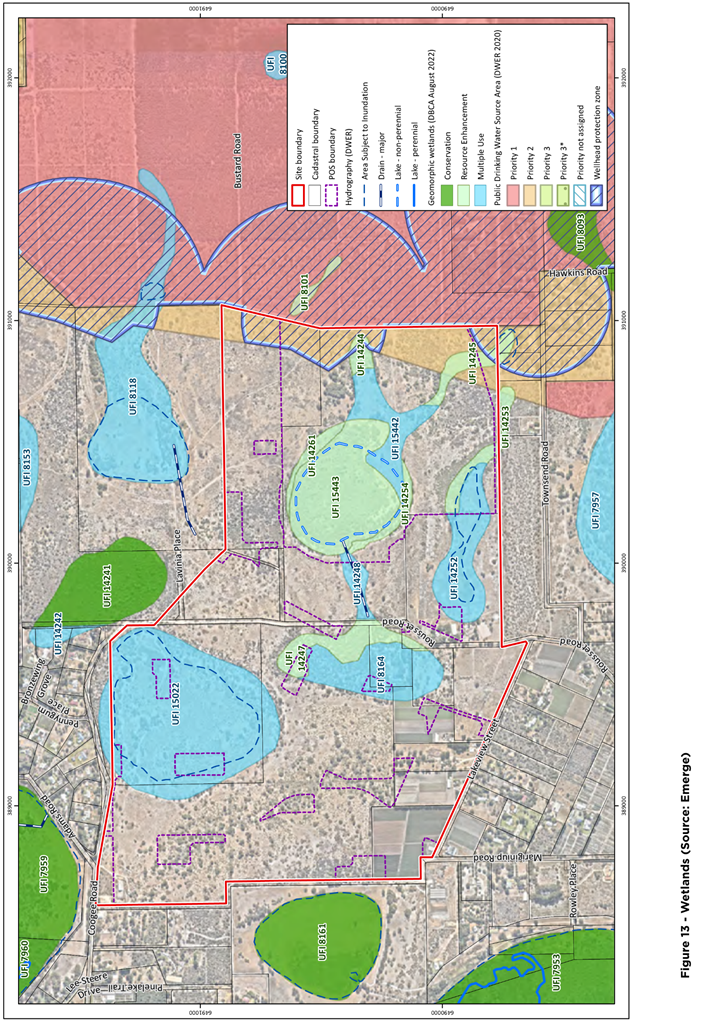
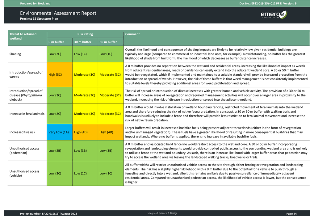
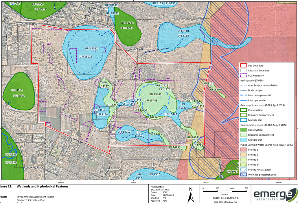
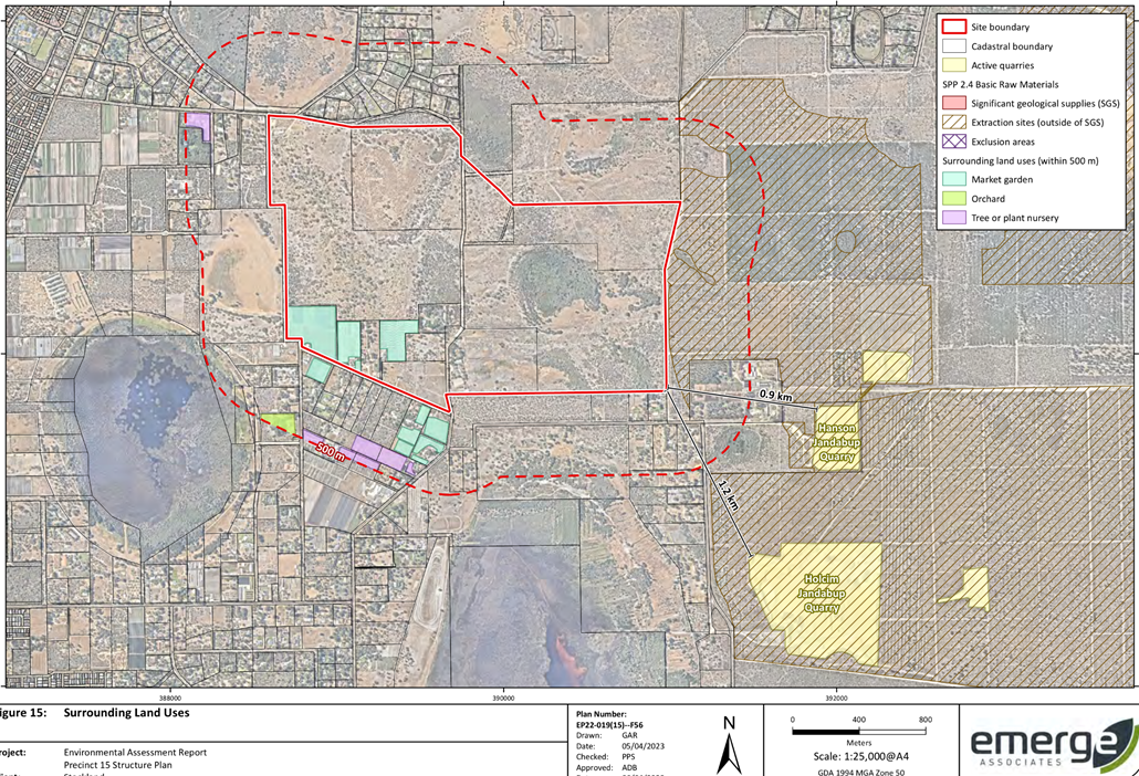
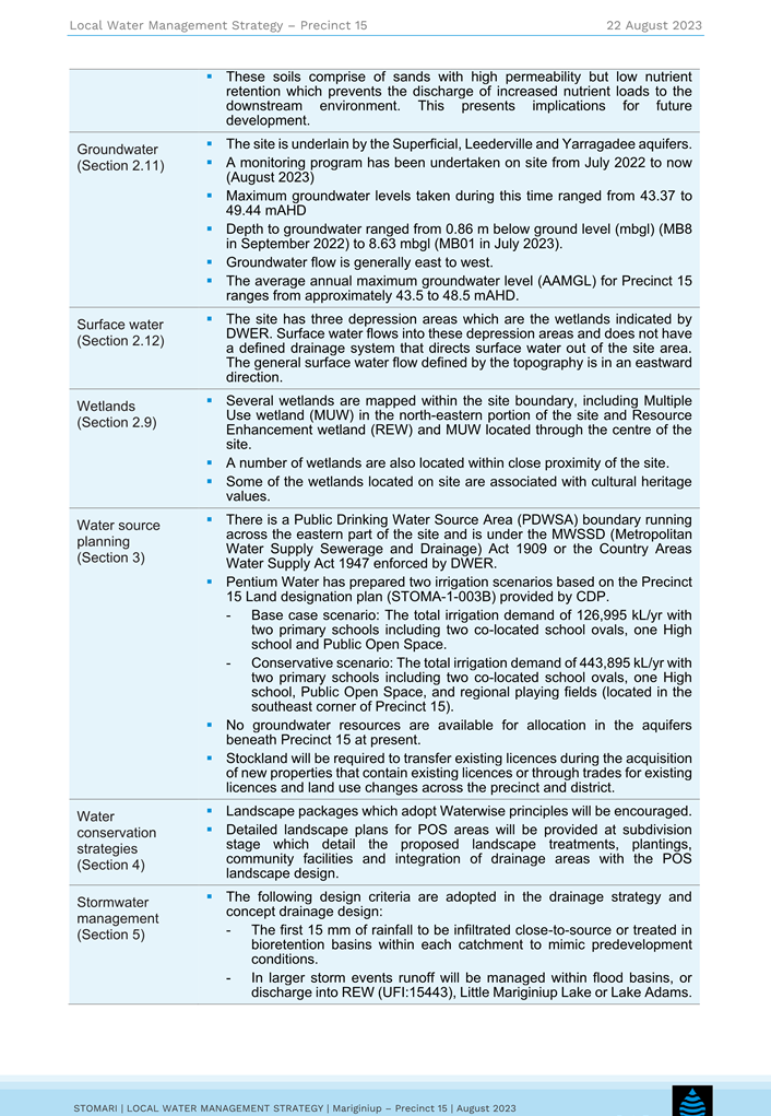
The EWDSP stipulates that a ‘foreshore strategy’ and wetland buffer assessment are required to be undertaken in preparation of a LSP. Figure 13 of the EAR demonstrates the significant range of wetlands and hydrological features which are present within and surrounding the LSP area. During the consultation process, DWER raised concern regarding the LSP’s lack of response in relation to the retention of existing wetlands and the absence of Wetland Management Plans underpinning the Structure Plan.
The Proponent’s response to DWERs comments is included in Attachment 9. As detailed within the EAR, the hydrology features identified to be retained are located within the Regional Sporting Complex site. The remaining hydrological features will be earth worked in order to accommodate the remainder of development within the LSP. To ensure the quality of the retained wetlands is maintained Administration recommends the following:
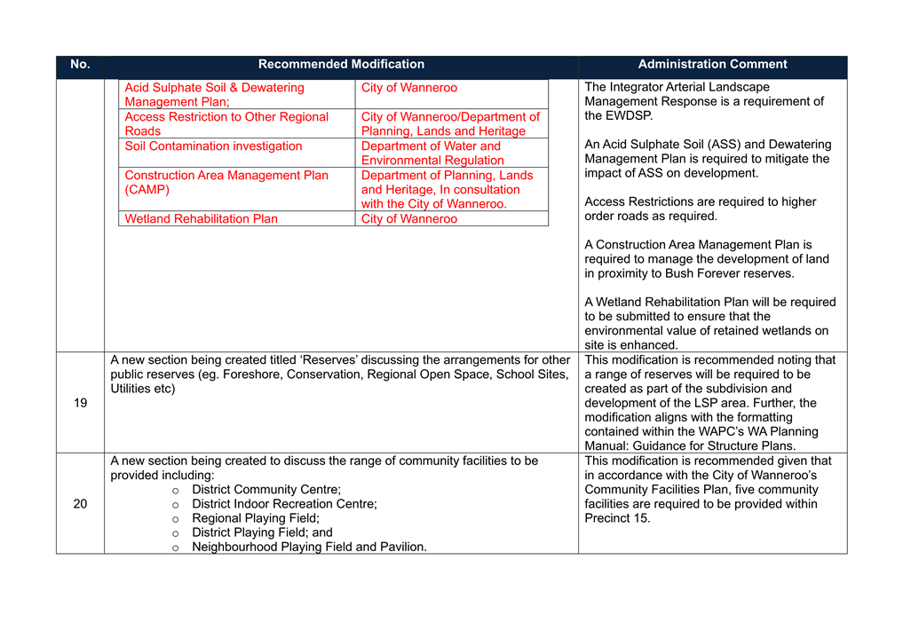
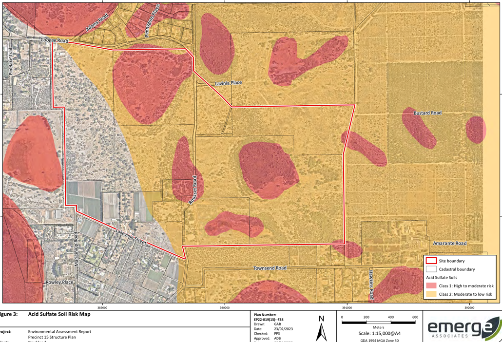
· Part 1 of the LSP is amended to require a Wetland Management Plan, Nutrient Management Plan and Acid Sulphate Soil and Dewatering Management Plan prior to lodging a development or subdivision application.
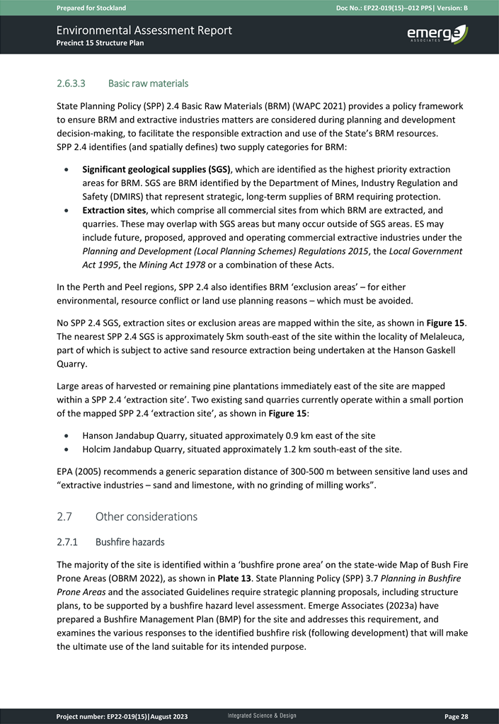
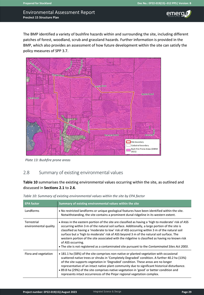
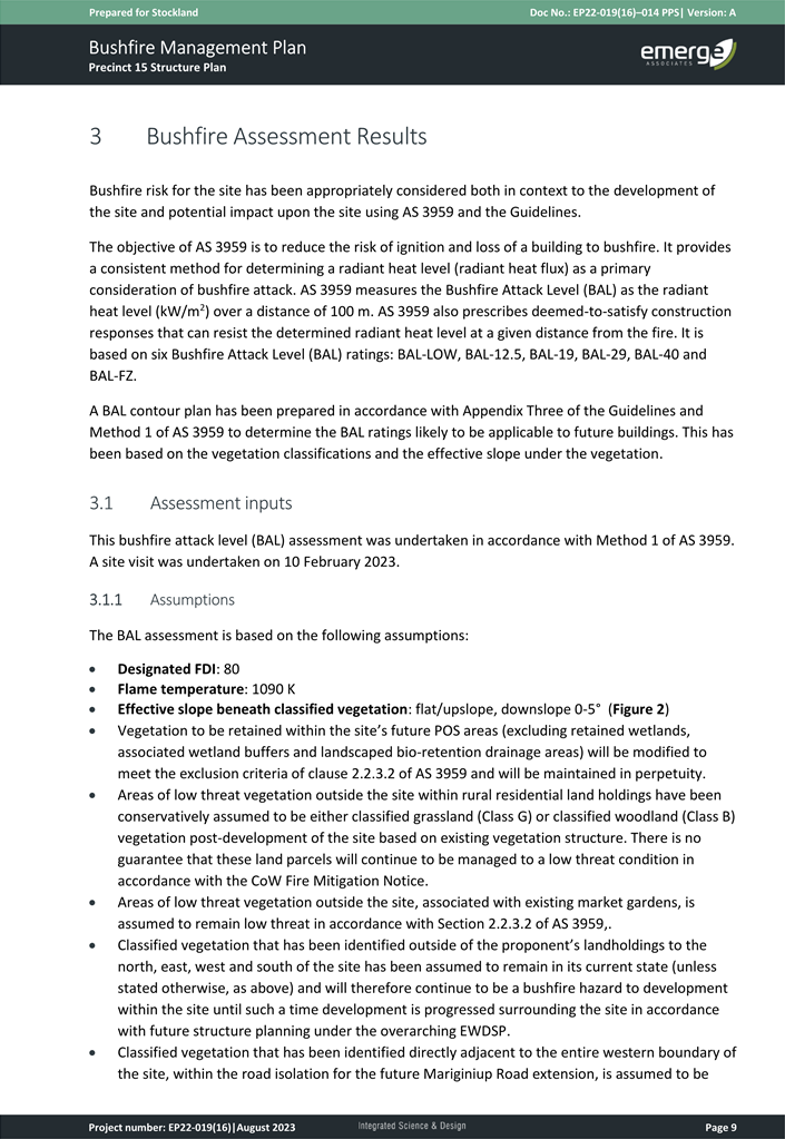
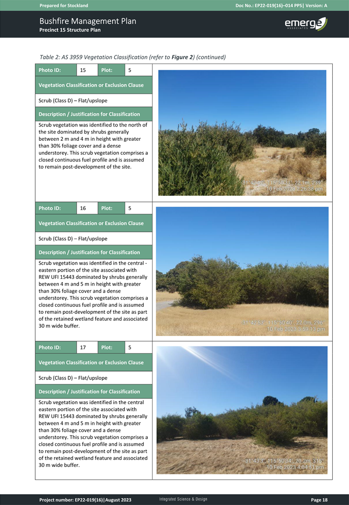
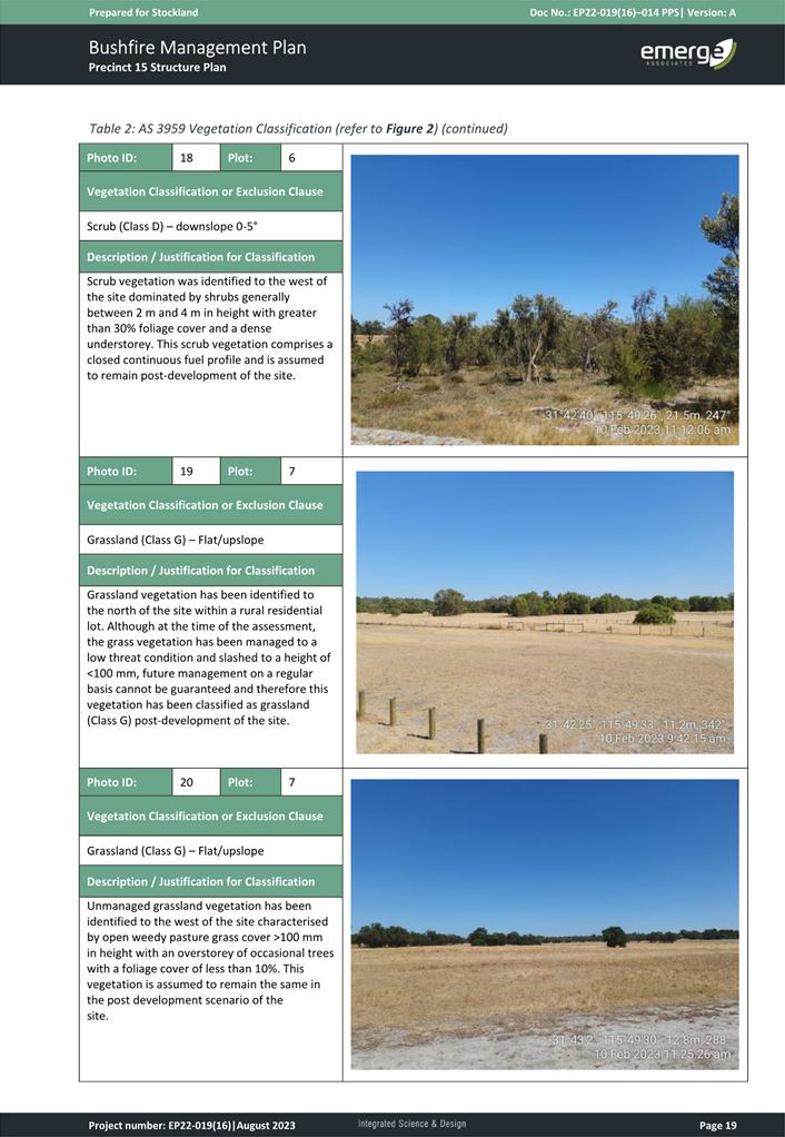
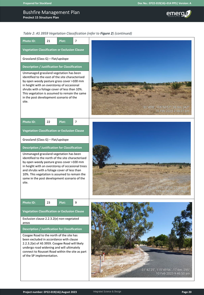
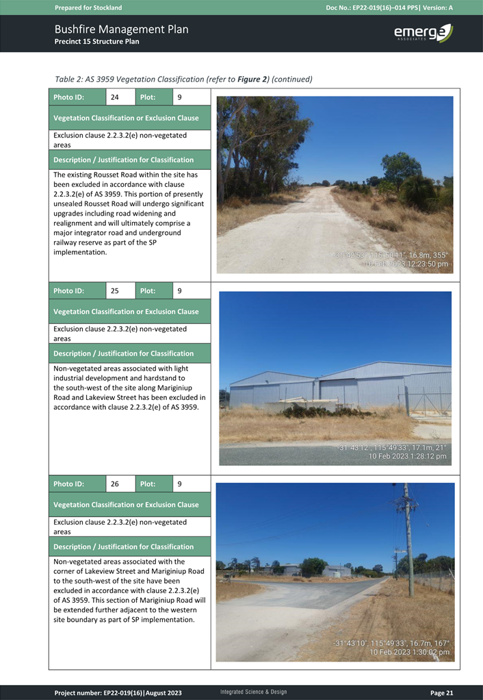
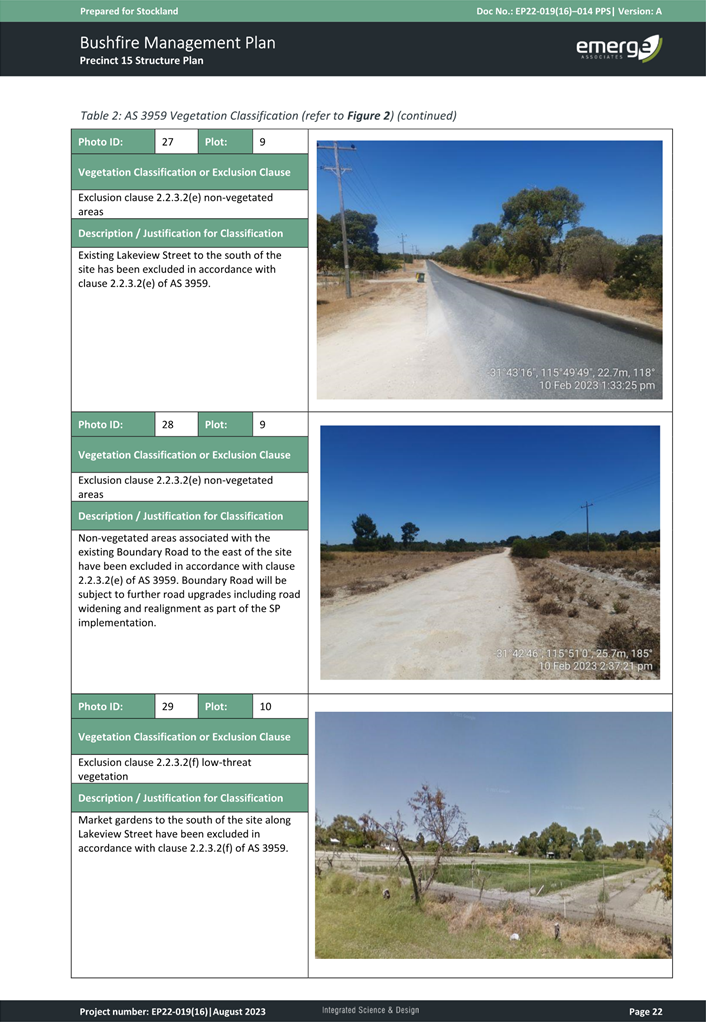
Bushfire
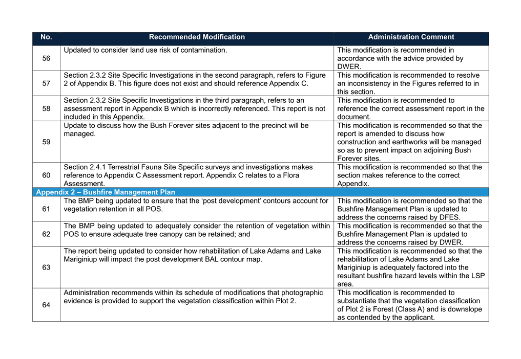
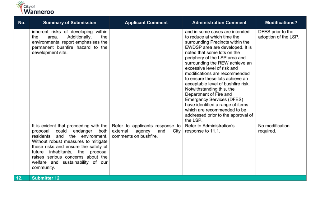
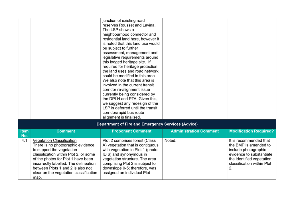
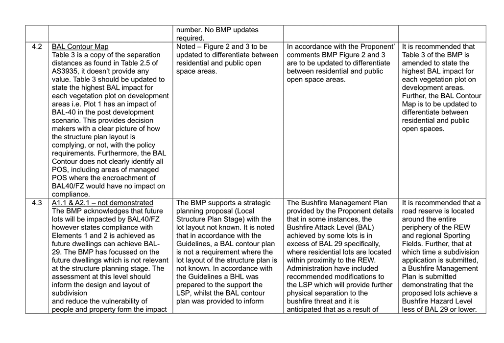
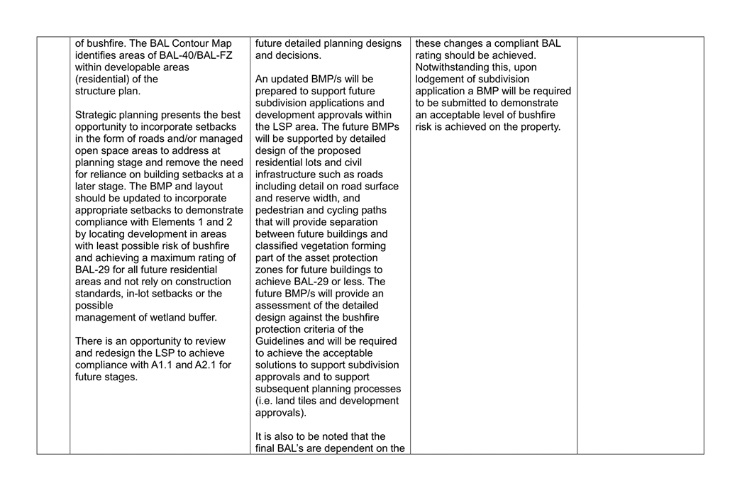
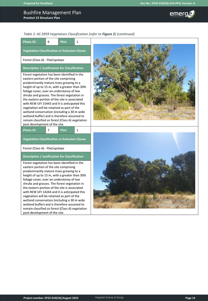
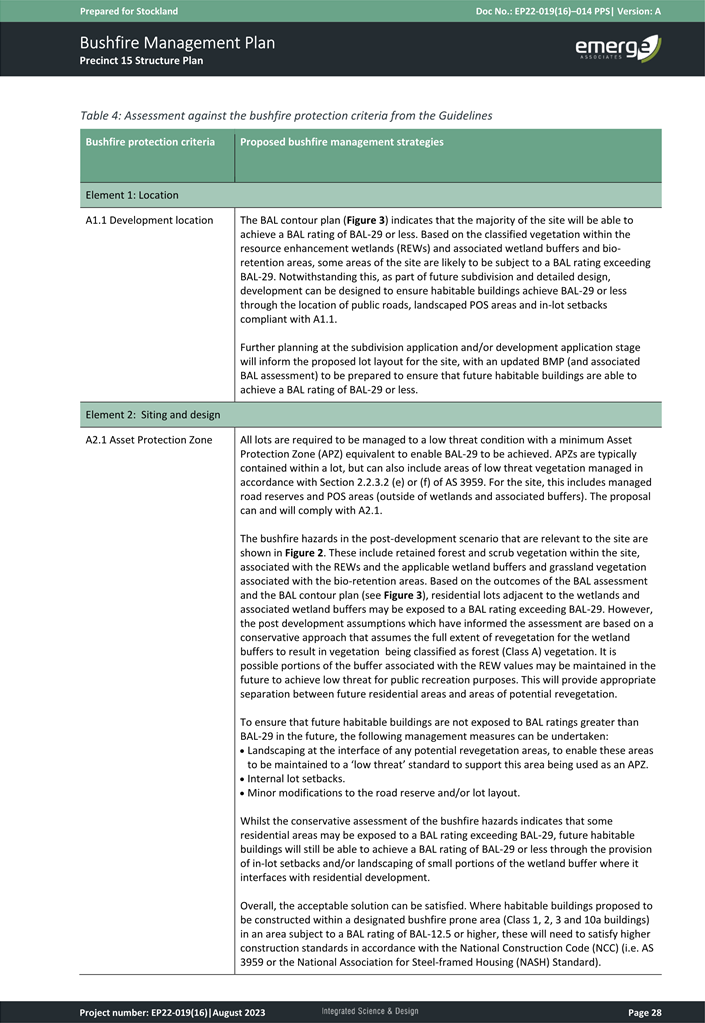
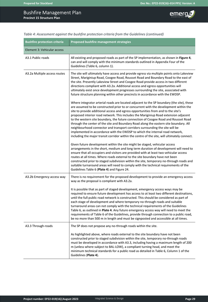
The proposed LSP is supported by a Bushfire Management Plan (BMP) (Attachment 18). The post development contour plan provided in Figure 5 of the BMP, shows that the proposed POS sites are to be managed to a ‘low threat state’ with the exception of drainage basins.
The proposed BMP does not reflect the intent of the POS Masterplan (Attachment 16) which seeks to retain significant trees and vegetation. Further, the western ridgeline accommodates the most significant foraging habitat for black cockatoo’s is also intended to be managed to a “low threat state” and is therefore unlikely to be able to retain the density of trees previously noted in Figures 9 and 10 of the EAR (Attachment 17).
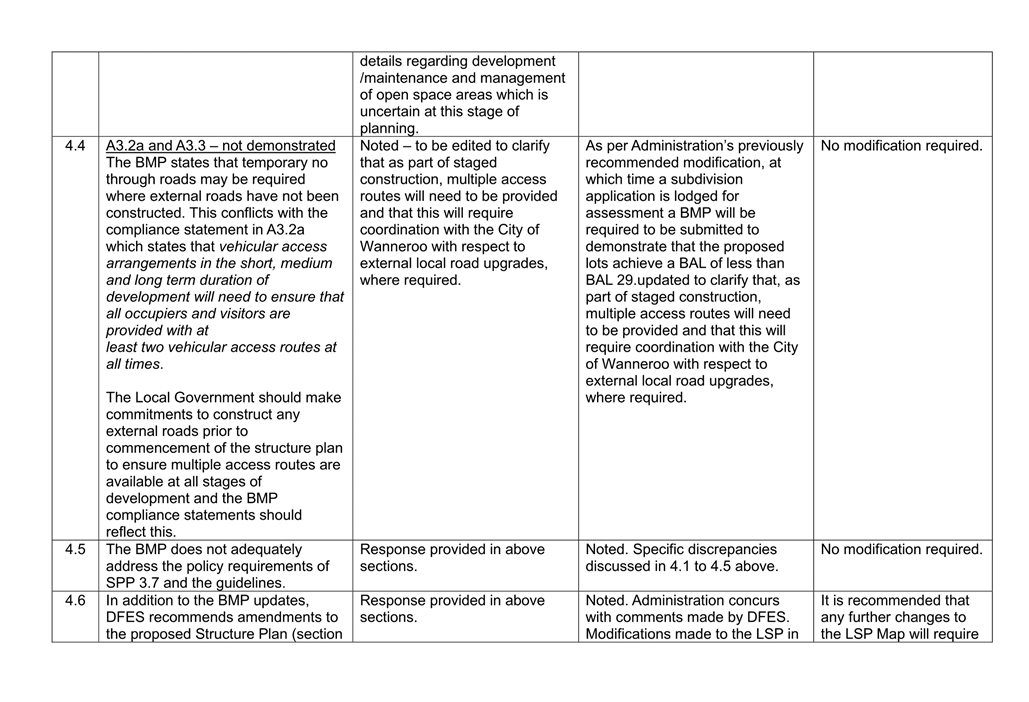
Advice from DFES in relation to the proposal and the Proponent’s response is contained within Attachment 9. Generally, the concerns raised by DFES are capable of being addressed through minor modifications to the BMP.
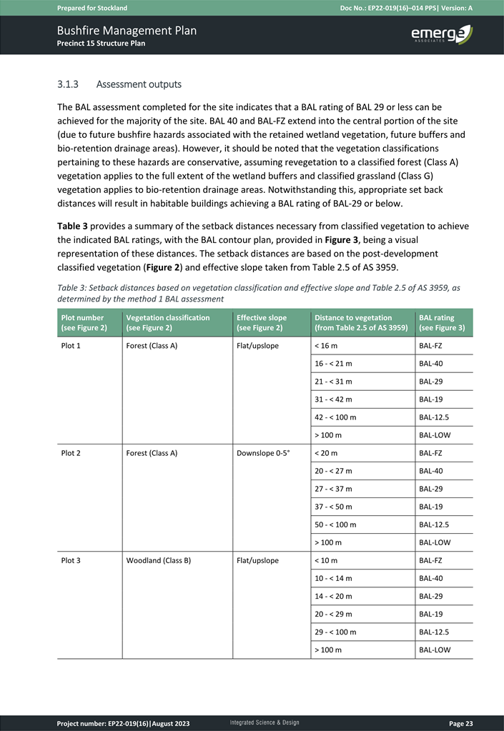
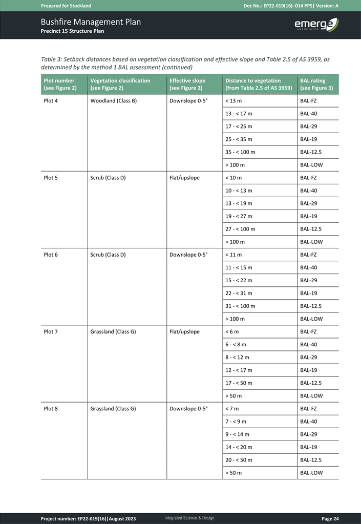
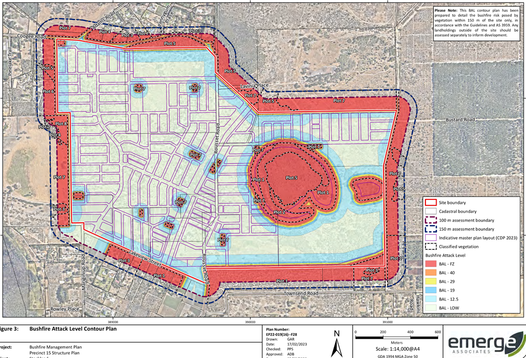
The BMP stipulates that in some cases residential lots created will achieve a Bushfire Attack Level (BAL) rating of BAL-40 or above. This rating is primarily surrounding the Resource Enhancement Wetland. This is also the case in the periphery of the LSP area given the existence of bushfire threat outside of the LSP area from undeveloped land.
Administration anticipates that bushfire risk on the periphery of the Precinct will generally decrease overtime as the surrounding Precincts are progressively developed for urban purposes. However, the BAL rating surrounding the Resource Enhancement Wetland will remain unchanged given that it will be subject to rehabilitation as part of the Wetland Management Plan. As such, it is recommended that a road be provided between the wetland and the adjoining residential development to provide further physical separation and reduce the BAL rating for these lots.
In accordance with the Proponent’s response to the DFES comments, it is recommended the following modifications be made to the LSP:
· The BMP being updated to address the comments from DFES; and
· The BMP being updated to adequately consider the retention of vegetation within POS to ensure adequate tree canopy can be retained.
In addition to the above, Administration recommends the following modifications:
· That Part 1 of the LSP be amended to require a BMP to be provided with any subdivision application lodged for assessment.
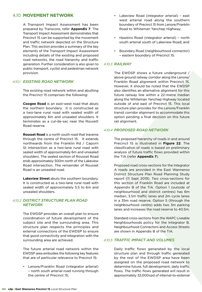
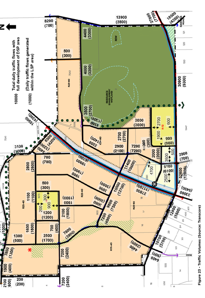
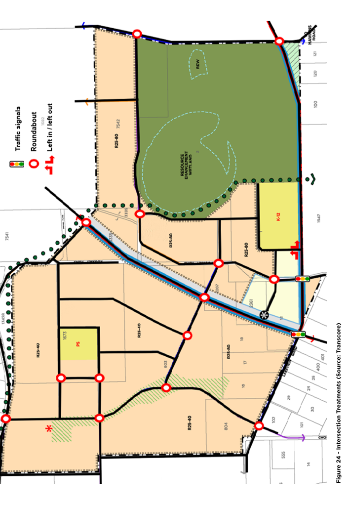
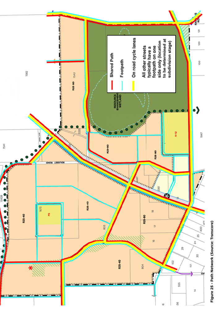
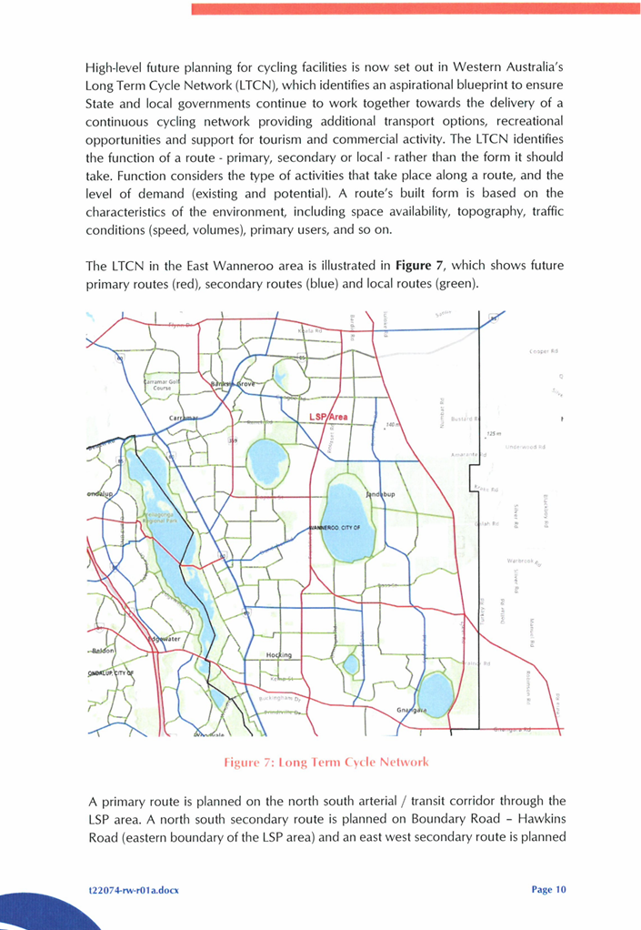
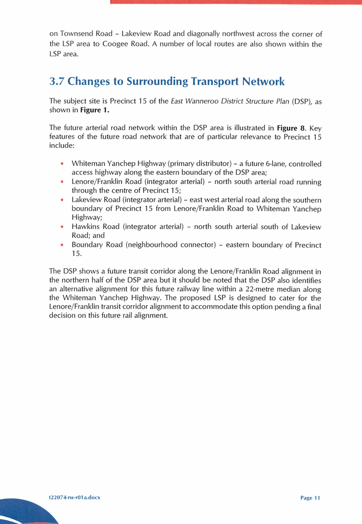
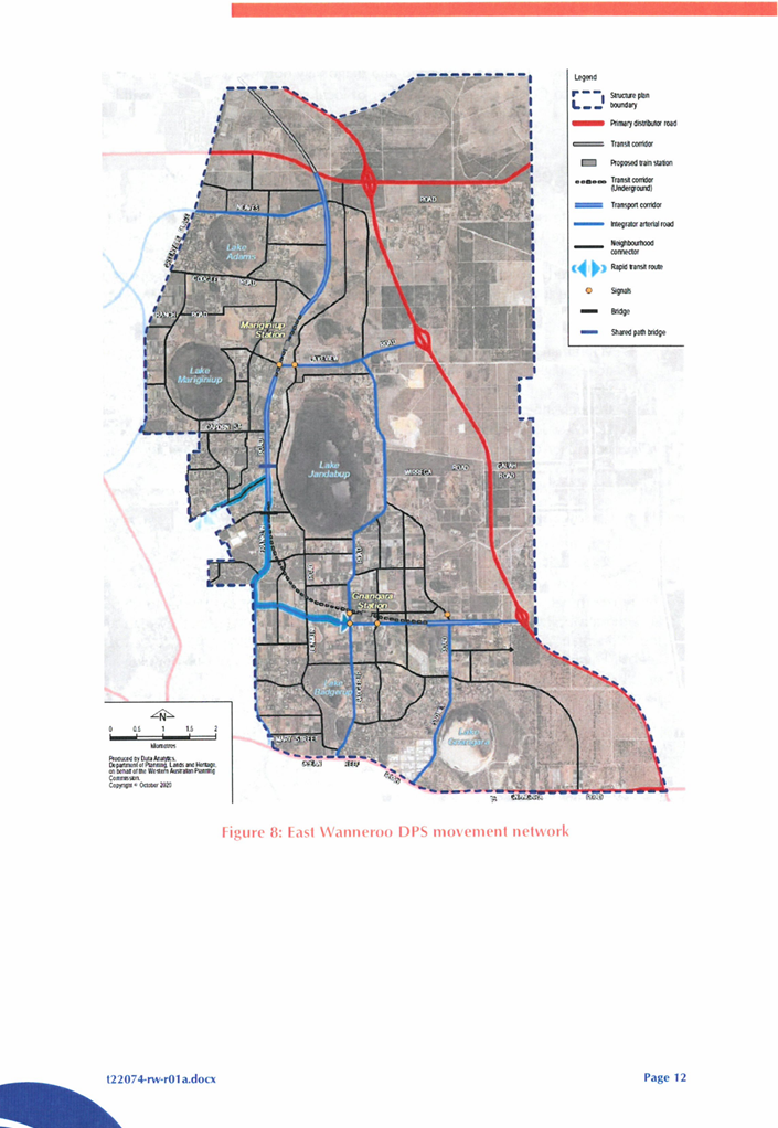
Movement Network
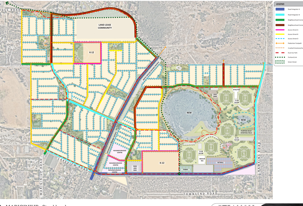
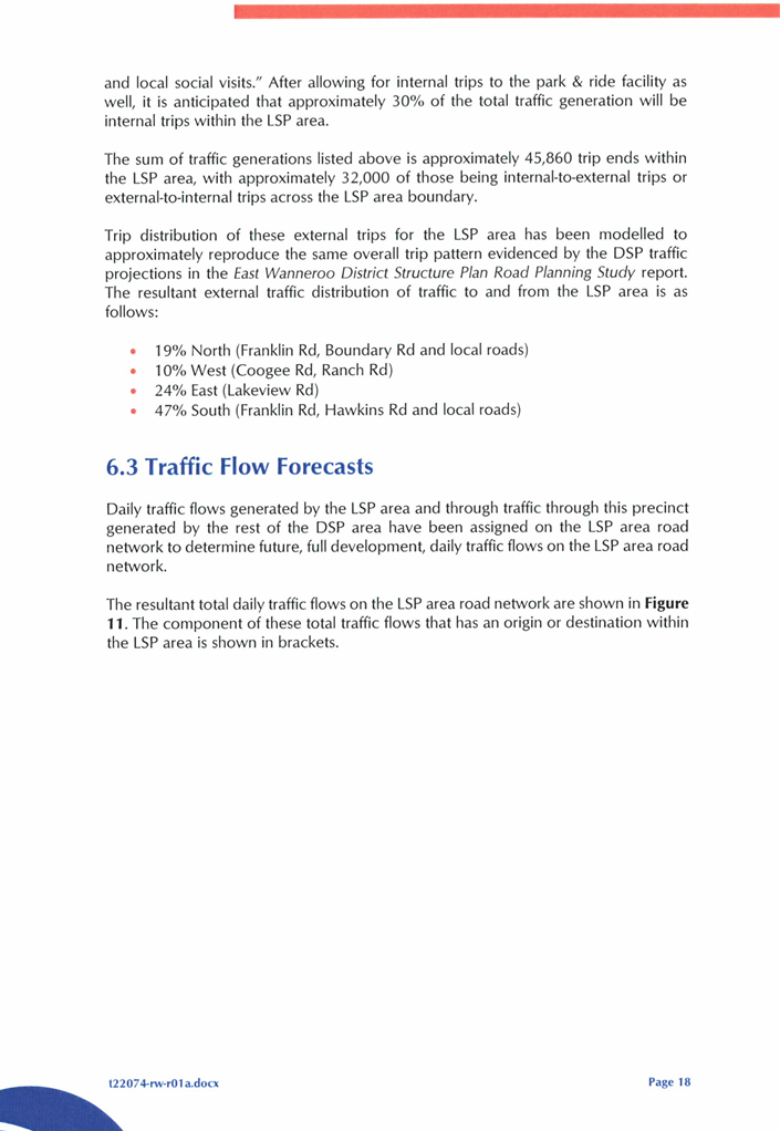
The EWDSP sets out and guides the future road network in all precincts across the EWDSP area to facilitate coordinated development within the target site and its vicinity.
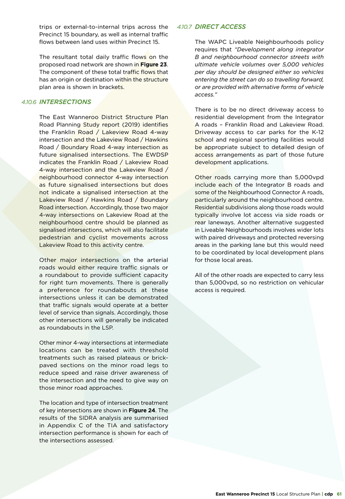
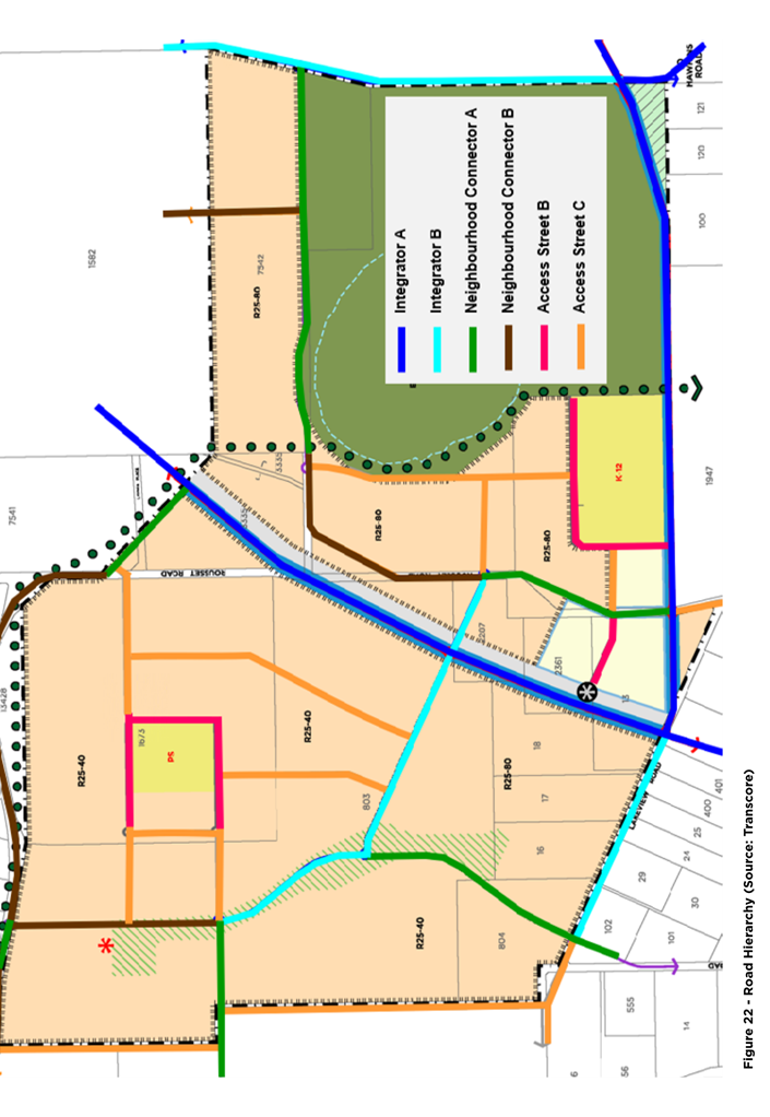
For Precinct 15, the planned arterial road network features include:
· Lenore/Franklin Road (major arterial) – a north-south road passing through the heart of Precinct 15;
· Lakeview Road (major arterial) – an east-west road running along the southern perimeter of Precinct 15, from Lenore/Franklin Road to Whiteman Yanchep Highway;
· Hawkins Road (major arterial) – a north-south road located south of Lakeview Road; and
· A boundary Road (local connector) – the road marking the eastern edge of Precinct 15.
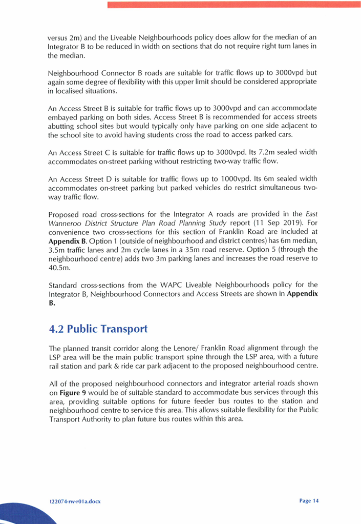
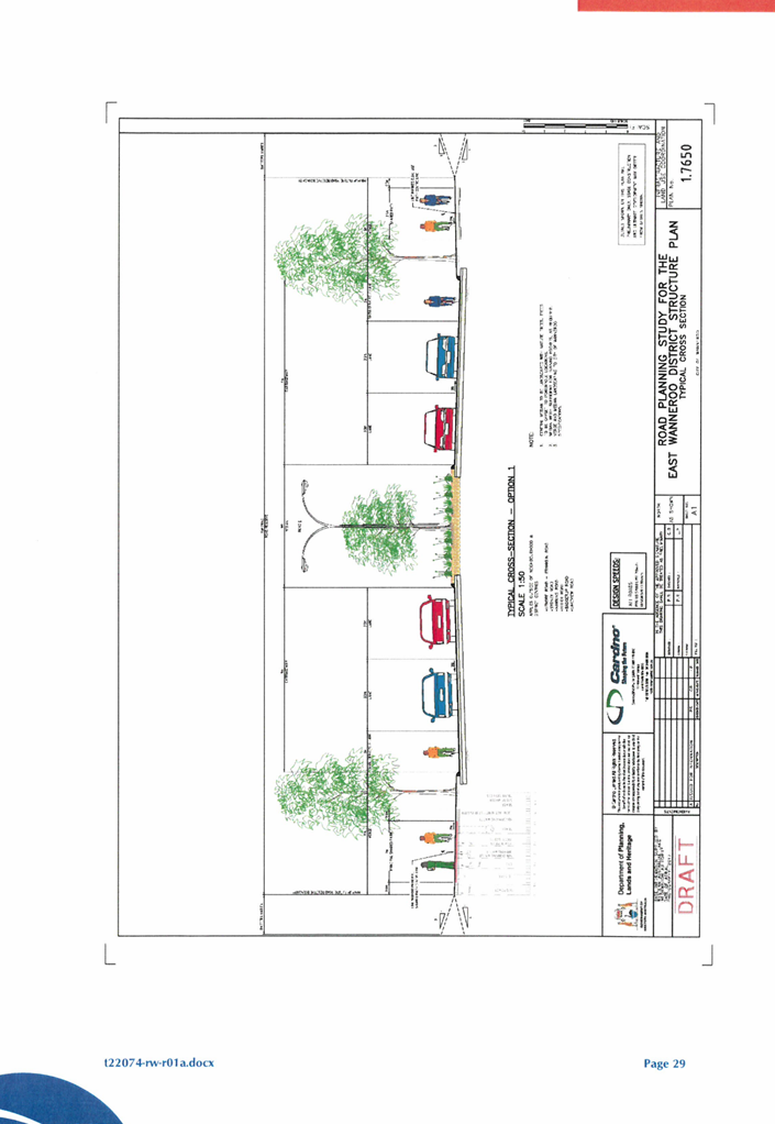
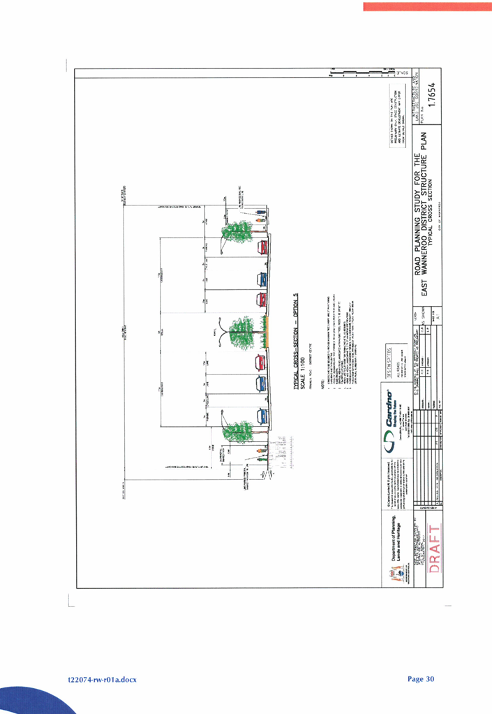
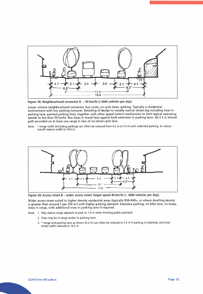
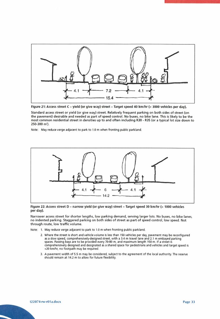
The EWDSP also sets out specific road cross sections that vary the requirements of LN.
Following the adoption of the EWDSP in August 2021, Administration progressed an amendment to LPP 5.3 which was adopted in November 2023. LPP 5.3 sets out detailed cross sections providing specific requirements for road reserves developed within the EWDSP area and vary the requirements of LN.
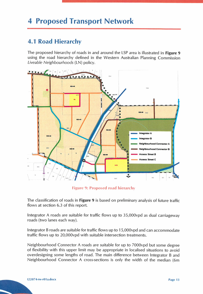
Road reserves
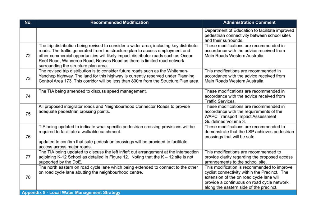
Details regarding the proposed road reserve widths are contained within the Transport Impact Assessment (TIA). The TIA (Attachment 19) provides an overview of the range of land uses to be incorporated within the LSP and the anticipated volumes of traffic which result. The TIA also comments on the existing surrounding roads and their development standards and indicates the anticipated road hierarchy within the LSP area. Surrounding roads such as Mariginiup Road, Coogee Road, Rousset Road and Lakeview Road (partially) are not covered by the DDCP and as such, will be required to be upgraded to an urban standard. It is recommended that the LSP boundaries are modified to include these roads, to ensure that they are upgraded to the appropriate standard as part of the development of the LSP area.
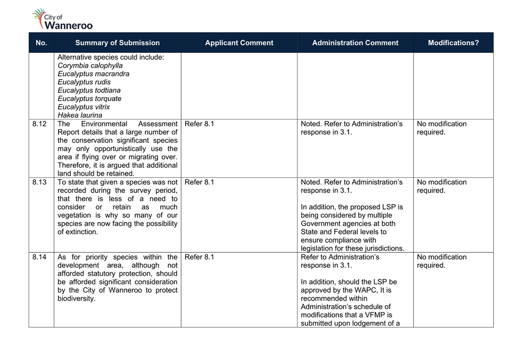
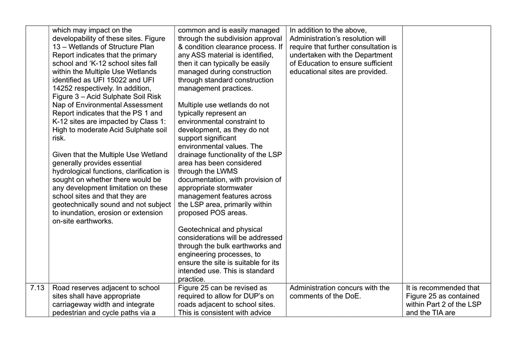
LPP 5.3 incorporates a series of cross sections for Other Regional Roads which are derived from the EWDSP’s road planning study. Additionally, LPP 5.3 further refines the Liveable Neighbourhood’s road cross sections providing a local interpretation of each of the road classifications. Road reserve widths are generally increased to permit wider verges facilitating wider footpaths and retention of native trees. The cross sections in LPP 5.3 are also intended to provide consistency and continuity between the Precincts within East Wanneroo. In the absence of native vegetation within a street, a planting palette has been established requiring particular trees to be planted in each road classifications. Appendix B of the TIA incorporates typical road cross sections which are derived from the EWDSP and LN. The cross sections incorporated within the TIA which have been derived from LN are not reflective of the City’s interpretation of these standards. The Proponent has advised that in response to objectives of LPP 5.3, they will seek to develop an Urban Greening Strategy to ensure that the road reserve widths contribute towards the character of the locality and its sense of place. Notwithstanding this, Administration has not received any further information regarding this strategy and in its absence recommends that the TIA and Part 1 of the LSP be amended to incorporate the road cross sections included in LPP 5.3: East Wanneroo within the schedule of modifications.
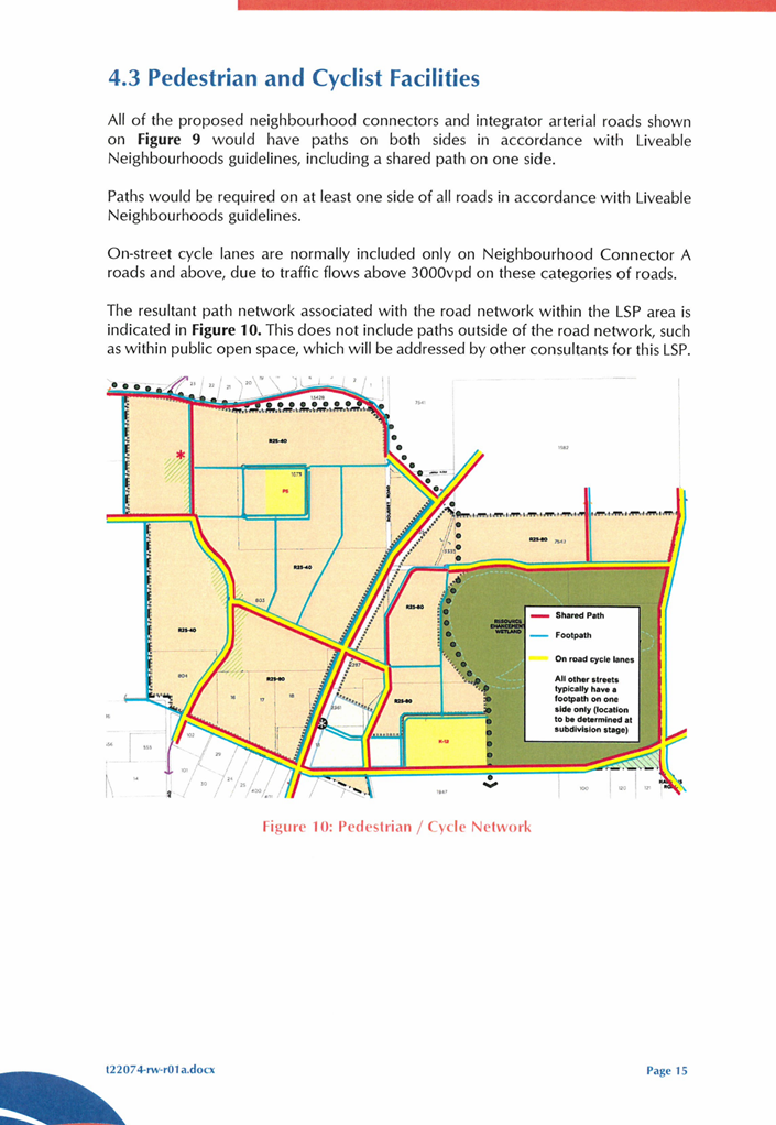
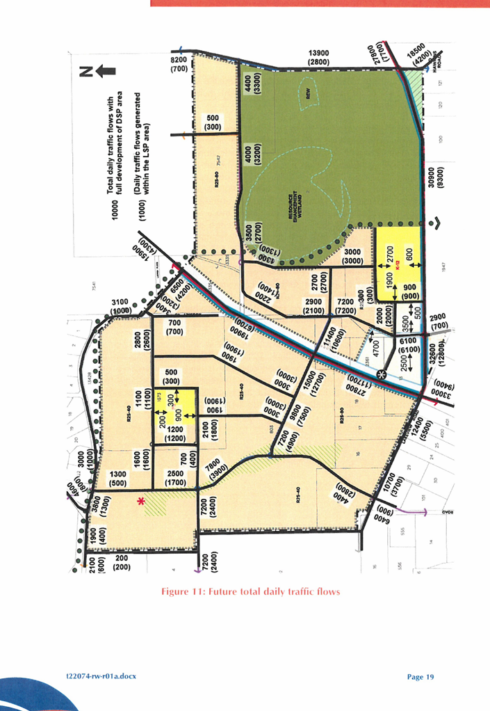
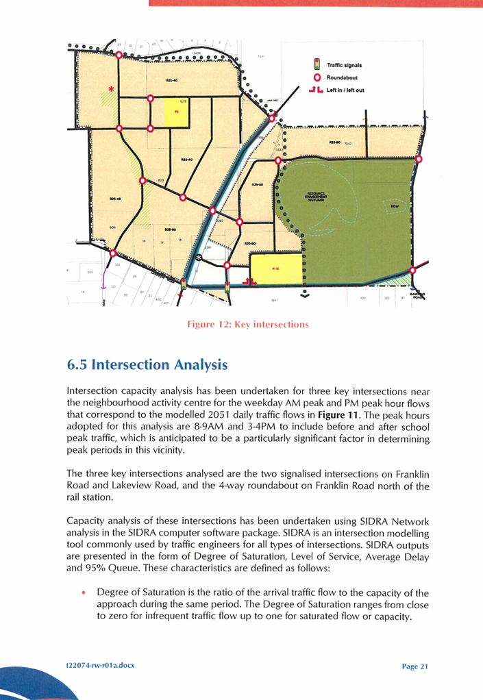
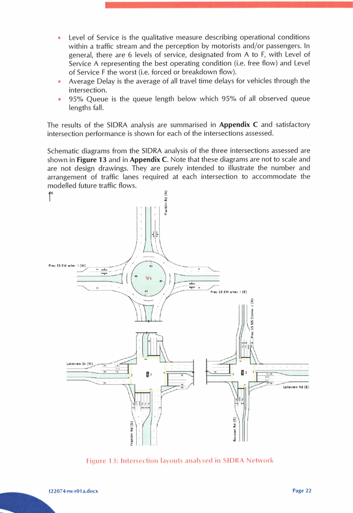
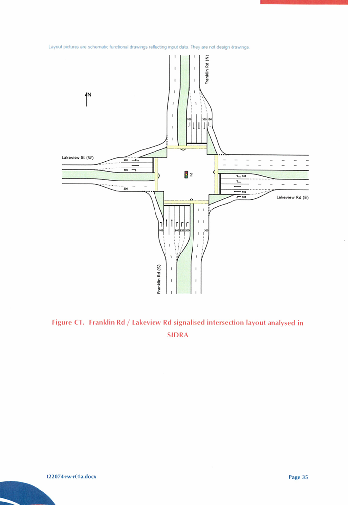
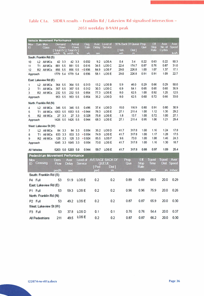
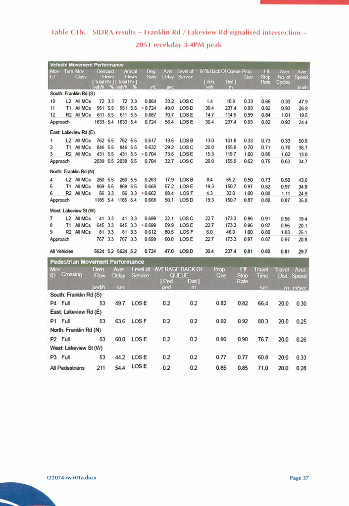
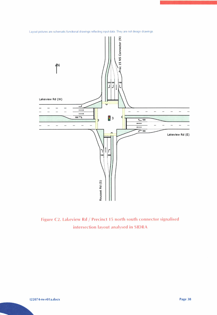
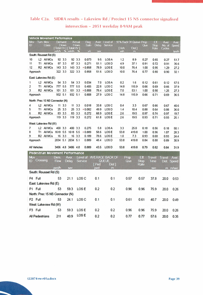
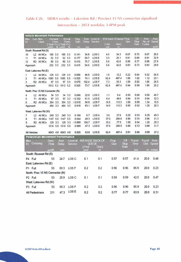
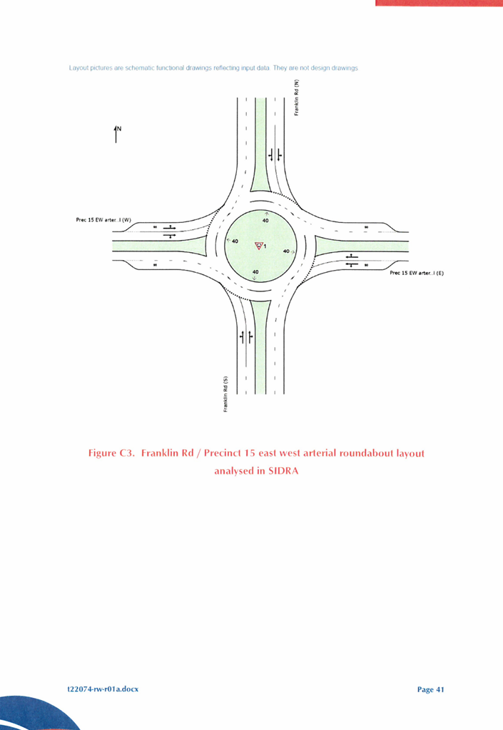
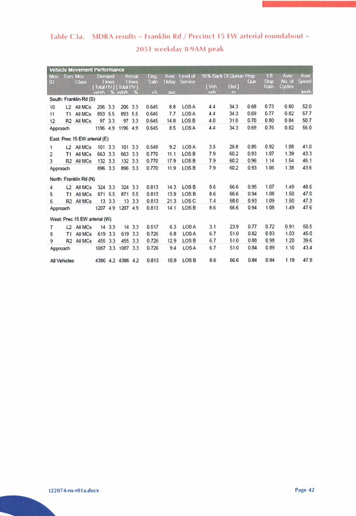
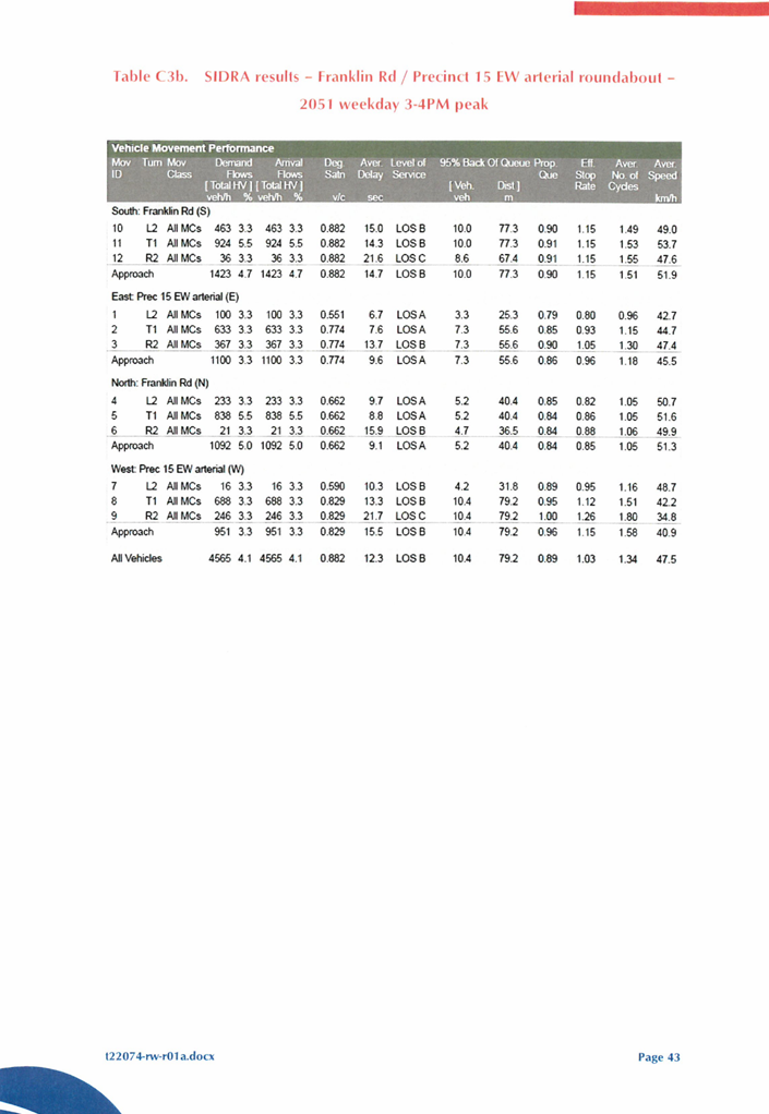
The LSP area in accordance with the EWDSP is separated by Franklin Road which is a high frequency transit corridor. Franklin Road is anticipated to be a six lane Integrator A road which will encompass a transit station as indicated in (Attachment 10). The TIA incorrectly identifies that intersections along Franklin Road will encompass roundabouts which will not be conducive to pedestrian and cyclist movements. Administration in its assessment of the proposal has raised concern regarding how pedestrian and cyclist movements will be managed. The proposed pedestrian and cycle paths are depicted in the TIA (Attachment 19) in Figure 10. Further discussions with the Proponent and DPLH have established that these intersections will be signalised. However, given that Franklin Road forms part of the DDCP, the design of Franklin road is yet to be finalised. As such, it is recommended that the TIA and the LSP Map is modified to indicate these intersections are signalised and not roundabouts.
It has been identified that the TIA (Attachment 19) provided by the Proponent does not adequately address the WAPC Transport Impact Assessment Guidelines as the TIA has not adequately considered traffic originating from destinations from outside the subject Precinct. Further, the TIA doesn’t discuss how traffic generated as a result of the development of the Precinct will impact the existing surrounding road network given that it has been developed to a rural standard. It is recommended that Part 1 is modified requiring a Traffic Impact Assessment be submitted at each stage of subdivision to determine whether the existing surrounding road connections which are developed to a rural standard are sufficient to service the proposed development stage proposed and any previous approved subdivisions in the LSP.
Noting the comments above, Administration recommends the following:
· Part 1 and the TIA be amended to incorporate cross sections for the road reserves contained within Local Planning Policy 5.3: East Wanneroo;
· The LSP Map be amended to include Lakeview Street, Mariginiup Road, Roussett Road, Coogee Road and the eastern boundary road; and
· Part 1 of the LSP be amended to require that a TIS/TIA be prepared and submitted as a requirement of subdivision and development.
Local Development Contribution Plan
The Proponent has proposed that as a result of the single significant landowner within Precinct 15, a Local Development Contributions Plan (LDCP) is not required. The Proponent contends that a single landholder represents 85% of land ownership in the Precinct and as such, the LSP details that a LDCP is not required on the basis that any inequalities between land owner contributions can be dealt with through the use of legal agreements. Precinct 15 incorporates a number of District items, these are intended to be funded and developed at the cost of the DDCP. Therefore, Administration is satisfied that the development requirements of the subject LSP are capable of being accommodated in the absence of a LDCP.
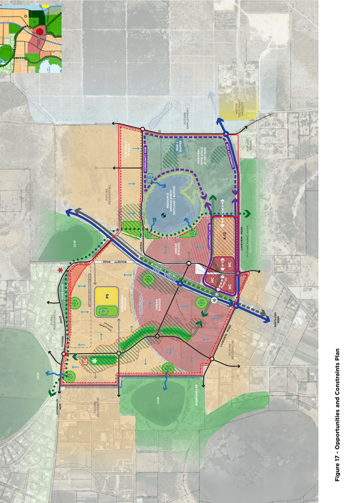
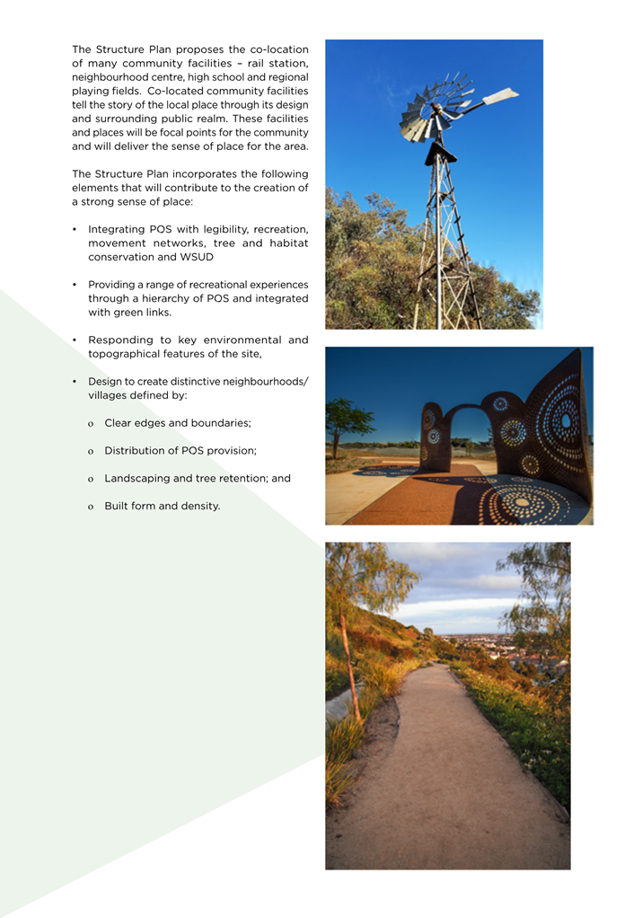
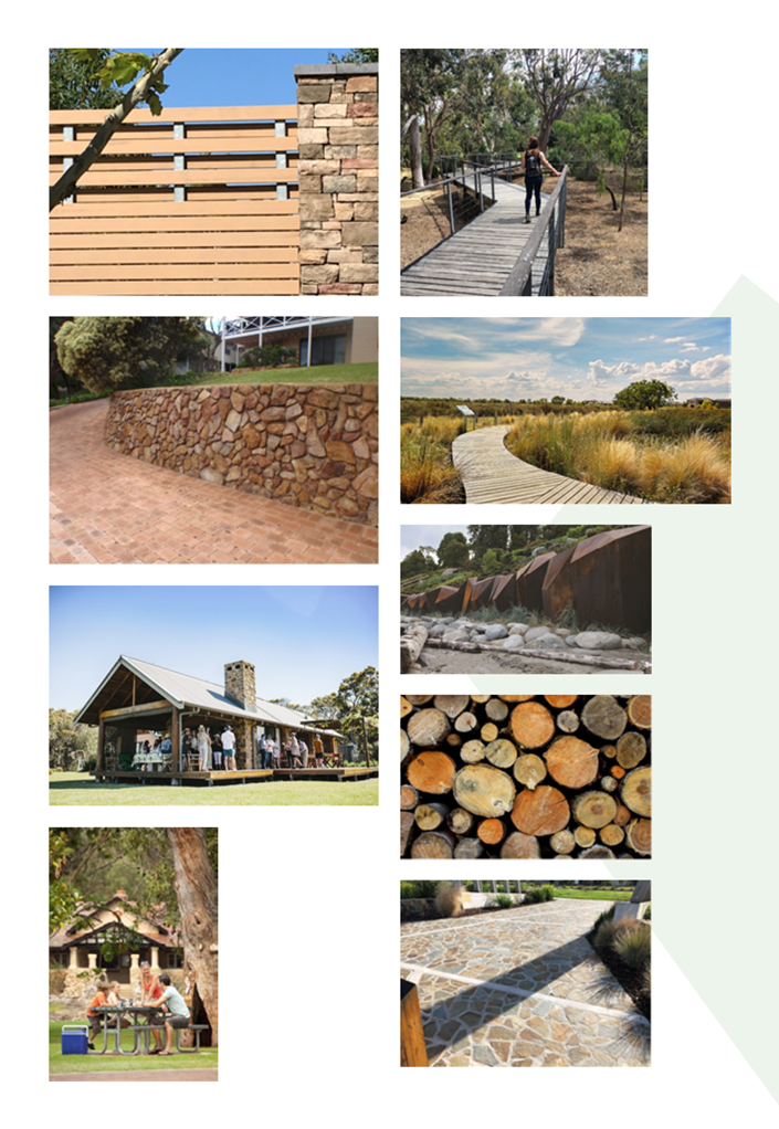
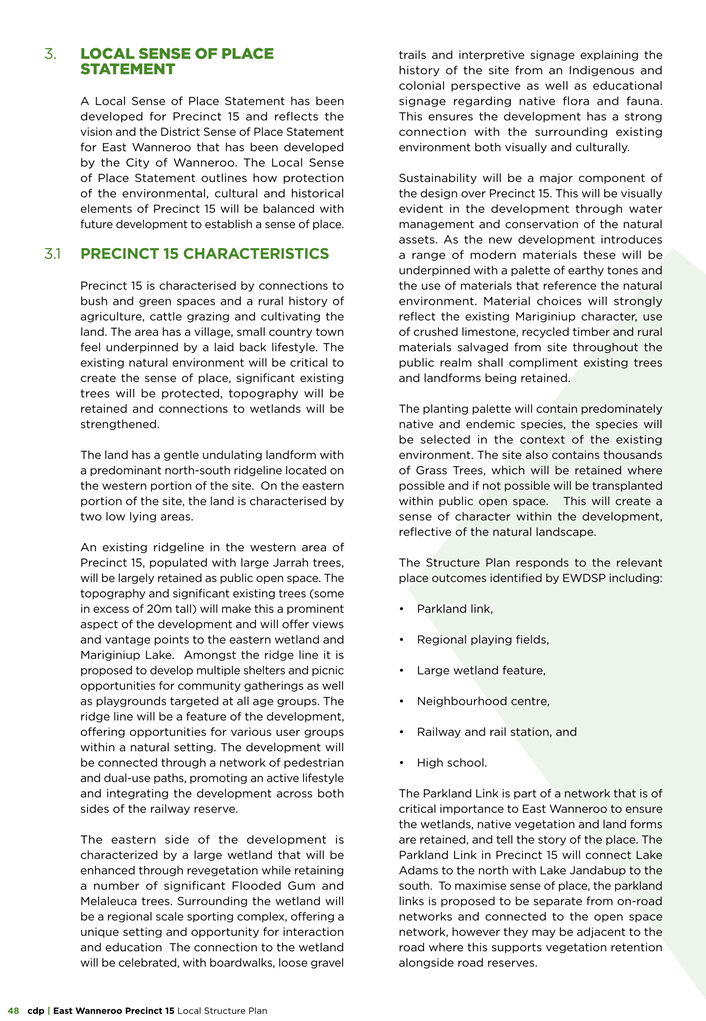
Sense of Place
The Local Sense of Place Statement (LSoPS) is required in accordance with the Local Structure Plan requirements detailed within LPP 5.3. The Proponent has provided a LSoPS is Part 2 of the LSP (Attachment 20).
Part 2 of the LSP incorporates a LSoPS which describes the Precinct as having a village feel which is underpinned by a laidback lifestyle. The LSoPS Identifies the Precincts natural features such as mature trees, topography and wetlands are critical to creating the sense of place for the locality. Making a distinction between land east and west of the existing ridgeline which incorporates POS 2, 4 and 6. The POS Masterplan (Attachment 16) is a design response which considers; topography of the precinct, natural drainage, retained vegetation and Carnaby’s Black Cockatoo foraging habitats. The LSP doesn’t incorporate any provisions which require the retention of vegetation nor are trees identified to be retained identified in the LSP Map (Attachment 10). Accordingly, it is recommended that provisions are incorporated within Part 1 identifying vegetation to be retained.
Administration also considers the Neighbourhood Centre to represent a significant opportunity for the sense of place of the precinct to be expressed both as part of its built form and public realm design. The EWDSP requires that Public Realm Guidelines (guidelines) are developed for the subject Precinct. At the time of consideration, no guidelines have been submitted for consideration. It is recommended that guidelines are developed for the Neighbourhood Centre prior to the submission of a development or subdivision application relating to the neighbourhood centre. The guidelines would consider items including but not limited to; planting palette, colours, paving materials, public art installations etc. It is recommended that Public Realm Guidelines are developed for the Neighbourhood Centre to maximise the Precinct’s design response to its local context.
Given the above, Administration recommends the following:
· Part 1 of the LSP be updated to incorporate the requirement to retain mature trees and the typography of the ridgeline;
· That Attachment 10 is updated to designate key areas where vegetation retention is envisaged within the LSP; and
· Part 1 of the LSP is amended to require public realm design guidelines to be prepared and approved prior to subdivision and development occurring within the Neighbourhood Centre.
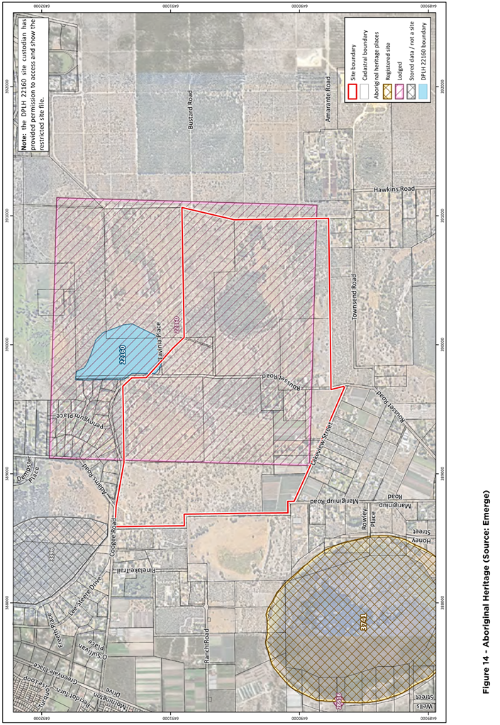
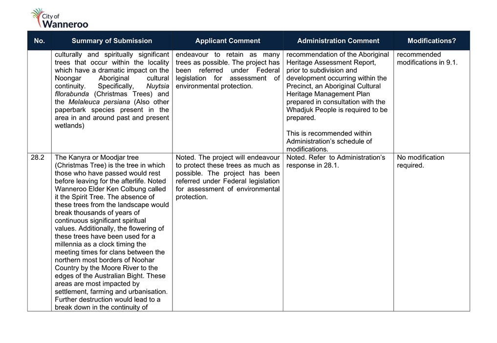
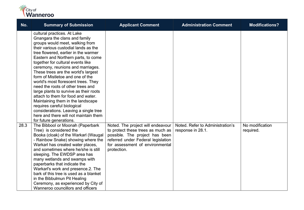
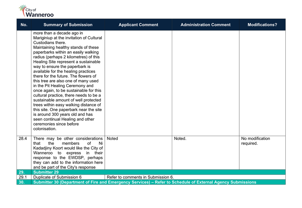
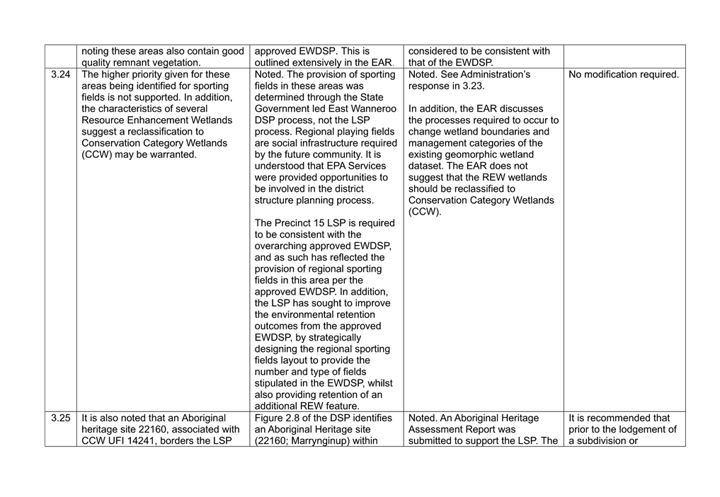
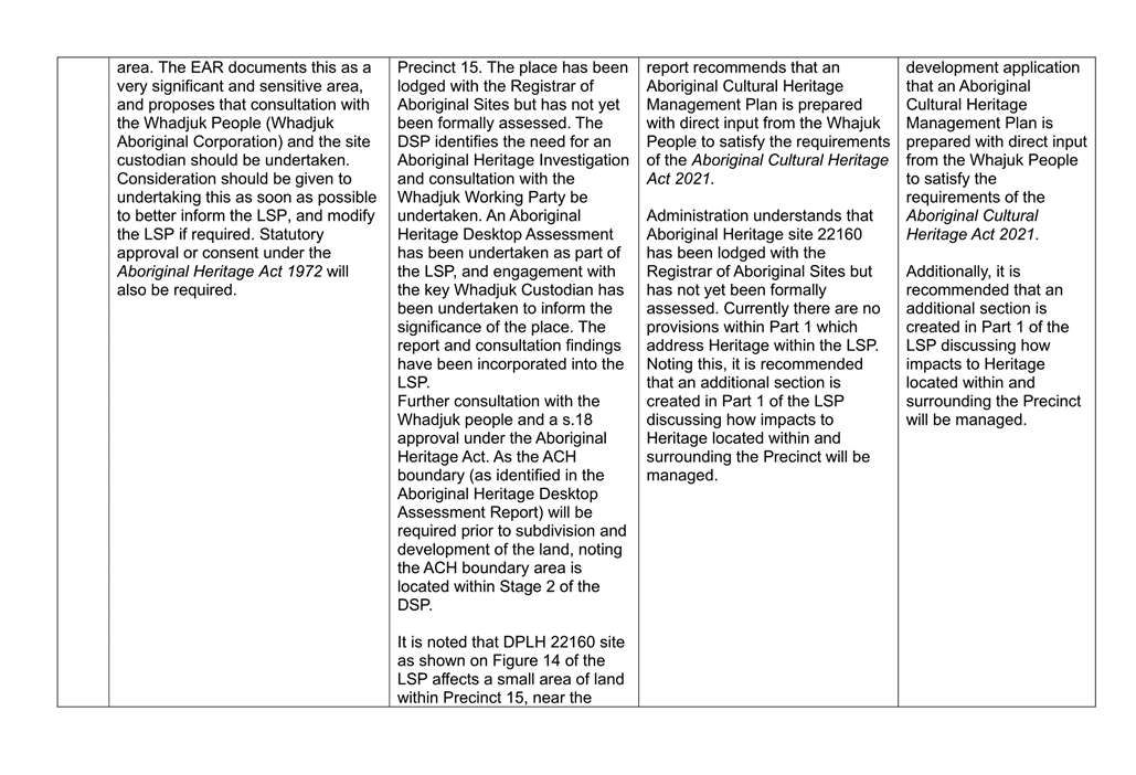
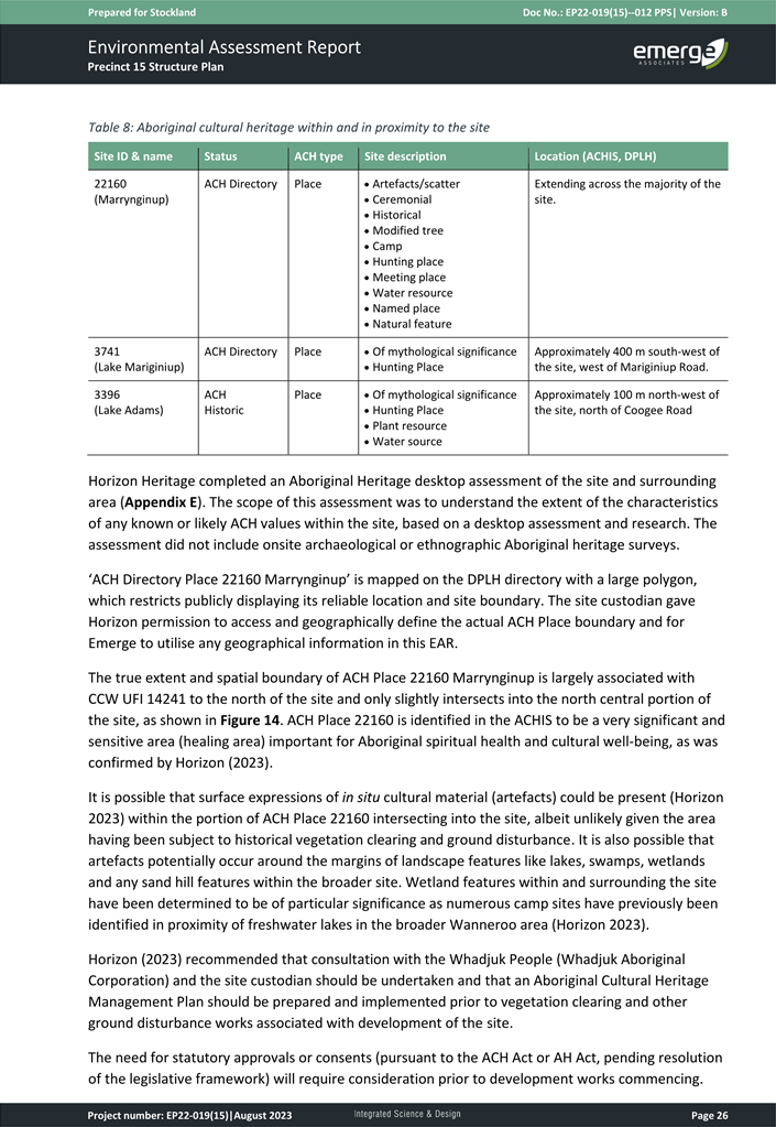
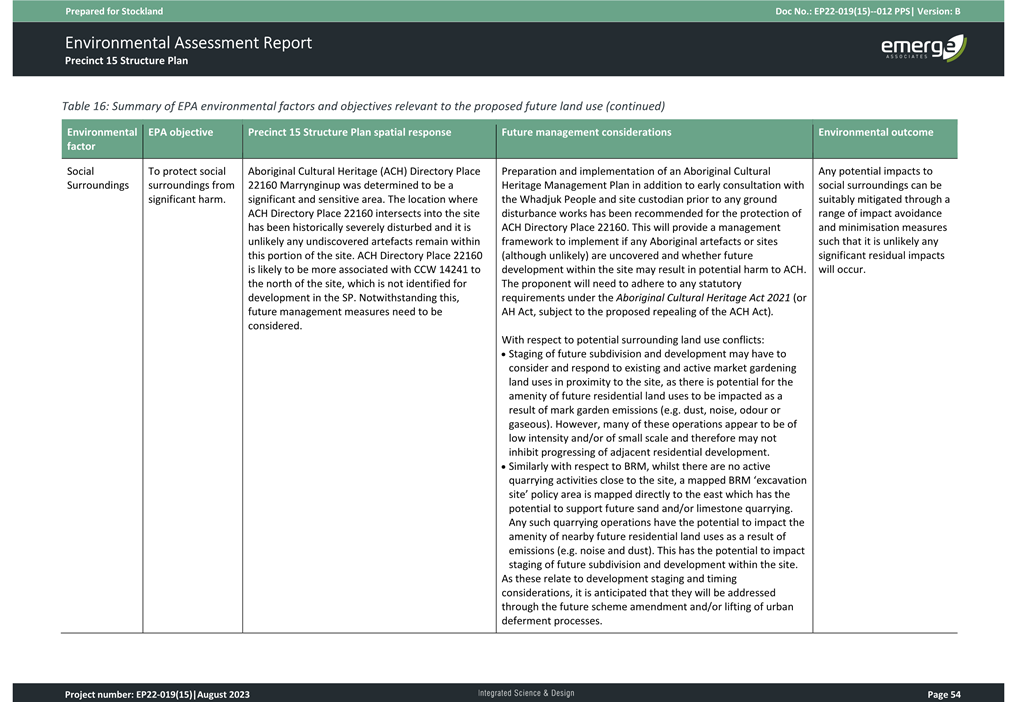
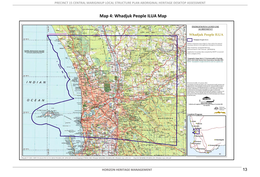
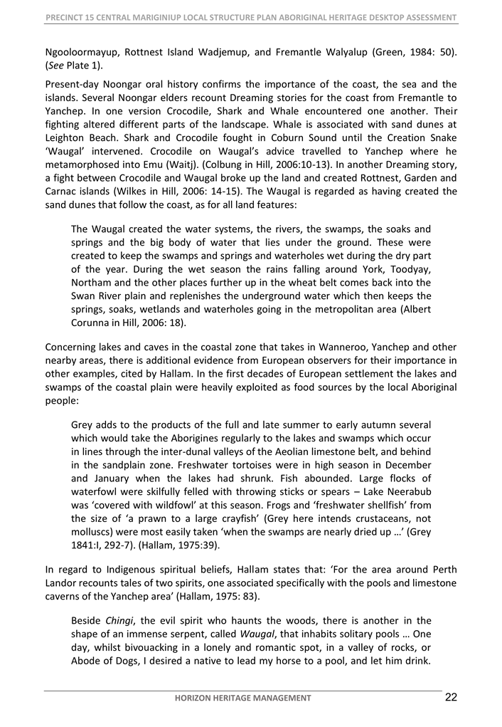
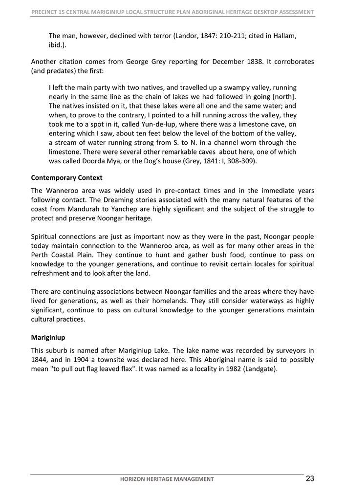
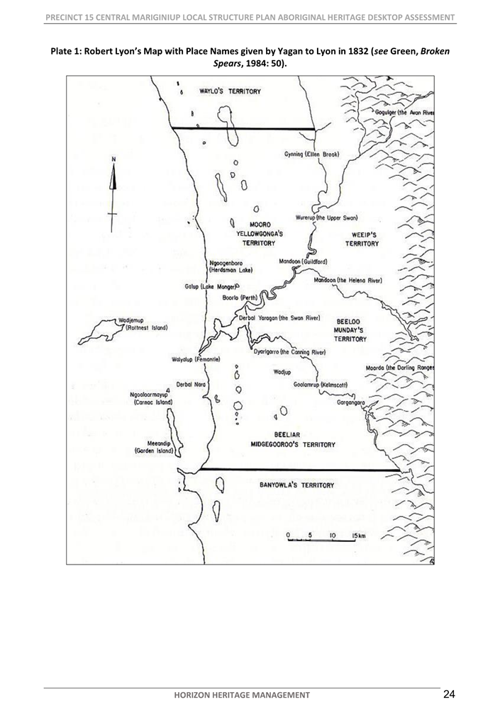
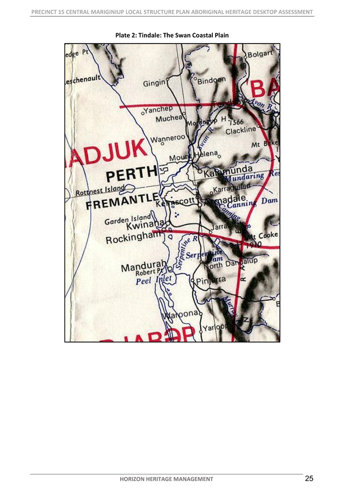
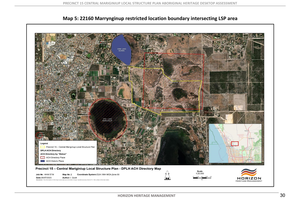
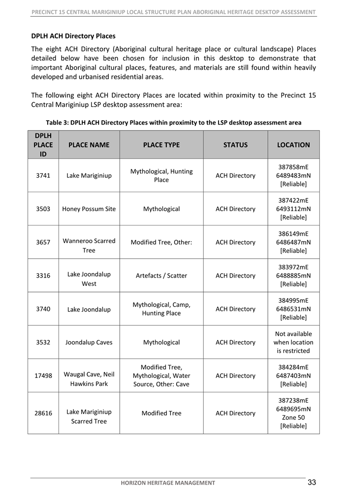
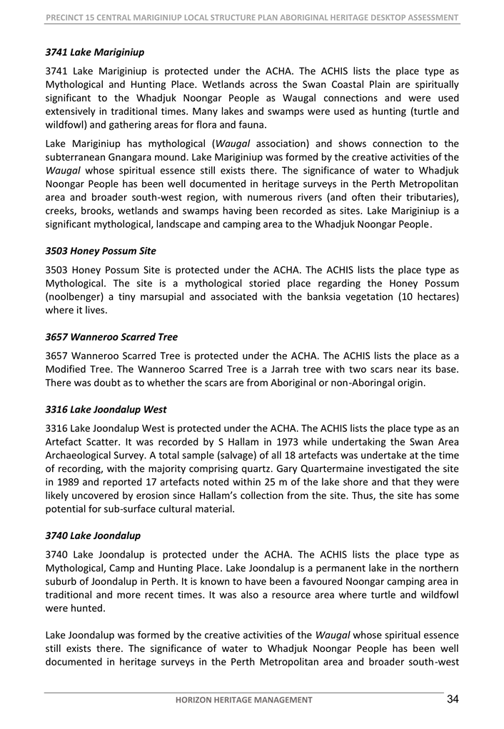
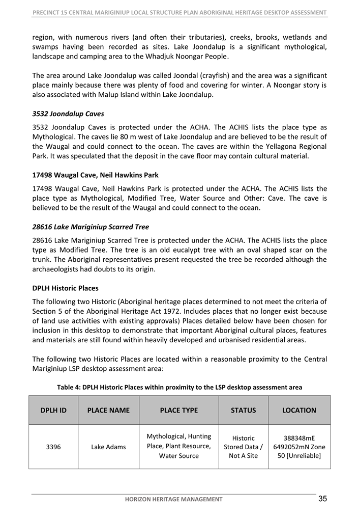
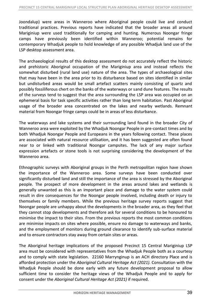
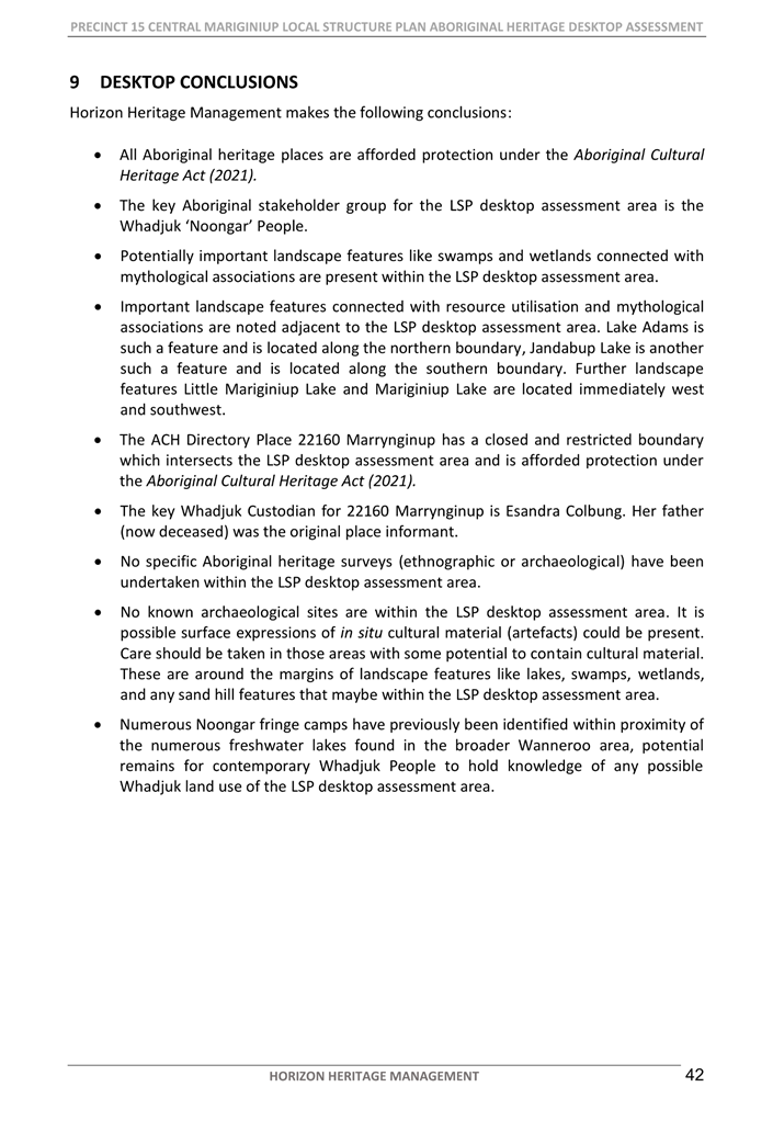
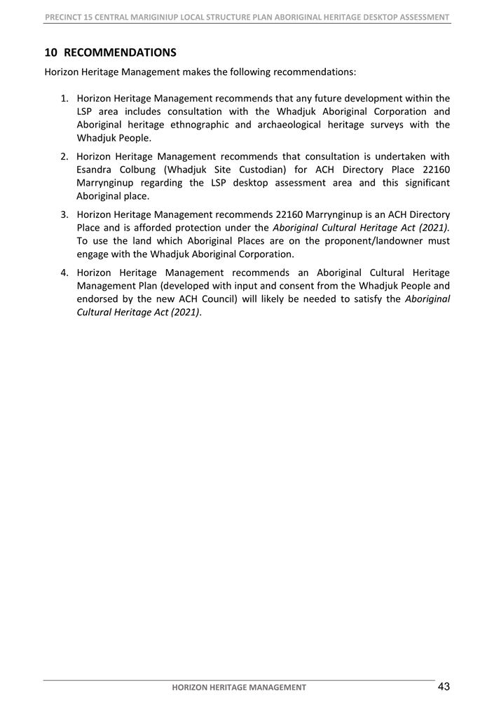
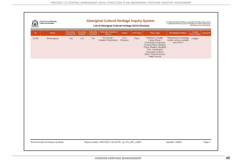
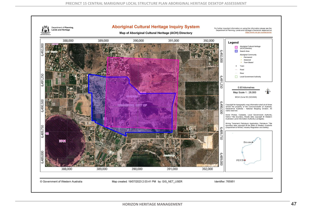
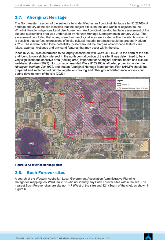
Indigenous Heritage
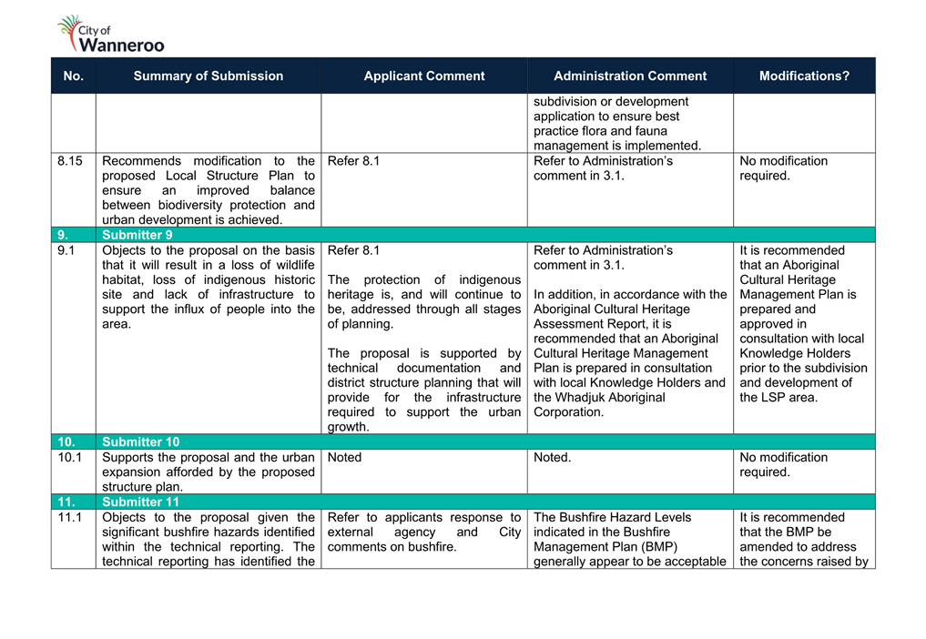
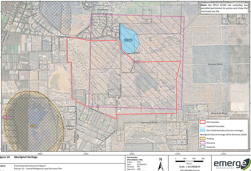
As detailed within the EWDSP, the subject site incorporates an important Aboriginal Cultural Heritage place that is listed on the Department of Planning Lands and Heritage’s (DPLH) Aboriginal Heritage Inquiry System (AHIS) ID No. 22160) comprising several cultural components and has historical and ongoing contemporary significance to Aboriginal people. The site has been identified (lodged) but not has not been assessed for consideration of Section 5 significance (register) at this time. The Applicant has provided an Aboriginal Cultural Heritage Assessment Report (Attachment 21) which provides details regarding the significance of the site. As stipulated on the cover page of the report, the report contains the name of a deceased Aboriginal person. Further, pages 31 and 32 contain restricted place and boundary information and as such Administration has redacted these pages from the report. In accordance with the recommendations of the report, Administration recommends that Part 1 of the LSP be modified to require:
· An Aboriginal Cultural Heritage Management Plan (including ethnography and archaeological heritage surveys) be developed in consultation with local Knowledge Holders prior to subdivision and development occurring within the LSP area.
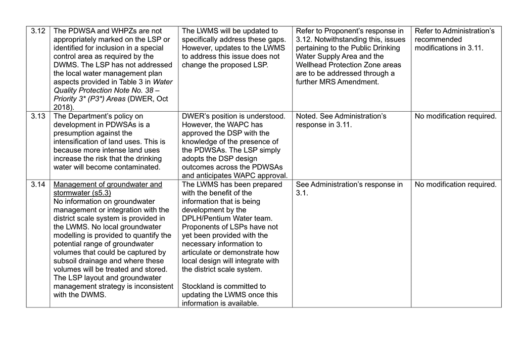
Water Management
Local Water Management Strategy
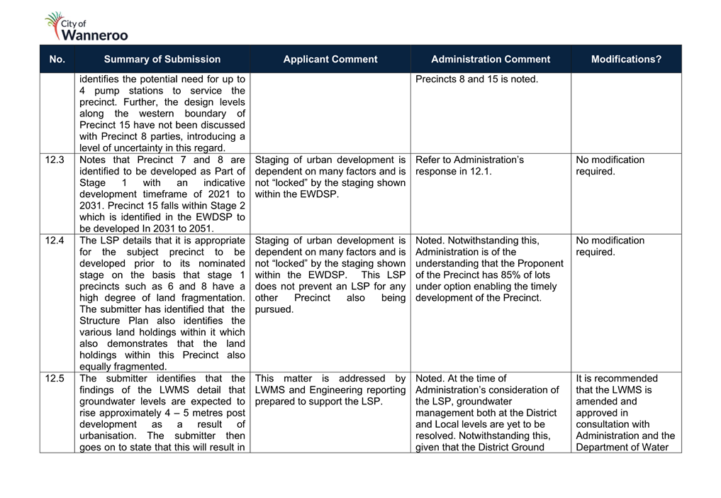
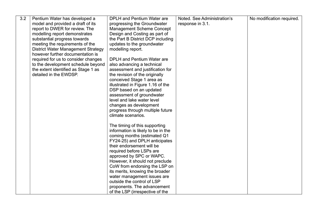
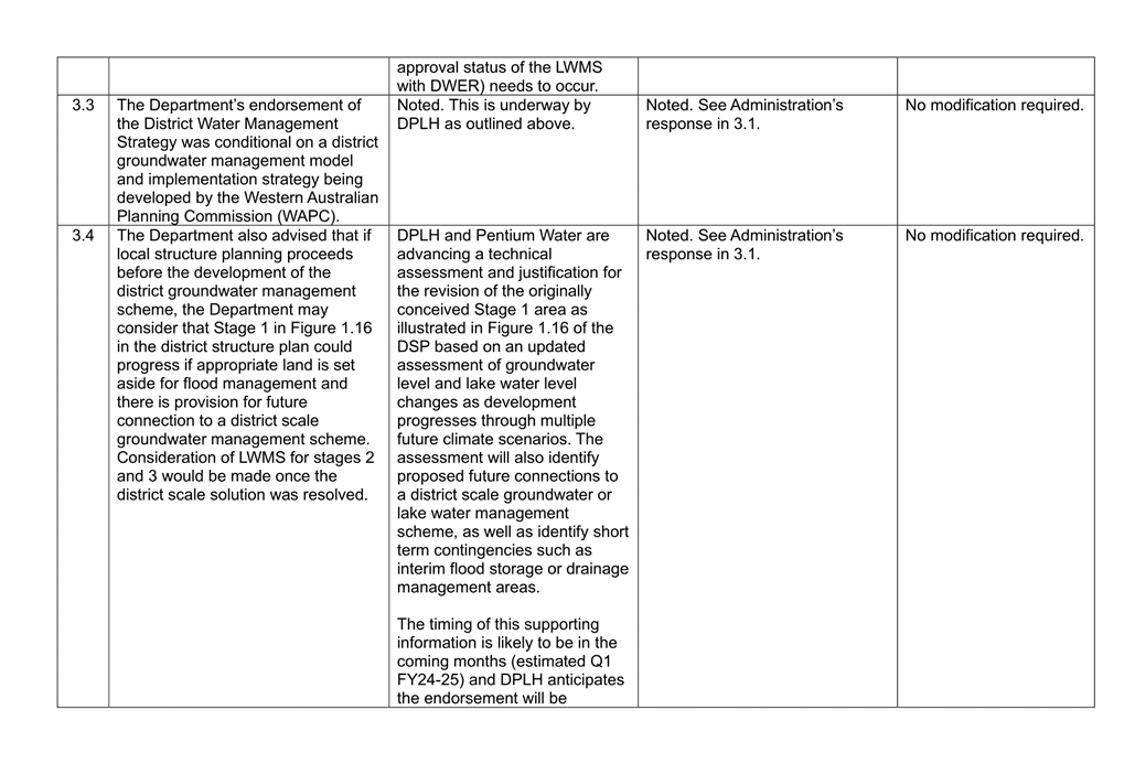
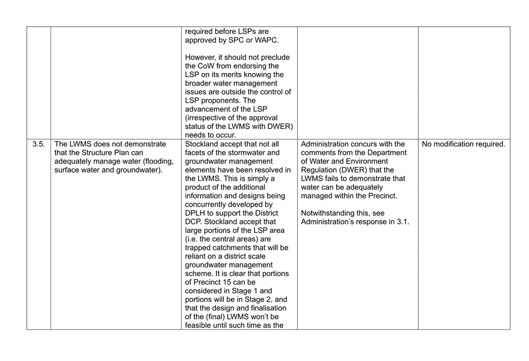
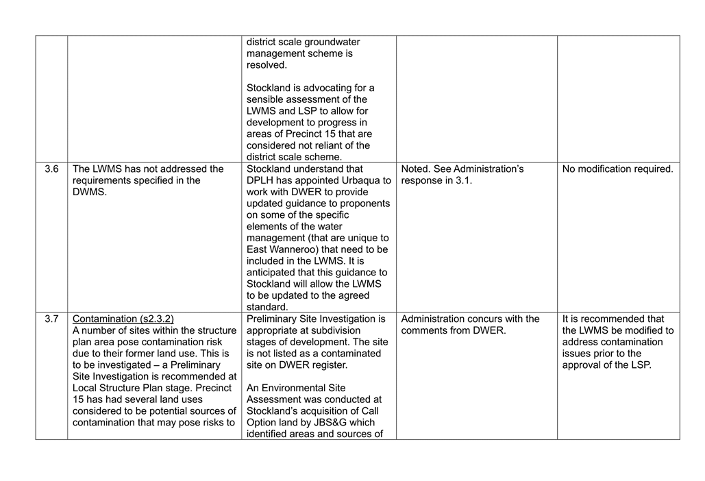
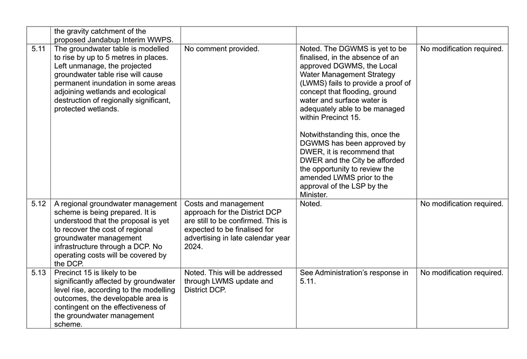
As previously mentioned, the development of Precinct’s within Stage 2 of the EWDSP is predicated on the ability for these Precinct’s being able to effectively manage ground and surface water. As a result of urbanisation, groundwater levels in Precinct 15 are anticipated to rise four to five metres. The LWMS (Attachment 22) submitted to the City does not provide a proof of concept that surface water can be adequately managed in the absence of the DGWMS. Administration is aware of the Department’s hydrology consultant Pentium Water’s progression towards addressing the outstanding groundwater management issues. Irrespective of this, and as acknowledged in the submission from the Department of Water and Environmental Regulation, further progress is required in order to establish whether Precinct’s beyond those within Stage 1 are capable of adequately managing groundwater, surface water and flooding within the Precinct. Notwithstanding the absence of this information, it is understood that revised information cannot be provided until such time as the DGWMS is approved by DWER.
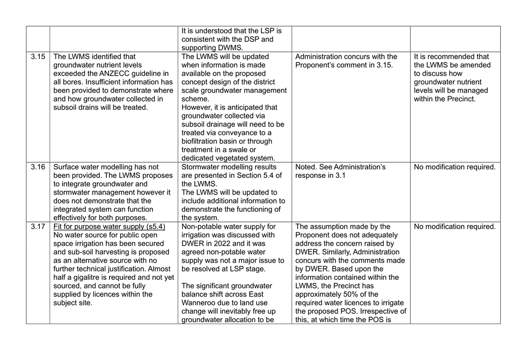
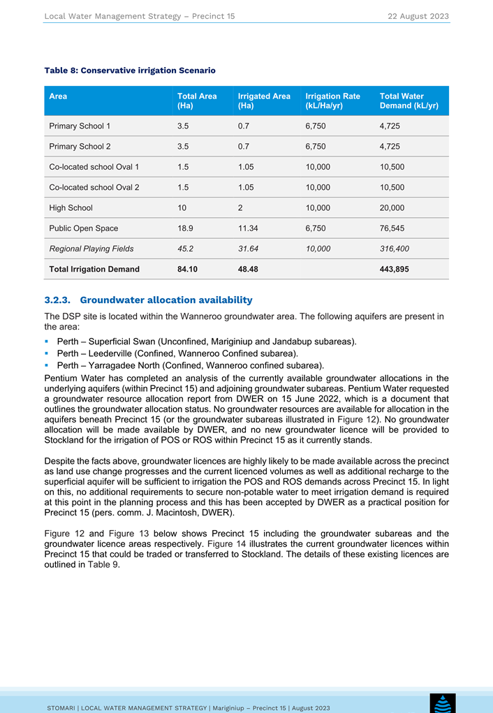
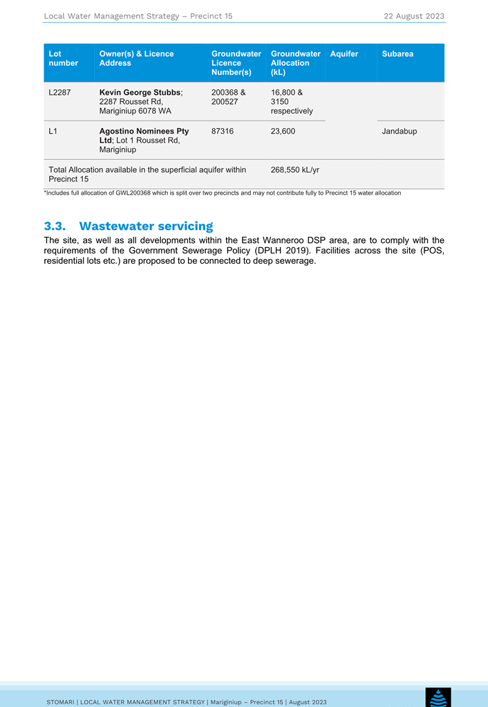
The LWMS (Attachment 22) identifies that insufficient groundwater allocation is available to irrigate the POS proposed as part of the LSP. The LWMS stipulates that 443,898kL is required based upon the various areas within the LSP. Existing groundwater licences within Precinct 15 are 268,550kL a year.
Therefore, inadequate licences are available to adequately irrigate the LSP Area and Administration recommends that:
· The LWMS is updated following the DGWMS being approved by DWER; and
· The proponent be required to establish In the LSP that adequate water licences are able to be sourced and transferred the City at subdivision sufficient to irrigate the future POS.
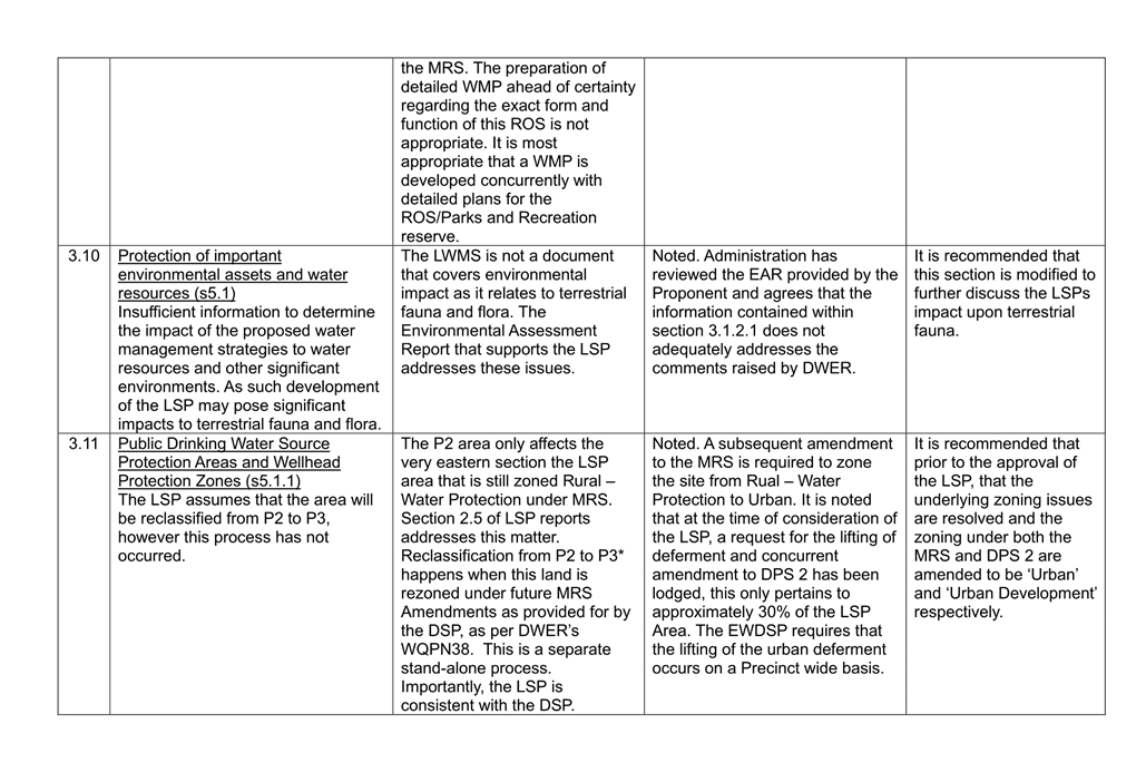
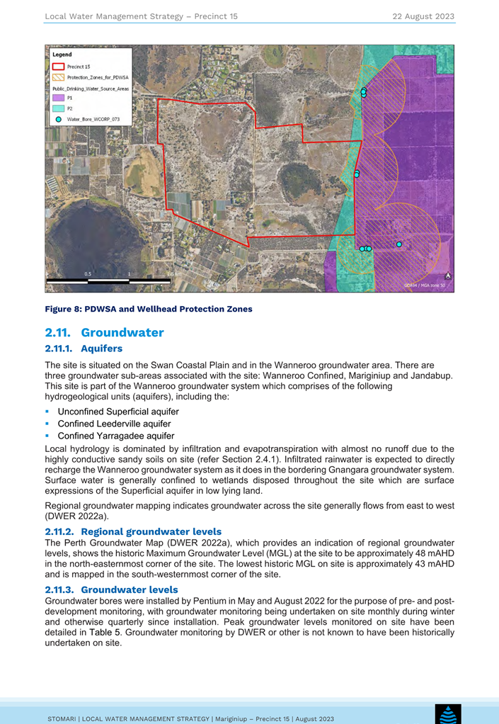
Public Drinking Water Supply Area:
A portion of Precent 15 is zoned ‘Rural – Water Protection’ which is classified as a Priority 2 (P2) Public Drinking Water Supply Area (PDWSA). A Well Head Protection Zone (WHPZ) is also located within this area which is intended to protect two drinking water production bores. The WHPZ and the PDWSA is represented in Figure 13 of the LSP. As stated in the LSP, residential subdivision of land within a P2 area zoned ‘Urban Deferred’ and the creation of recreational parks and/or sporting ovals is incompatible with the zone in the MRS. Further the LSP states that the rezoning of land will trigger the reclassification of the areas from P2 to Priority 3 (P3).
DWER have raised concerns regarding the assumption that this area will be reclassified from P2 to P3 stating that the intensification of land within a Public Drinking Water Supply Area (PDWSA) increases the risk of drinking water becoming contaminated, which in turn may affect the health of those people who consume the water. As discussed in the Metropolitan Region Scheme Zoning section above, the ‘Rural – Water Protection’ zoning issue remains unresolved given that once a LSP is adopted over the land, applications for subdivision and development can be considered. In this regard the recommendation under the above Metropolitan Region Scheme Zoning section has been made.
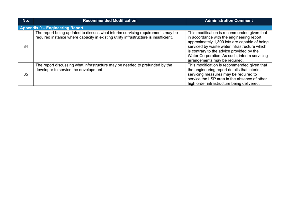
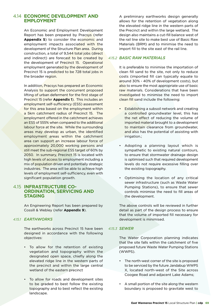
Servicing
As a requirement of the EWDSP, to lift the urban deferment Proponents are required to demonstrate that they have received confirmation from servicing agencies on the provision of water and waste water services. This is discussed further below.
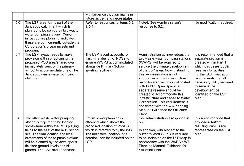
Waste Water
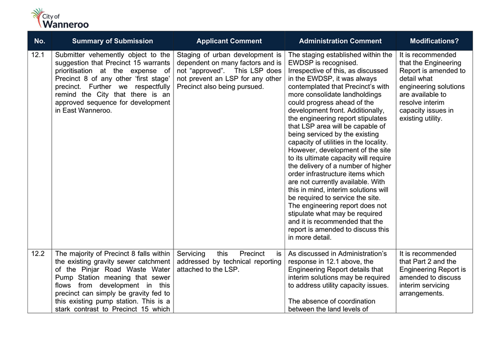
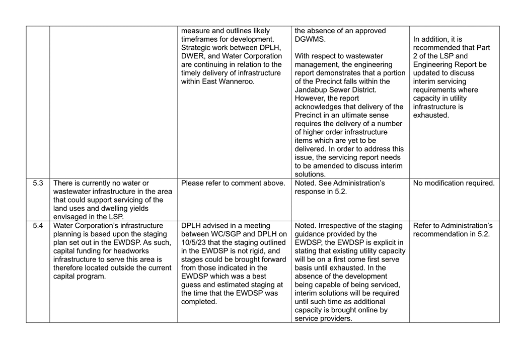
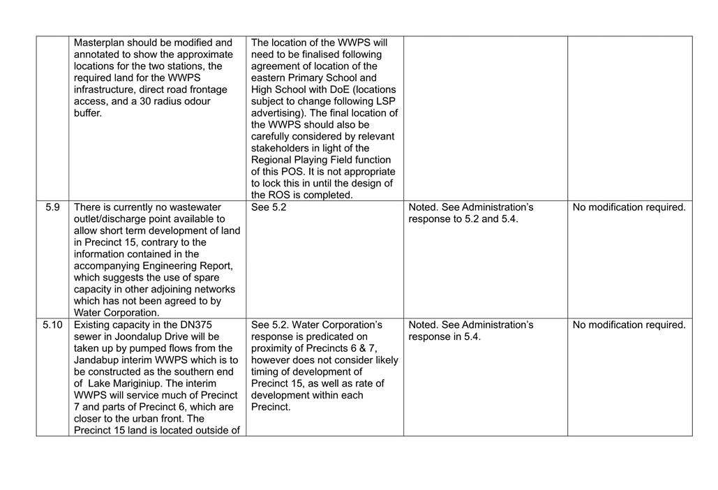
The EWDSP states that the take up of existing servicing capacity will generally be on a first come, first served basis until exhausted with additional capacity added in accordance with their capital works programs in response to market demand. The LSP details that the site falls within the catchment of five Waste Water Pumping Stations (WWPS). Part 2 of the LSP details that the development of the entirety of the Precinct will require the delivery of a number of higher order infrastructure items which are currently not available and therefore it is likely interim measures may be required to be implemented. The LSP does not provide further detail as to what higher order infrastructure items are nor the interim servicing measures that may be required to be implemented.
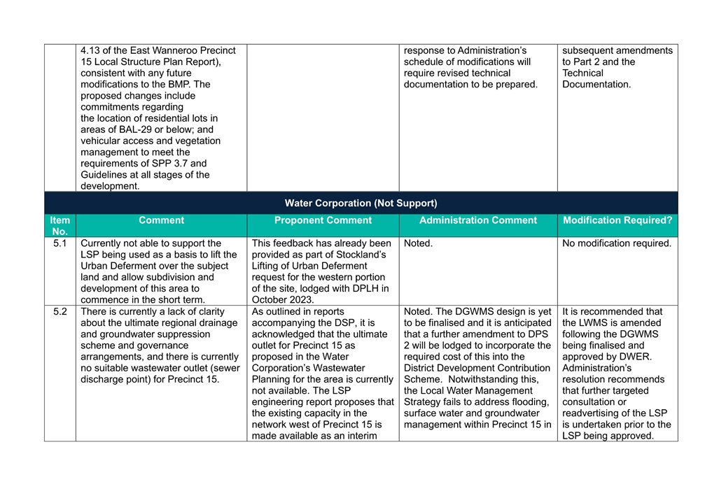
Water Corporation (WC) in its referral response identified that two WWPS will need to be developed within Precinct 15 both of which are outside the Water Corporation’s five year Capital Investment Program. Further, WC disagrees that the LSP area is capable of being serviced given that there is currently no wastewater outlet/discharge point available to allow short term development of land in Precinct 15. Additionally, the use of spare capacity in adjoining networks has not been agreed with WC, nor can it be implemented as suggested by the Proponent’s engineers. Further, Precinct’s 7 and 8 have also progressed their LSPs for assessment and it is anticipated that these precincts may be developed in a similar timeframe to Precinct 15 and therefore exhaustion of existing utility capacity may occur quicker than anticipated. As such, Administration recommends the following:
· That Part 2 of the LSP and the Servicing Report is amended to discuss what interim measures are required to be implemented in order to service the LSP area as a schedule of modification; and
· That further consultation with Water Corporation is undertaken to confirm the serviceability of Precinct 15 prior to the LSP being approved.
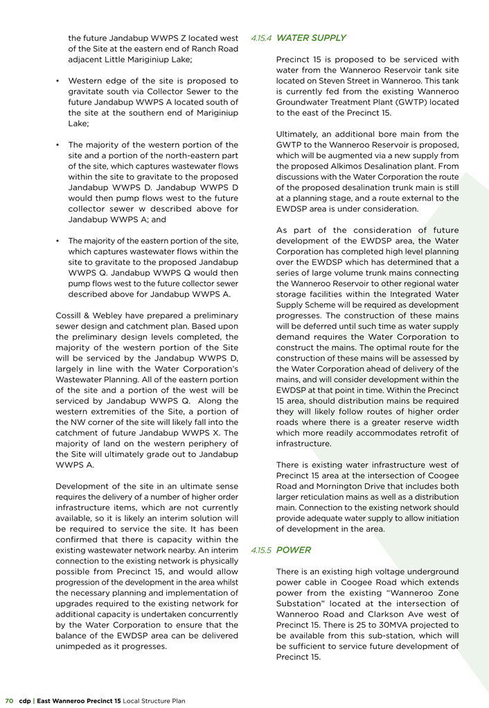
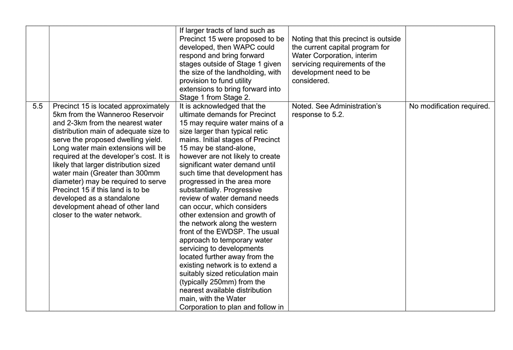
Water Reticulation
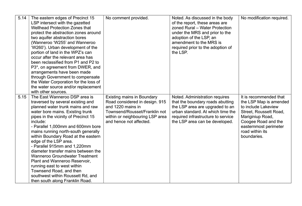
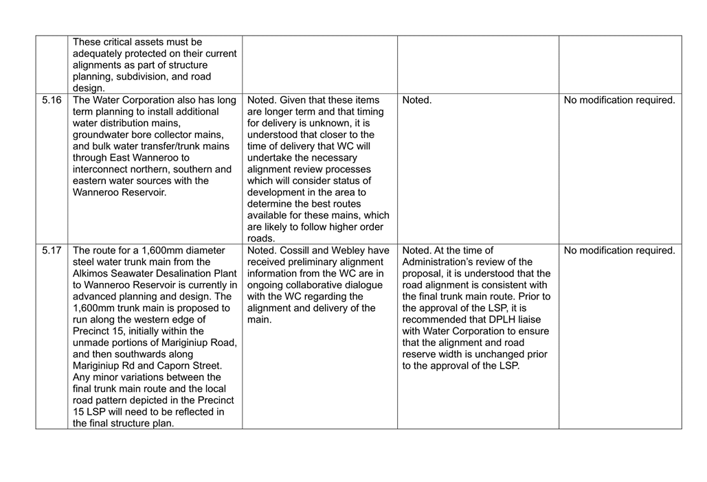
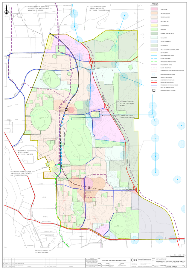
Precinct 15 is located 5 km from the Wanneroo Reservoir and 2 - 3km from the nearest water distribution main of adequate size to serve to the proposed dwelling yield. Significant extensions to water mains will be required at the developer’s cost to service the precinct. Water Corporation has not raised any concerns regarding the capacity of existing water infrastructure to service the development. Planned trunk mains and raw water bore mains are required to be established as part of the proposed district water supply scheme (Attachment 23) developed as part of the EWDSP. The road network proposed as part of the subject LSP appears to reflect the required infrastructure alignment and WC has not raised any concerns regarding the current alignment of the road network in the LSP area.
Electricity
The servicing report references that adequate capacity in the existing Wanneroo Substation will be available to service the precinct. It is also acknowledged that switch stations and transformers will be required to be installed throughout the Precinct to meet individual site needs. Administration recommends that prior to the approval of electrical designs for any particular stage of development within the precinct, that Administration is consulted in order to minimise impacts on the provision of POS which often host electricity infrastructure.
Telecommunications
The servicing report details that the site can be serviced with optic fibre under NBN’s (National Broadband Network) roll-out scheme for greenfield developments. Alternatively, a separate provider may facilitate the provision of a high speed broadband network. Infrastructure will generally be provided for in road reserves in accordance with the Utilities Service Providers handbook. The servicing report also acknowledges that local land may be required for equipment sites, which will be accommodated at detailed subdivision stage. In accordance with Local Planning Policy 2.5: Telecommunications Infrastructure consideration of the demand for telecommunication services should be considered at part of an LSP. The LSP does not consider whether additional telecommunication towers may be required to service the eventual population of the area. Consideration of this will ensure that future residents will be aware of the potential provision of infrastructure when they chose to purchase a lot and minimise future objections. Therefore, it is recommended that:
· The LSP is amended to consider the anticipated demand for telecommunications infrastructure and discuss potential locations in which telecommunication towers may be necessary to service the LSP area as a schedule of modification.
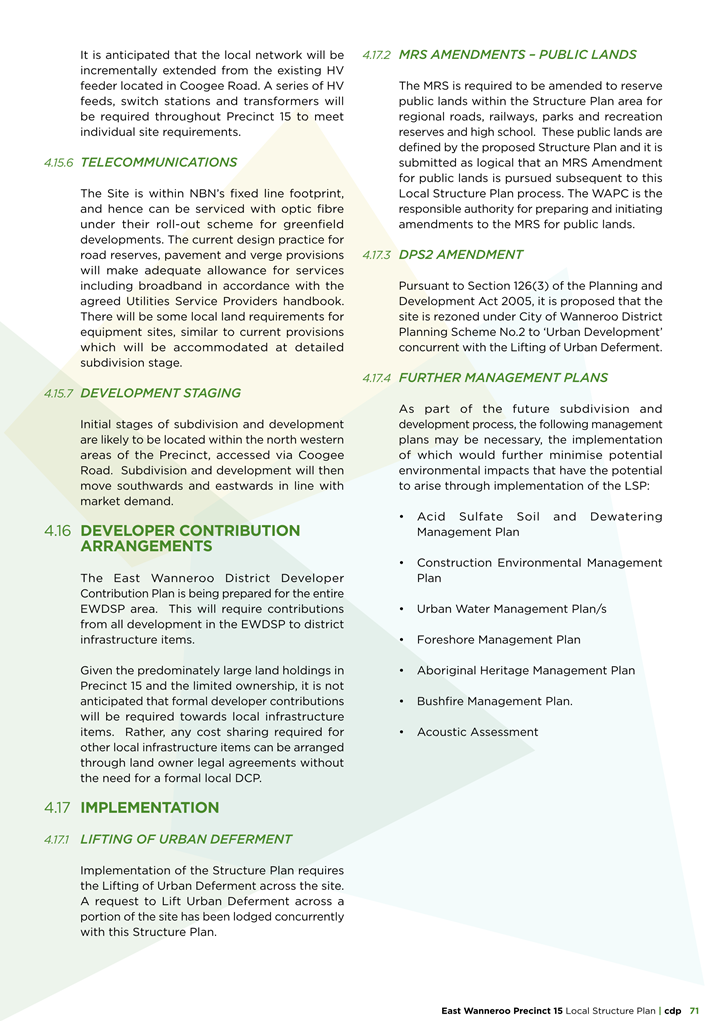
Conclusion
It is noted that the Precinct 15 LSP has been developed generally in accordance with the requirements of the EWDSP. There are a number of outstanding district and precinct level processes that remain to be resolved and a range of modifications are recommended to be made in order to bring the LSP to closer alignment with the requirements of the relevant planning framework. The recommendation is made on the basis that the City will continue to be engaged with once, the recommendation has been forwarded to the WAPC for its consideration. Administration’s recommended modifications will result in extensive changes to the LSP Map and therefore further consultation needs to be undertaken once these matters have been addressed to the satisfaction of the WAPC.
It is recommended that the proposed amended Precinct 15 – Central Mariginiup Local Structure Plan included in Attachment 7 be supported, subject to the modifications set out in Attachment 4.
Statutory Compliance
Precinct 15 - Central Mariginiup Local Structure Plan has been processed in accordance with the Planning and Development (Local Planning Schemes) Regulations 2015.
Strategic Implications
The proposal aligns with the following objective within the Strategic Community Plan 2021 – 2031:
5 ~ A well planned, safe and resilient City that is easy to travel around and provides a connection between people and places
5.2 - Plan for and manage land use
Risk Appetite Statement
In pursuit of strategic objective goal 5, we will accept a Medium level of risk, extended to High in the areas of Community / Reputation & Financial / Commercial impacts. Shifting transport modes and usage in the City may require short term pain for longer term gain as the City supports the development, maintenance and connection of alternatives to car use (e.g. cycle ways) and the supporting infrastructure.
Risk Management Considerations
|
Risk Title |
Risk Rating |
|
ST-S04 – Integrated Infrastructure and Utility Planning |
Low |
|
Accountability |
Action Planning Option |
|
Director Planning & Sustainability and Director Assets |
Manage |
|
Risk Title |
Risk Rating |
|
ST-S23 – Stakeholder Relationships |
Medium |
|
Accountability |
Action Planning Option |
|
Director Corporate Strategy and Performance |
Manage |
|
Risk Title |
Risk Rating |
|
ST-S26 – Resilient and Productive Communities |
Medium |
|
Accountability |
Action Planning Option |
|
Director Community and Place |
Manage |
|
Risk Title |
Risk Rating |
|
ST-S27 – Rising Ground Water |
Medium |
|
Accountability |
Action Planning Option |
|
Director Planning & Sustainability and Director Assets |
Manage |
|
Risk Title |
Risk Rating |
|
CO-O22 Environmental Management |
Medium |
|
Accountability |
Action Planning Option |
|
Director Planning & Sustainability |
Manage |
The above risks relating to the issues contained within the report have been identified and considered within the City’s Strategic and Corporate risk registers. Action plans have been developed to manage this risk to support existing management systems.
Policy Implications
The proposed Precinct 15 – Central Mariginiup Local Structure Plan has been assessed against the provisions of the WAPC’s Liveable Neighbourhoods policy, State Planning Policy 3.7 – Planning in Bushfire Prone Areas, State Planning Policy 4.2 – Activity Centres, District Planning Scheme No.2, the East Wanneroo District Structure Plan, Local Planning Policy 4.3: Public Open Space and Local Planning Policy 5.3: East Wanneroo.
Financial Implications
The developer will be subject to the payment of development contributions at which time a District Development Contributions Plan is approved and is progressed as a separate Amendment to DPS 2.
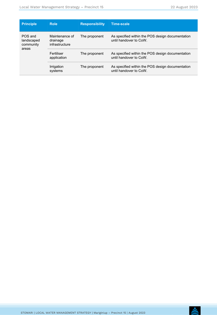
The City will be responsible for maintenance of all local roads as a result of the subsequent subdivision of land, public open space and community facilities resulting from the subdivision and development of land.
Voting Requirements
Simple Majority
|
That Council:- 1. Pursuant to Clause 19 of the deemed provisions for local planning schemes contained in Schedule 2 of the Planning and Development (Local Planning Schemes) Regulations 2015, CONSIDERS the submissions received in respect to Precinct 15 – Central Mariginiup Local Structure Plan, as summarised in Administration’s response in Attachment 8 and Attachment 9. 2. Pursuant to Clause 15 and subclause 20(2)(e) of the deemed provisions for local planning schemes contained in Schedule 2 of the Planning and Development (Local Planning Schemes) Regulations 2015, RECOMMENDS to the Western Australian Planning Commission that the Precinct 15 – Central Mariginiup Local Structure Plan included in Attachment 7 and the associated Part 2 and technical appendices be APPROVED subject to: a) the schedule of modifications included as Attachment 4; and b) the underlying Metropolitan Region Scheme and District Planning Scheme No.2 zoning being suitable for urban development. 3. Pursuant to Clause 22 of the deemed provisions for local planning schemes contained in Schedule 2 of the Planning and Development (Local Planning Schemes) Regulations 2015 and as a result of the recommended modifications made in response to Attachment 8 and Attachment 9, RECOMMEND that the Western Australian Planning Commission direct the Local Government to: a) Readvertise the Structure Plan in the manner specified by the Commission; and b) Reconsult with relevant external agencies.
4. Pursuant to subclause 20(2) of the deemed provisions for local planning schemes contained in Schedule 2 of the Planning and Development (Local Planning Schemes) Regulations 2015, PROVIDES a copy of the report on Precinct 15 – Central Mariginiup Local Structure Plan to the Western Australian Planning Commission, including the summary of submissions included in Attachment 8 and Attachment 9 and the schedule of modifications included in Attachment 4. 5. ADVISES the submitters of its decision.
|
|
1⇩. |
Attachment 1 - East Wanneroo District Structure Plan Map |
24/274233 |
|
|
2⇩. |
Attachment 2 - Central Mariginiup - Initial Local Structure Plan Map |
24/274243 |
|
|
3⇩. |
Attachment 3 - East Wanneroo District Structure Plan Staging Plan |
24/274263 |
|
|
4⇩. |
Attachment 4 - Administration's Schedule of Modifications |
24/294791 |
|
|
5⇩. |
Attachment 5 - Location Plan |
24/1649 |
|
|
6⇩. |
Attachment 6 - East Wanneroo Process Chart |
24/285615 |
|
|
7⇩. |
Attachment 7 - Central Mariginiup Local Structure Plan |
24/281332 |
|
|
8⇩. |
Attachment 8 - Schedule of Public Submissions following advertising |
24/285638 |
|
|
9⇩. |
Attachment 9 - Schedule of External Agency Submissions following advertising |
24/285631 |
|
|
10⇩. |
Attachment 10 - Central Mariginiup - Amended Local Structure Plan Map |
24/280951 |
|
|
11⇩. |
Attachment 11 - Metropolitan Region Scheme Map |
24/280959 |
|
|
12⇩. |
Attachment 12 - Proposed Lifting of Urban Deferment Map |
24/302409 |
|
|
13⇩. |
Attachment 13 - East Wanneroo Community Facilities Plan Map |
24/274234 |
|
|
14⇩. |
Attachment 14 - Preliminary Earthworks Plan |
24/285608 |
|
|
15⇩. |
Attachment 15 - Post Development Surface Water Drainage Plan |
24/285606 |
|
|
16⇩. |
Attachment 16 - Public Open Space Masterplan |
23/340296 |
|
|
17⇩. |
Attachment 17 - Environmental Assessment Report |
24/294794 |
|
|
18⇩. |
Attachment 18 - Bushfire Management Plan |
23/340280 |
|
|
19⇩. |
Attachment 19 - Transport Impact Assessment |
23/340301 |
|
|
20⇩. |
Attachment 20 - Local Sense of Place Statement |
24/285603 |
|
|
21⇩. |
Attachment 21 - Aboriginal Heritage Assessment Report |
24/285601 |
|
|
22⇩. |
Attachment 22 - Local Water Managment Strategy |
24/294793 |
|
|
23⇩. |
Attachment 23 - District Water Supply Scheme |
24/294792 |
|
File Ref: 49550 – 24/260421
Responsible Officer: Director Assets
Attachments: 2
Issue
To consider Tender No: 24043 for the Provision of Park and Streetscape Maintenance in Jindalee, Alkimos and Eglinton Streetscape and Park Maintenance in Three (3) Separable Portions for an initial period of three (3) years with two (2), twelve (12) months, or part thereof, options to extend at the discretion of the City.
Background
Jindalee, Alkimos and Eglinton Streetscape and Park Maintenance is currently undertaken by Environmental Industries under Contract No. 22065. This contract commenced on the 29 August 2022 and expired on the 28 August 2024. 1 x 2-month option to extend was accepted to 28 October 2024 to allow for an RFT process to be finalised. The 2 x 12-month options to extend were not taken due to contract specification improvements identified through the recent Service Review – Manage and Maintain Streetscapes.
The City is seeking to appoint suitably qualified and experienced contractor(s) to continue to provide park and streetscape maintenance services to the suburbs, each as a separate portion listed below:
· Jindalee - Separable Portion 1
· Alkimos - Separable Portion 2
· Eglinton - Separable Portion 3
Detail
Tender 24043 for the Provision of Park and Streetscape Maintenance in Jindalee, Alkimos and Eglinton in Three (3) Separable Portions was advertised on 11 May 2024 and closed on 28 May 2024, during which time one addenda was issued, responding to a bidder clarification request.
Essential details of the proposed contract are as follows:
|
Item |
Detail |
|
Contract Form |
Good and/or Services |
|
Contract Type |
Lump Sum and Schedule of Rates |
|
Contract Duration |
3 Year Term |
|
Commencement Date |
29 October 2024 |
|
Expiry Date |
28 October 2027 |
|
Extension Permitted |
Yes, two (2) periods of twelve months or part thereof |
|
Rise and Fall |
Maximum Perth All Groups CPI increases upon extensions. |
Tender submissions were received from the following companies:
|
Legal Name |
Trading Name |
Abbreviation |
|
Sanpoint Pty Ltd ATF Fiore Family Trust |
LD Total |
LDT |
|
Environmental Industries Pty Ltd |
Environmental Industries |
EI |
|
Landscape Elements Pty Ltd |
Landscape Elements |
LE |
|
Pinochle Holdings Pty Ltd t/as Landscape Australia Construction |
Landscape Australia Construction |
LAC |
Probity Oversight
Probity oversight to the tender assessment process was undertaken by William Buck Consulting (WA) Pty Ltd and the City’s Contracts Officer.
Please refer to Confidential Attachment 2 for reference to the external Probity Advisor Final Report.
Tender submissions were evaluated in accordance with the Procurement and Evaluation Plan (PEP) which included the following selection criteria:
|
Item No |
Description |
Weighting |
|
1 |
Sustainable (Corporate Social Responsibility) Procurement a. Environmental Considerations 5% b. Buy Local 10% c. Reconciliation Action Plan 5% d. Disability Access & Inclusion 5% |
25% |
|
2 |
*Work Health & Safety (WHS) |
20% |
|
3 |
*Demonstrated Experience relative to request |
15% |
|
4 |
*Methodology |
20% |
|
5 |
*Demonstrated Capacity and Resources |
20% |
All tenderers must meet the City’s minimum requirements (as determined by the City) for each of the qualitative criteria detailed above (*) in order to be considered for further evaluation.
Pricing is not included in the qualitative criteria and is considered as part of the overall value for money (VFM) assessment.
All Tenderers attended the mandatory site meeting which outlined the objectives of the tender, scope of services, and addition of new sites included in the contract. All attendees were provided with a copy of the power point presentation from the session.
All submissions were deemed conforming.
Evaluation Criteria 1 – Sustainable (Corporate Social Responsibility) Procurement (25%)
Evidence of Sustainable (Corporate Social Responsibility) Procurement assessment was based on the tenderers’ responses provided within the Questionnaires set out in Schedules 3A, 3B, 3C and 3D that were included in the tender documentation.
An assessment was made to determine the ranking based on the tenderers’ environmental policy and practices, buy local contributions, as well as commitment to reconciliation and disability access and inclusion.
Sub Criteria a) – Environment Consideration (5%)
The City is committed to procuring goods and services that provide positive environmental, social and economic impacts over the entire life cycle of a product or service. Respondents are encouraged to provide credentials of any environmental claims of the goods and/or services submitted in this tender.
Tenderers provided details of their environmental considerations within Schedule 3A, with the following ranking:
|
Tenderer |
Ranking |
|
EI |
1 |
|
LE |
2 |
|
LAC |
3 |
|
LDT |
4 |
Sub Criteria b) – Buy Local (10%)
An assessment was made based on the response provided, detailing the following information:
· Location of tenderer’s offices and workshops;
· Residential addresses of staff and company addresses of subcontractors;
· Purchasing arrangements through local businesses; and
· Requirement for new employees arising from award of the contract.
Tenderers provided details of their “Buy Local” considerations within Schedule 3B, with the following ranking:
|
Tenderer |
Ranking |
|
EI |
1 |
|
LDT |
1 |
|
LAC |
3 |
|
LE |
4 |
Sub Criteria c) – Reconciliation Action Plan (5%)
An assessment was made to determine the ranking based on the responses provided that relate to:
· RELATIONSHIPS - building positive relationships between indigenous and non-indigenous people;
· RESPECT – recognising the contribution of Indigenous people to Australia and learning more about the history, culture and diversity in a two-way communication process; and
· OPPORTUNITIES – attracting, developing and retaining organisational talent to build opportunities for aboriginal employment, training, and development and mentoring.
Tenderers provided information specifying differing levels of actions in relation to indigenous reconciliation action with assessment resulting in the following ranking:
|
Tenderer |
Ranking |
|
EI |
1 |
|
LE |
1 |
|
LDT |
3 |
|
LAC |
4 |
Sub Criteria d) – Access & Inclusion (5%)
An assessment was made to determine the ranking based on the responses provided that relate to:
· People with disabilities having the same buildings and facilities access opportunities as other people;
· People with disabilities receiving information in a format that will enable them to access information as readily as other people are able to access it;
· People with disabilities receiving the same level and quality of service from staff as other people receive;
· People with disabilities having the same opportunities as other people to make complaints; and
· People with disabilities having the same opportunities as other people to participate in any employment opportunities.
Tenderers’ provided information specifying considerations for access and inclusion provisions with assessment resulting in the following ranking:
|
Tenderer |
Ranking |
|
EI |
1 |
|
LE |
1 |
|
LDT |
3 |
|
LAC |
4 |
Overall Sustainable Procurement Ranking Summary
The overall assessment of the Sustainable Procurement criteria has resulted in the following overall ranking:
|
Tenderer |
Ranking |
|
EI |
1 |
|
LDT |
2 |
|
LE |
3 |
|
LAC |
4 |
Evaluation Criteria 2 – Work Health and Safety (20%)
Evidence of WHS management policies and practices was assessed from the tender submissions. The assessment for safety management was based on the tenderer’s responses to a specific questionnaire included within the tender documentation.
Tenderers provided details of their safety management systems with the following ranking:
|
Tenderer |
Ranking |
|
EI |
1 |
|
LDT |
1 |
|
LAC |
3 |
|
LE |
4 |
Evaluation Criteria 3 – Demonstrated Experience Relative to Request (15%)
The tenderer’s relevant experience in demonstrating the achievement of meeting client expectations as presented in the tender submissions were assessed to evaluate Tenderers capability to meet the requirements of the contract. Assessment of this criterion considered the tendering entity’s credentials to fulfil the requirements of the contract.
The assessment of this criterion has resulted in the following ranking:
|
Tenderer |
Ranking |
|
EI |
1 |
|
LE |
2 |
|
LDT |
2 |
|
LAC |
4 |
Evaluation Criteria 4 – Methodology (20%)
Respondents must be able to demonstrate a clear understanding of Park and Streetscape maintenance services within an urban environment, why it is carried out and what is to be achieved. Respondents must also provide a breakdown of hours for each task listed in the table below, for each portion tendered for. The assessment of this criterion has resulted in the following ranking:
|
Tenderer |
Ranking |
|
EI |
1 |
|
LE |
2 |
|
LAC |
3 |
|
LDT |
4 |
Evaluation Criteria 5 – Demonstrated Capacity and Resources (20%)
The tenderer’s demonstrated capacity and resources as presented in their tender submission were assessed in order to evaluate their capability to meet the requirements of the contract. Assessment of this criterion considered the tendering entity’s resources and capacity to fulfil the requirements of the contract. The assessment of this criterion has resulted in the following ranking:
|
Tenderer |
Ranking |
|
EI |
1 |
|
LE |
1 |
|
LAC |
3 |
|
LDT |
3 |
Overall Qualitative Weighted Assessment and Ranking
Tenderer’s submissions were reviewed in accordance with the PEP. The overall assessment of qualitative weighted criteria resulted in the following ranking:
|
Tenderer |
Ranking |
|
EI |
1 |
|
LE |
2 |
|
LDT |
3 |
|
LAC |
4 |
Pricing for the Works Offered
Based on the information provided, tenderers are ranked as follows:
|
Tenderer |
Ranking |
|
LE |
1 |
|
EI |
2 |
|
LAC |
3 |
|
LDT |
4 |
Overall Assessment
The overall assessment based on the likely contract sum including lump sum and scheduled of rates items and Qualitive Assessment result in the following ranking:
|
Tenderer |
Ranking |
|
EI |
1 |
|
LAC |
2 |
|
LDT |
3 |
|
LE |
4 |
Please refer to the Confidential Attachment 1 for further detail relating to the tenderers lump sum pricing and conditions offered, schedule of rates items, value for money assessment and further information supporting the recommendation.
Overall Assessment and Comment
The tender submission from Environmental Industries satisfied the overall VFM assessment in accordance with the assessment criteria and weightings as detailed in the PEP and is therefore recommended as the successful tenderer. The selected tenderer was ranked highest in all evaluated criteria sections and was ranked second in VFM. Further to this, the tendered is the incumbent contractor and has strong knowledge of all sites and the City’s expectations.
Refer to confidential Attachment 1 for further details regarding the pricing offered.
Consultation
Nil
Comment
The tender submission from Environmental Industries satisfied the overall VFM assessment in accordance with the assessment criteria and weightings as detailed in the Procurement Evaluation Plan and is therefore recommended as the successful tenderer.
Statutory Compliance
Tenders were invited in accordance with the requirements of Section 3.57 of the Local Government Act 1995. The tendering procedures and evaluation complied with the requirements of Part 4 of the Local Government (Functions and General) Regulations 1996.
Strategic Implications
The proposal aligns with the following objective within the Strategic Community Plan 2021 – 2031:
5 ~ A well planned, safe and resilient City that is easy to travel around and provides a connection between people and places
5.3 - Responsibly managed and maintained assets
Risk Appetite Statement
In pursuit of strategic objective goal 5, we will accept a Medium level of risk, extended to High in the areas of Community / Reputation & Financial / Commercial impacts. Shifting transport modes and usage in the City may require short term pain for longer term gain as the City supports the development, maintenance and connection of alternatives to car use (e.g. cycle ways) and the supporting infrastructure.
Enterprise Risk Management Considerations
|
Risk Title |
Risk Rating |
|
ST-S23 Stakeholder Relationships |
Medium |
|
Accountability |
Action Planning Option |
|
Director Corporate Strategy and Performance |
Manage |
|
Risk Title |
Risk Rating |
|
CO-022 Environmental Management- |
Medium |
|
Accountability |
Action Planning Option |
|
Director Planning and Sustainability |
Manage |
Financial and Performance Risk
Financial Risk
A financial risk assessment was undertaken by Equifax Australasia Credit Ratings Pty Ltd as part of the tender evaluation process and the outcome of this independent assessment advised that Environmental Industries is assessed with the financial capacity to meet the requirements of the contract.
Performance Risk
Environmental Industries hold several maintenance contracts with Local, State and other Government agencies including the City of Wanneroo with no history of disputes or claims reported in the last five years.
Policy Implications
Tenders were invited in accordance with the requirements of the City’s Purchasing Policy.
Financial (Budget) Implications
The costs associated with 24043 for the Provision of Jindalee, Alkimos and Eglinton Streetscape and Park Maintenance are included in the Parks & Conservation Annual Operational Budget.
Voting Requirements
Simple Majority
That Council:
1. ACCEPTS the tender submitted by Environmental Industries for Tender 24043 Provision of Park and Streetscape Maintenance in Jindalee, Alkimos and Eglinton for an initial Period of Three (3) Years for Separable Portion 1 Jindalee, Separable Portion 2 Alkimos and Separable Portion 3 Eglinton as detailed in Confidential Attachment 1, as per the fixed lump sums and schedule of rates in the tender submission, with the option of two (2), twelve (12) month or part thereof options to extend, at the City’s discretion and subject to budget availability and satisfactory performance; and
2. NOTES that the information contained in the Confidential Attachment 1 will be released via the City’s website after a formal letter of Tender Award is issued to the successful tenderer (as per item 1 above).
Attachments:
|
1. |
Confidential Attachment 1 - 24043 Provision of Park & Streetscape Maintenance for Jindalee, Alkimos & Eglinton |
Confidential |
|
|
2. |
Confidential Attachment 2 - DRAFT Probity Letter - Tender 24043 Provision of Jindalee Alkimos and Eglinton Streetscapes and Park Maintenance |
Confidential |
|
|
These attachments are confidential and distributed under separate cover to all Council Members. |
|
|
24043 Provision of Park & Streetscape Maintenance for Jindalee, Alkimos & Eglinton |
24/303011 |
|
DRAFT Probity Letter - Tender 24043 Provision of Jindalee Alkimos and Eglinton Streetscapes and Park Maintenance |
24/290888 |